- Usage in publication:
-
- Pepper formation
- Modifications:
-
- Original reference
- Dominant lithology:
-
- Shale
- AAPG geologic province:
-
- Ouachita folded belt
Summary:
Pg. 239, 270, 417-422. Pepper formation. The basal noncalcareous blue-purplish clay shale that extends southward from the Woodbine outcrop proper in McLennan County, eastern Texas, and underlies the ACANTHOCERAS flags (Tarrant formation) of the Eagle Ford. It is a distinct stratigraphic unit, separated from underlying Grayson (Del Rio) by an unconformity represented by a pebble conglomerate. Its top is marked by a sharp break in character of sedimentation, the overlying Tarrant formation being an arenaceous flaggy limestone containing much fish debris, phosphatic bodies, and fossil wood, and showing many evidences of shallow-water deposition. The Pepper shale has a distinct fauna. In the past it has been referred to either Woodbine or Eagle Ford. It may be part of Woodbine. Age is Late Cretaceous (Gulf).
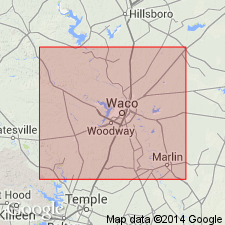
Type locality: an exposure on a small branch of Pepper Creek, just south of the Belton-Temple highway, Bell Co., and 1.6 mi east of easternmost of two underpasses of the highway under Santa Fe RR, Trinity and Brazos River regions, eastern TX.
Source: US geologic names lexicon (USGS Bull. 896, p. 1638).

- Usage in publication:
-
- Pepper shale member*
- Modifications:
-
- Revised
- Biostratigraphic dating
- Adopted
- AAPG geologic province:
-
- Ouachita folded belt
Summary:
Pg. 57-66. Pepper shale member of Woodbine formation. Rank reduced to member of Woodbine formation. Thickness 23.5 feet. Unconformably underlies Eagle Ford shale; unconformably overlies Grayson marl (formerly Del Rio clay). Mollusks described. Fossil evidence confirms conclusion that the Pepper shale is southward extension of the Woodbine and probably an extension of Lewisville member. [Age is Late Cretaceous (Gulf).] (Pepper shale member of Woodbine formationadopted by the USGS.)
Source: US geologic names lexicon (USGS Bull. 1200, p. 2984).

- Usage in publication:
-
- Pepper Shale
- Modifications:
-
- Mapped 1:250k
- Dominant lithology:
-
- Shale
- AAPG geologic province:
-
- Ouachita folded belt
Summary:
Pepper Shale. Shale, pyritic, massive, breaks with blocky fracture, thin to very thinly laminated; upon weathering develops fissility, selenite, and jarosite. Thins southward to 20 feet. Lies above Buda Limestone and below Lake Waco Formation of Eagle Ford Group. Equivalent to Woodbine Formation (recognized north of Brazos River). Age is Late Cretaceous.
Recognized south of Brazos River. Mapped in Bell and McLennan Cos., eastern TX.
Source: Publication.
For more information, please contact Nancy Stamm, Geologic Names Committee Secretary.
Asterisk (*) indicates published by U.S. Geological Survey authors.
"No current usage" (†) implies that a name has been abandoned or has fallen into disuse. Former usage and, if known, replacement name given in parentheses ( ).
Slash (/) indicates name conflicts with nomenclatural guidelines (CSN, 1933; ACSN, 1961, 1970; NACSN, 1983, 2005, 2021). May be explained within brackets ([ ]).

