


- Usage in publication:
-
- Peoria stage of deglaciation*
- Peorian loess*
- Peorian soil and weathered zone
- Peorian interglacial stage
- Modifications:
-
- Overview
Summary:
Peorian stage is name which for many years has commonly been applied to the interglacial stage succeeding Iowan stage of glaciation and preceeding Wisconsin stage of glaciation. The name was proposed by Frank Leverett (Jour. Geol., v. 6, p. 244-249, 1898), in the form of Peorian soil and weathered zone, also Peorian interglacial stage, with statements that the name was applied "to the interval between the Iowan loess and the Shelbyville till sheet, a till sheet which appears to be the earliest of the Wisconsin series" [stage], and that it is "best displayed east of Peoria, Tazewell County, Illinois." Subsequently the loess was included in Peorian interglacial stage, and the name Iowan was restricted to the preceding glacial stage. Later work led Leverett to opinion that "this weathering interval, and also the time of the loess deposition, are parts of the third [Sangamon] interglacial stage," and that the Iowan stage of Keewatin ice sheet may be of same age as Illinoian stage of Labrador and Patrician ice sheets. This, however, is still a moot question.
Source: US geologic names lexicon (USGS Bull. 896, p. 1637-1638).
- Usage in publication:
-
- Peorian loess
- Modifications:
-
- Revised
Summary:
Kay and Leighton included Peorian loess and Iowan glacial stage in Wisconsin stage, and somewhat modified the definition of Peorian. [See under Wisconsin stage.]
Source: US geologic names lexicon (USGS Bull. 896, p. 1637-1638).
- Usage in publication:
-
- Peoria loess
- Modifications:
-
- Areal extent
Summary:
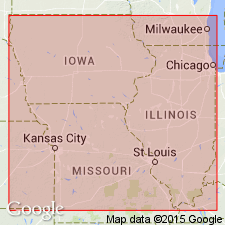
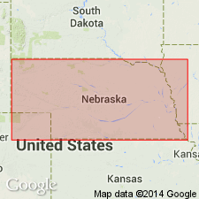
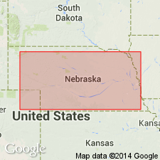
Pg. 350-351. Peorian loess. Occurs as an almost unbroken mantle of yellowish eolian silt and clay over 42,000 sq mi of Nebraska. It mantles the eroded Loveland formation, on an irregular surface. Thickness in eastern Nebraska 10 to 100 feet; in south-central Nebraska 30 to 200 feet; to north of Platte River 30 to 250 feet. Writer is not in agreement with recent suggestions to eliminate Peorian as a stage of the Pleistocene, as proposed by M.M. Leighton (Jour. Geol., v. 39, p. 45-53, 1931, and Sci., n.s., v. 77, 1933) and by G.F. Kay and Leighton (GSA Bull., v. 44, p. 669-674, 1933).
Source: US geologic names lexicon (USGS Bull. 896, p. 1637-1638).

- Usage in publication:
-
- Peorian formation (loess)
- Modifications:
-
- Overview
Summary:
Pg. 6. Shown in stratigraphic section as Peorian formation (loess). Overlies Loveland formation; underlies Recent. Thickness 5 to 80 feet. Some dune sand of Peorian age. [Age is Pleistocene.]
Source: US geologic names lexicon (USGS Bull. 1200, p. 2983-2984).
- Usage in publication:
-
- Peoria stage†
- Modifications:
-
- Abandoned
- AAPG geologic province:
-
- Atlantic Coast basin
Summary:
Pg. 1714. †Peoria stage. Under previous usage by the USGS, the Iowan drift was regarded as representing a distinct stage of glaciation separated from the Wisconsin by Peorian stage of glaciation. The USGS now classifies the Iowan drift as representing an early substage of the Wisconsin stage, and name Peorian is not used either for a distinct stage or substage.
Source: US geologic names lexicon (USGS Bull. 1200, p. 2983-2984).
- Usage in publication:
-
- Peorian loess
- Modifications:
-
- Areal extent
Summary:
Pg. 55 (fig. 1). Peorian loess underlies Bignell formation (new). [Age is Pleistocene.]
Source: US geologic names lexicon (USGS Bull. 1200, p. 2983-2984).

- Usage in publication:
-
- Peorian formation
- Modifications:
-
- Areal extent
- AAPG geologic province:
-
- Salina basin
Summary:
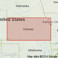
Pg. 25, 31-33; Nebraska Geol. Survey Bull., no. 15-A, p. 25, 32-33, 1950. Peorian formation, as exposed at type locality of Crete formation, consists of light-brownish-gray to buff loess in upper part, medium-light-gray in middle part, and light-gray to brownish, partly iron-stained in lower part. Thickness, including soil at top, 11 feet. Overlies Loveland formation. Peorian loess of middle to late Wisconsin age deposited to variable thickness widely on Loveland loess in Nebraska and other areas and on exposed areas of Todd Valley sand, and older formations. However, term Peorian, as now used, represents time interval between the lowan and Mankato substages in Iowa and should not be applied formationally where this interval includes both till and loess substages, as in Illinois and parts of South Dakota. Contact with Bignell loess indicated by buried soils. [Age is Pleistocene.]
Source: US geologic names lexicon (USGS Bull. 1200, p. 2983-2984).

- Usage in publication:
-
- Peoria silt member
- Modifications:
-
- Revised
- Areal extent
Summary:
Pg. 45-50. Peoria silt member of Sanborn formation. The Peorian loess has been described in western Illinois and Iowa and is exposed unconformably above Loveland loess in Missouri Valley area of Iowa and Nebraska. Unit has been traced westward from Missouri Valley across Nebraska and southward as far as central Kansas. Since term Peorian is now generally used in time sense, adjectival ending dropped for stratigraphic unit here called Peoria silt member of Sanborn formation. Member in upland areas may be a complex of loesses of slightly different ages, at a few places separated by feebly developed soils. Its lithologic continuity in Kansas and Nebraska warrants inclusion of the complex of loesses, associated colluvial silts on some slopes, and fluvial-eolian silts on lower levels within a single member. Buried soil on Peoria silt member has been named Brady. Peoria silt occurs extensively in northern tier of Kansas counties in upland areas and on slopes, overlain by deposits of Bignell silt above Brady soil. Thickness more than 100 feet at type locality of Sanborn. Overlies Loveland silt member. [Age is Pleistocene.]
Source: US geologic names lexicon (USGS Bull. 1200, p. 2983-2984).
- Usage in publication:
-
- Peorian loess*
- Modifications:
-
- Areal extent
- AAPG geologic province:
-
- Salina basin
Summary:
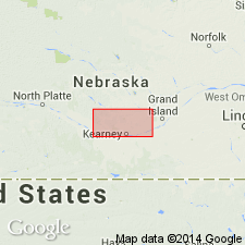
Pg. 14 (table), 23. Peorian loess. In Buffalo County and adjacent areas, Nebraska, consists of wind deposits of grayish-yellow silty clay (loess), locally grading into dune sand; contains several buried soils. Thickness 0 to 75 feet. Overlies Todd Valley formation; underlies post-Iowan terrace deposits. [Age is Pleistocene.]
Source: US geologic names lexicon (USGS Bull. 1200, p. 2983-2984).
- Usage in publication:
-
- Peoria formation
- Modifications:
-
- Revised
- AAPG geologic province:
-
- Anadarko basin
Summary:
Pg. 55 (fig. 1). Peoria formation. Rank raised to formation in Sanborn group. [Age is Pleistocene.]
Source: US geologic names lexicon (USGS Bull. 1200, p. 2983-2984).
- Usage in publication:
-
- Peoria formation
- Modifications:
-
- Revised
Summary:
Graphic column and classification of rocks in Kansas. Peoria formation shown on correlation chart in Bradyan stage. [Kansas does not use Sanborn group.]
Source: US geologic names lexicon (USGS Bull. 1200, p. 2983-2984).
- Usage in publication:
-
- Peoria loess
- Modifications:
-
- Areal extent
Summary:
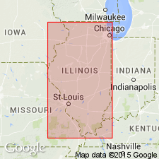
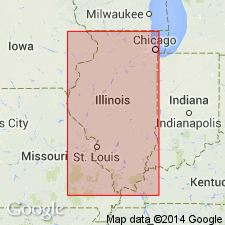
Pg. 7, 10, 12, 13. Peoria loess. Beyond limit of Shelbyville till the Peoria loess serves as a supplementary type for Woodfordian substage (new). Peoria loess has been called Peorian, but it is here used as rock-stratigraphic rather than time-stratigraphic unit and adjectival ending is dropped. Stratigraphically overlies Farmdale silt; overlies Roxana silt (new) of Altonian substage (new). Thickness 15 to 25 feet. Age is Pleistocene.
Source: US geologic names lexicon (USGS Bull. 1200, p. 2983-2984).
- Usage in publication:
-
- Peorian loess
- Modifications:
-
- Areal extent
- AAPG geologic province:
-
- Illinois basin
Summary:
Pg. 536. Peorian loess. Frye and Willman's (1960) type section of "Roxana silt" reinterpreted. "Roxana silt" is Peoria loess. Unit term Peoria loess by Frye and Willman is possibly Bignell loess.
Source: US geologic names lexicon (USGS Bull. 1200, p. 2984).

- Usage in publication:
-
- Peoria Formation
- Modifications:
-
- Overview
Summary:
(Cenozoic Era; Quaternary System by C.K. Bayne and H.G. O'Connor, p. 59-68.) Peoria Formation. Buff to light-gray eolian silt (loess). Mantles most of upland areas in eastern, central, and western Kansas. Thickest adjacent to Missouri River valley, up to 100 feet. Age is Pleistocene (Wisconsinan).
Source: Publication.
- Usage in publication:
-
- Peoria Loess*
- Modifications:
-
- Areal extent
- Age modified
- AAPG geologic province:
-
- Denver basin
- Chadron arch
Summary:
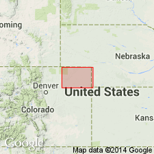
Extended into extreme southwest NE in Chadron arch and northeast CO in Denver basin. Most extensive occurrence is in northeast and central parts of map area; also occurs in northwest, southwest and southeast parts. Thickness probably reaches 130 ft. Overlies Louviers Alluvium; underlies Broadway Alluvium. Assigned Bull Lake and Pinedale (Pleistocene) age.
Source: GNU records (USGS DDS-6; Denver GNULEX).

- Usage in publication:
-
- Peoria loess
- Modifications:
-
- Overview
- Dominant lithology:
-
- Loess
- AAPG geologic province:
-
- Illinois basin
Summary:
Major parent material of IL soils. Ranges from less than 20 in. to more than 300 in. Surficial unit of IL beyond the Wisconsinan morainal border. Within this border in northeastern IL, lower portion of Peoria is buried by younger Woodfordian tills and is called the Morton loess. Upper portion, overlying these younger tills, is called Richland loess. Deposited 22,000 to 12,500 years B.P. according to Willman and Frye (1970). Overlies the Roxana loess in western and southern IL. In south-central and southern IL, where Roxana is less than 15 in. thick, a mixed zone at base, called lower textural zone of Peoria by Olson and Ruhe (1979), is here named Casey Formation.
Source: GNU records (USGS DDS-6; Reston GNULEX).

- Usage in publication:
-
- Peoria Silt
- Peoria Loess
- Modifications:
-
- Revised
- AAPG geologic province:
-
- Illinois basin
Summary:
Peoria Silt, also called Peoria Loess, is generally 0.5 to 1.3 m thick in the study area. Typically altered to yellowish brown and is lighter in color than the underlying Roxana Silt. Characterized by consistent vertical trends in clay mineralogy and particle-size distribution. Texture ranges from silty clay loam to silt loam. Contains more silt and less sand than the Roxana.
Source: GNU records (USGS DDS-6; Reston GNULEX).
- Usage in publication:
-
- Peoria Formation
- Modifications:
-
- Biostratigraphic dating
- AAPG geologic province:
-
- Wisconsin arch
Summary:
Here used as Pleistocene Peoria Formation in WI. Described as surface deposit on uplands throughout Driftless Area and constitutes bulk of upland loess. Like Pleistocene Loveland Formation (revised), it consists of light-brownish-gray to yellowish-brown silt loam that becomes darker and redder toward top because of pedogenic alteration. Unweathered basal portion is massive and calcareous, while moderate to strong blocky peds and a noncalcareous mineralogy characterize its weathered top. Abrupt basal boundary. Overlies Pleistocene Roxana Formation (redescribed). An AMS radiocarbon date of 24,250+/-970 14C yr B.P. was determined from 40 mg of snail shells near base of the Peoria in core section GT6 (Leigh and Knox, 1993). This date, and others from top of the Roxana (Leigh and Knox, 1993) place basal radiocarbon age of the Peoria at 25,000 yr B.P., which agrees with its basal age in IL (McKay, 1979) and elsewhere in the Midcontinent (Ruhe, 1976, 1983; Forman and others, 1992). Lithologic characteristics and radiocarbon dates indicate the Peoria of WI is stratigraphic equivalent of Peoria Loess of IL (Willman and Frye, 1970). Report includes geochemical and mineralogical data.
Source: GNU records (USGS DDS-6; Reston GNULEX).
- Usage in publication:
-
- Peoria Silt*
- Modifications:
-
- Principal reference
- Revised
- AAPG geologic province:
-
- Illinois basin
- Michigan basin
- Wisconsin arch
Summary:
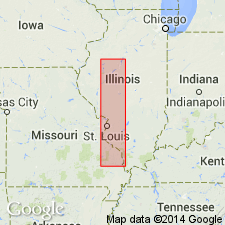
Pg. 6 (fig. 2), 15, 17 (fig. 9), 18, 20 (fig. 10), 32 (fig. 16), 42 (fig. 27), 51 (fig. 29), 54-55, 74-75, 81+, 96-97, 102+. Peoria Silt of Mason Group. Light yellow tan to gray silt. Locally contains beds of well-sorted sand (formerly Parkland Sand; see Parkland facies) and fossils. Where it is at surface, modern soil has developed in upper part. Includes Morton Tongue (formerly Morton Loess) and Richland tongue (informal; formerly Richland Loess). Thickest along major river valleys, 33 to 82 feet (10 to 25 m). Overlies Roxana Silt or older units. Underlies tongues of Henry and Equality Formations of Mason Group. Interfingers with diamicton units of Wedron Group. Correlates with Vicksburg Loess of Mississippi and part of Atherton Formation of Indiana. Interpreted to be predominantly proglacial loess derived from glacial meltwater channels. Age is Pleistocene (Wisconsinan Age; Woodfordian Subage), based on radiocarbon dating.
Type section: Tindall School section, in west bluff of Illinois Valley south of Peoria, Tazewell Co., IL.
Principal reference sections:
(1) Athens north quarry section, in north highwall of limestone quarry, 5 mi (8 km) northeast of Athens, in SW/4 SE/4 NE/4 sec. 18, T. 18 N., R. 5 W., Mason City SW 7.5-min quadrangle, Menard Co., IL;
(2) Bellefontaine quarry section, in southwest corner of large quarry, in sec. 9, T. 47 N., R. 7 E., Columbia Bottom, MO-IL 7.5-min quadrangle, St. Louis Co., MO;
(3) Cottonwood School section, roadcuts along center east line of sec. 11, T. 18 N., R. 11 W., Clear Lake 7.5-min quadrangle, Cass Co., IL;
(4) Danvers (Rock Creek) section, in cutbank on south side of Rock Creek, in NW/4 NE/4 NW/4 sec. 32, T. 25 N., R. 1 W., Danvers 7.5-min quadrangle, Woodford Co., IL;
(5) Farm Creek section, on south side of Farm Creek, in NE/4 SW/4 SE/4 sec. 30, T. 26 N., R. 3 W., Washington 7.5-min quadrangle, Tazewell Co., IL;
(6) Gardena section, exposed in stream bank 99 ft (30 m) west (downstream) of Toledo, Peoria, and Western RR bridge, in NW/4 SW/4 NW/4 sec. 32, T. 26 N., R. 3 W., Washington 7.5-min quadrangle, Tazewell Co., IL.
Source: Publication.
For more information, please contact Nancy Stamm, Geologic Names Committee Secretary.
Asterisk (*) indicates published by U.S. Geological Survey authors.
"No current usage" (†) implies that a name has been abandoned or has fallen into disuse. Former usage and, if known, replacement name given in parentheses ( ).
Slash (/) indicates name conflicts with nomenclatural guidelines (CSN, 1933; ACSN, 1961, 1970; NACSN, 1983, 2005, 2021). May be explained within brackets ([ ]).