The National Geologic Map Database is migrating to a new infrastructure. We apologize for any service disruptions during this process.
|
|---|


- Usage in publication:
-
- Pentagon shale
- Modifications:
-
- Original reference
- Dominant lithology:
-
- Limestone
- Shale
- AAPG geologic province:
-
- Montana folded belt
Summary:
Pentagon shale. Is shale and shaly limestones only in immediate vicinity of Pentagon Mountain, but in all other sections it is generally massive limestone. Thickest (290 feet) at type locality; thins most rapidly south-southeast to Prairie Reef-White Ridge area [Lewis and Clark County, northwestern Montana], where it consists of tan to chocolate-gray massive thick-bedded limestone with small amount of clay disseminated as flakes. Lower 92 feet is calcareous gray to buff-gray, rather thick-bedded platy shale interbedded with platy blue-gray argillaceous limestones in thin beds. Overlying 150 feet is platy, irregularly bedded argillaceous limestone, blue gray to tan gray in upper part. Above these platy limestones come 22 feet of black-gray paper shale interbedded with a few thin limestones in lower part. Top of formation consists of 26 feet of nodular platy interbedded chocolate and white-gray argillaceous limestones. Overlies Pagoda oolite and underlies Gordon Mountain limestone. Age is Middle or Late Cambrian.
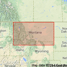
Type locality: on Continental Divide, in NE/4 sec. 24, T. 25 N., R. 12 W., [Pentagon Mountain 7.5-min quadrangle (1994 ed.), Flathead and Lewis and Clark Co. bdry.], northwestern MT. Named from Pentagon Mountain, which lies approx. 2 mi northwest of type locality, [in NW/4 NW/4 NW/4 sec. 14, T. 25 N., R. 12 W., Pentagon Mountain 7.5-min quadrangle (1994 ed.), Flathead Co., northwestern MT].
Source: US geologic names lexicon (USGS Bull. 896, p. 1636).
- Usage in publication:
-
- Pentagon shale
- Modifications:
-
- Age modified
- Biostratigraphic dating
- AAPG geologic province:
-
- Montana folded belt
Summary:
Pg. 42-45, 57; GSA Bull., v. 49, no. 7, p. 1074-1075, 1089, 1090 (fig. 2), 1938. Pentagon shale. As here defined, overlies Pagoda limestone and underlies Steamboat limestone. Thickness at type locality 290 feet. Unquestionably correlates with lower part of Meagher limestone of central Montana and Yellowstone Park based on trilobites "AGNOSTUS" BREVISPINUS Deiss, "A." ROBUSTUS Deiss, BATHYURISCUS FORMOSUS Deiss, ELRATHINA FECUNDA Deiss, KOOTENIA SERRATA (Meek), etc. Age is Middle Cambrian (Albertan).
[Misprint: GSA Spec. Paper no. 20 is cited in lexicon (USGS Bull. 1200, p. 2981). Should be Spec. Paper no. 18.]
Source: Publication; US geologic names lexicon (USGS Bull. 1200, p. 2981-2982).
For more information, please contact Nancy Stamm, Geologic Names Committee Secretary.
Asterisk (*) indicates published by U.S. Geological Survey authors.
"No current usage" (†) implies that a name has been abandoned or has fallen into disuse. Former usage and, if known, replacement name given in parentheses ( ).
Slash (/) indicates name conflicts with nomenclatural guidelines (CSN, 1933; ACSN, 1961, 1970; NACSN, 1983, 2005, 2021). May be explained within brackets ([ ]).