

- Usage in publication:
-
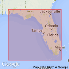
- Pensacola clay
- Modifications:
-
- First used
- Dominant lithology:
-
- Clay
- AAPG geologic province:
-
- Mid-Gulf Coast basin
Summary:
Name proposed by Marsh (1964, ms.) for subsurface lithologic unit of Alum Bluff age that occurs in southern part of Escambia and Santa Rosa Cos. and extends laterally into Okaloosa Co. and into AL. Thickness about 380 ft in type area. Attains maximum thickness beneath Mobile Bay, AL, where it is over 1,000 ft. Subdivided into three members, an upper and lower clay member separated by Escambia Sand Member (new). Overlies Chattahoochee Formation. Eastward grades laterally into Miocene coarse clastics (Fort Preston formation?). Age is middle and late Miocene (Alum Bluff-Choctawhatchee Stages.)
Source: GNU records (USGS DDS-6; Reston GNULEX).
- Usage in publication:
-
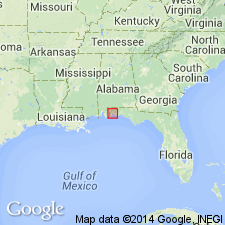
- Pensacola Clay*
- Modifications:
-
- Named
- AAPG geologic province:
-
- Mid-Gulf Coast basin
Summary:
Name Pensacola Clay formally proposed. Three oil test wells, 22 to 24 mi west and southwest of Pensacola, FL, have been selected as type wells. Formation consists of three members: an upper member composed of clay, the relatively thin Escambia Sand Member in middle, and lower clay member. Upper and lower members consist of tough dark- to light-gray clay, but at a few localities clay is brownish gay. Escambia Sand Member consists predominantly of light-gray to brownish-gray fine to coarse quartz sand. The Pensacola cannot be traced into any established formation to west, north, or east. South of area it extends for an unknown distance beneath the Gulf of Mexico [now called Gulf of America]. In central and eastern Escambia and Santa Rosa Cos. and also about 28 mi east of area, the Pensacola grades laterally into Miocene coarse clastics. Contact with underlying Tampa Formation gradational and probably conformable. In south-central Escambia Co. and southwestern Santa Rosa Cos, Pensacola is overlain unconformably by the Citronelle Formation.
[Gulf of Mexico renamed Gulf of America (U.S. Board on Geographic Names per Presidential Executive Order 14172, issued January 20, 2025, and Department of Interior's Secretarial Order 3423, issued Feb. 7, 2025).]
Source: GNU records (USGS DDS-6; Reston GNULEX).
- Usage in publication:
-
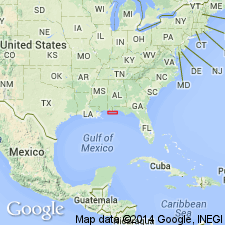
- Pensacola Formation
- Modifications:
-
- Revised
- AAPG geologic province:
-
- Mid-Gulf Coast basin
Summary:
Pensacola Clay of Marsh (1966) here referred to as Pensacola Formation. [No explanation offered for name variation.] Underlies Perdido Key Formation (new name). Subdivided into (ascending) Amos Member, Escambia Member, and Pascagoula Member (rank reduced).
Source: GNU records (USGS DDS-6; Reston GNULEX).
- Usage in publication:
-
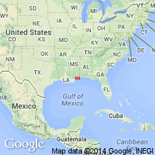
- Pensacola Formation
- Modifications:
-
- Revised
- Age modified
- AAPG geologic province:
-
- Mid-Gulf Coast basin
Summary:
Definition of Pensacola is expanded to include strata between the early middle Miocene and the sub-Citronelle unconformities. Unit comprises marine, terrestrial-brackish siliciclastic deposits with rare limestone beds and following suggestion of Otvos (1988) is renamed from Clay to Formation. In the study area now encompasses the Amos Member, the Escambia Member, the Pascagoula Member, and the Graham Ferry Member and ranges in age from middle Miocene (Langhian) to late Pliocene (Piacenzian). Overlies the newly named Hancock Formation in southernmost MS.
Source: GNU records (USGS DDS-6; Reston GNULEX).
- Usage in publication:
-
- Pensacola Formation*
- Modifications:
-
- Revised
- Age modified
- AAPG geologic province:
-
- Mid-Gulf Coast basin
GNU Staff, 1995, Draft copy of Otvos, E.G., Mississippi Gulf Coast; geologic evolution, stratigraphy, coastal geomorphology, and Gulf-wide Pleistocene correlations, USGS Bull. XXXX (unpublished): U.S. Geological Survey Digital Data Series, DDS-6, 1 CD-ROM., release 3
Summary:
A maximum 4,900-ft-thick Miocene sequence underlies younger sandy-clayey alluvial-paralic deposits in MS. In absence of clearly definable and correlatable litho- or biostratigraphic horizons to bracket them, application of formation names, previously assigned to paralic-alluvial intervals (Oligocene to Miocene Catahoula Formation, Miocene Hattiesburg and Pascagoula Formations, and Pliocene Graham Ferry Formation; Brown and others, 1944) is unacceptable in MS. In intervals for which a Miocene or Pliocene age cannot be established, the term "undifferentiated Neogene clastics" is recommended. Whenever applicable, the names Pascagoula and Graham Ferry Members of Pensacola Formation are now used. Age changed to Miocene and Pliocene. Author follows usage of Otvos (1994).
Source: GNU records (USGS DDS-6; Reston GNULEX).
For more information, please contact Nancy Stamm, Geologic Names Committee Secretary.
Asterisk (*) indicates published by U.S. Geological Survey authors.
"No current usage" (†) implies that a name has been abandoned or has fallen into disuse. Former usage and, if known, replacement name given in parentheses ( ).
Slash (/) indicates name conflicts with nomenclatural guidelines (CSN, 1933; ACSN, 1961, 1970; NACSN, 1983, 2005, 2021). May be explained within brackets ([ ]).