The National Geologic Map Database is migrating to a new infrastructure. We apologize for any service disruptions during this process.
|
|---|


- Usage in publication:
-
- Penones Limestone*
- Modifications:
-
- Named
- Dominant lithology:
-
- Limestone
Summary:
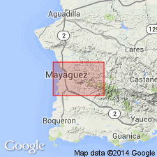
The Penones Limestone, here named, is a pale-gray, massive, thick-bedded limestone and limestone breccia containing clasts of pelecypod shells, stromatoporoids, echinoderm plates, rudists, and Foraminifera. It is concordantly interbedded with the Yauco Formation, and locally intruded by small stocks. Age equivalent to the Cotui Limestone. Limestone bodies formed part of a gravity-glide block which came to rest on intrusive porphyritic pyroxene andesite-diorite. Age is Maastrichtian, based on fossils.
Source: GNU records (USGS DDS-6; Reston GNULEX).

- Usage in publication:
-
- Penones Limestone*
- Modifications:
-
- Overview
- AAPG geologic province:
-
- Caribbean region
Summary:
The Penones Limestone occurs in southwestern Puerto Rico and consists of limestone with minor volcanic lithic and mineral clasts similar to the Sabana Grande Formation. Unit is locally metamorphosed to a coarse crystalline marble near intrusive contacts. Maximum estimated thickness is 250 meters. The Penones is of Late Cretaceous age.
Source: GNU records (USGS DDS-6; Reston GNULEX).
For more information, please contact Nancy Stamm, Geologic Names Committee Secretary.
Asterisk (*) indicates published by U.S. Geological Survey authors.
"No current usage" (†) implies that a name has been abandoned or has fallen into disuse. Former usage and, if known, replacement name given in parentheses ( ).
Slash (/) indicates name conflicts with nomenclatural guidelines (CSN, 1933; ACSN, 1961, 1970; NACSN, 1983, 2005, 2021). May be explained within brackets ([ ]).