- Usage in publication:
-
- Pelham Quartzite Member*
- Modifications:
-
- Overview
- AAPG geologic province:
-
- New England province
Summary:
Used as Pelham Quartzite Member of Dry Hill Gneiss of Proterozoic Z age. [No explanation given for implied reinstatement, reduction in rank, or change in age.]
Source: GNU records (USGS DDS-6; Reston GNULEX).

- Usage in publication:
-
- Pelham Quartzite Member*
- Modifications:
-
- Revised
- Reinstated
- Age modified
- Overview
- AAPG geologic province:
-
- New England province
Summary:
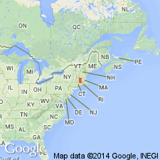
Detailed mapping done in central and southern parts of Pelham dome by Ashenden (1973, map only) and Robinson and others (1973) shows quartzite within Dry Hill Gneiss. This quartzite was previously called Pelham Quartzite within the Becket Gneiss by Emerson (1898).
Emerson (1917) later termed these rocks "northfieldite" on his preliminary geologic map of MA and RI. The quartzite within Dry Hill Gneiss is here redefined as Pelham Quartzite Member. Type locality is low ledge, partially buried by sand and gravel, in front yard of Town Hall of Pelham, Hampshire Co., western -central MA. Better exposures occur on Rte 202, approx 1.6 km to the north and 1.6 km to the south of the Town Hall. Age is Late Proterozoic, based on the age change of Dry Hill Gneiss as determined by Zartman
and Naylor, 1984). [Note: Although Balk (1956) abandoned the name Pelham, this report doesn't mention Balk (1956) and so reinstatement is implied.}
Source: GNU records (USGS DDS-6; Reston GNULEX).
For more information, please contact Nancy Stamm, Geologic Names Committee Secretary.
Asterisk (*) indicates published by U.S. Geological Survey authors.
"No current usage" (†) implies that a name has been abandoned or has fallen into disuse. Former usage and, if known, replacement name given in parentheses ( ).
Slash (/) indicates name conflicts with nomenclatural guidelines (CSN, 1933; ACSN, 1961, 1970; NACSN, 1983, 2005, 2021). May be explained within brackets ([ ]).

