The National Geologic Map Database is migrating to a new infrastructure. We apologize for any service disruptions during this process.
|
|---|


- Usage in publication:
-
- Peerless shale member*
- Modifications:
-
- Original reference
- Dominant lithology:
-
- Dolomite
- Shale
- AAPG geologic province:
-
- Eagle basin
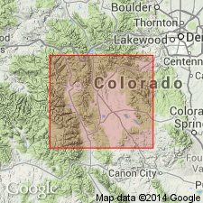
- South Park basin
Summary:
Pg. 58. Peerless shale member of Sawatch quartzite. Sandy and shaly dolomitic beds and calcareous shaly beds, with prominent fucoid markings, forming top member of Sawatch quartzite in Weston Pass district. In earlier reports called "transition shale." Thickness at Weston Pass 50 feet. Typical occurrence on northwestern slope of Peerless Mountain, 6 miles east-southeast of Leadville, [Lake and Park Counties, central Colorado]. Grades into overlying Manitou limestone (Ordovician). Underlain by quartzites. [Age is Late Cambrian.]
Source: US geologic names lexicon (USGS Bull. 896, p. 1628).

- Usage in publication:
-
- Peerless shale member*
- Modifications:
-
- Overview
- AAPG geologic province:
-
- Eagle basin
Summary:
Peerless shale member of Sawatch quartzite. The "transition shale" of Alma district consists of (descending): (1) shaly beds, 12 to 27 feet; (2) dolomitic and sandy limestone with shale partings, 15 to 30 feet; (3) shaly beds, 18 to 30 feet; (4) dolomitic limestone with shale partings, 15 to 30 feet; (5) purple quartzite containing tiny angular quartz pebbles, 2 to 15 feet; the aggregate thickness of the member being 62 to 132 feet. [Age is Late Cambrian.]
Source: US geologic names lexicon (USGS Bull. 896, p. 1628).
- Usage in publication:
-
- Peerless formation*
- Modifications:
-
- Areal extent
- AAPG geologic province:
-
- Eagle basin
Summary:
Is a unit about 100 ft thick conformably above the Sawatch quartzite and unconformably below the Harding quartzite in the Pando area, Eagle basin. Two measured sections north of Pando described. Assigned to the Cambrian.
Source: GNU records (USGS DDS-6; Denver GNULEX).
- Usage in publication:
-
- Peerless formation*
- Modifications:
-
- Areal extent
- AAPG geologic province:
-
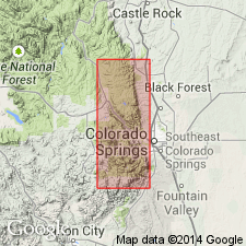
- Denver basin
Summary:
Replaces use of name Ute Pass dolomite at Missouri Gulch where Peerless overlies Sawatch quartzite and underlies Manitou formation. Is a dark-red, finely to coarsely granular and rhombic, sandy and glauconitic, partly cross-bedded dolomite 16 ft thick at Missouri Gulch, north of Manitou Park, El Paso Co, CO in the Denver basin. Upper beds are conglomeratic. Includes a few thin beds of very fine grained sandstone, siltstone, and shale. Is not the same unit as the one named Ute Pass at Williams Canyon. Assigned to the Late Cambrian, middle Franconian to Trempealeauan. Cross section.
Source: GNU records (USGS DDS-6; Denver GNULEX).
- Usage in publication:
-
- Peerless Formation
- Modifications:
-
- Revised
- AAPG geologic province:
-
- Denver basin
- Piceance basin
- South Park basin
Summary:
Name Horseshoe Mountain Group applied to rocks of the Sauk sequence in central CO of Late Cambrian and Early Ordovician age. In its northwest province near Glenwood Springs, Garfield Co in the Piceance basin, the group is divided into the Sawatch Sandstone, Dotsero Formation (and its Glenwood Canyon and Clinetop Members), and Manitou Limestone (and its Deadhorse and Tie Gulch Members). In its southeast province--near Salida, Gunnison Co in the Piceance basin, Colorado Springs, El Paso CO in the Denver basin, and Fairplay, Park Co in the South Park basin--the group is divided into the Sawatch Sandstone, Peerless Formation, and Manitou Limestone (and its Helena Canyon, Ptarmigan (provisional), and Fairplay (provisional) Members). The group is named for exposures on Horseshoe Mountain (the type section) near Fairplay in Park Co. Rocks of the group include conglomerate, sandstone, shale, limestone, and dolomite. Correlation chart. Thickness of group at type (southeast facies--sec. 12, T. 10 S., R. 79 W.) is 352 ft: Manitou, 167 ft; Peerless, 35 ft; and Sawatch, 150 ft. Thickness of group in northwest facies (sec. 15, T. 5 S., R. 87 W.) is 772 ft: Manitou, 156 ft; Dotsero, 96 ft; and Sawatch, 520 ft.
Source: GNU records (USGS DDS-6; Denver GNULEX).
- Usage in publication:
-
- Peerless Formation
- Modifications:
-
- Revised
- AAPG geologic province:
-
- Denver basin
- Piceance basin
- South Park basin
Summary:
Peerless revised in that it is assigned to the newly named Horseshoe Mountain Group as its middle formation, at Salida, Gunnison Co, CO in the Piceance basin; Colorado Springs, El Paso Co, CO in the Denver basin; and at Fairplay, Park Co, CO in the South Park basin. Correlation chart. Age not discussed. [Same information presented in Gerhard, 1972, Colorado School of Mines Quarterly, v. 67, no. 4, p. 1-36.]
Source: GNU records (USGS DDS-6; Denver GNULEX).
For more information, please contact Nancy Stamm, Geologic Names Committee Secretary.
Asterisk (*) indicates published by U.S. Geological Survey authors.
"No current usage" (†) implies that a name has been abandoned or has fallen into disuse. Former usage and, if known, replacement name given in parentheses ( ).
Slash (/) indicates name conflicts with nomenclatural guidelines (CSN, 1933; ACSN, 1961, 1970; NACSN, 1983, 2005, 2021). May be explained within brackets ([ ]).