- Usage in publication:
-
- Peerless Park Member
- Modifications:
-
- Named
- Reference
- Dominant lithology:
-
- Limestone
- AAPG geologic province:
-
- Ozark uplift
- Illinois basin
Summary:
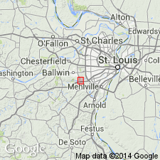
Named for exposures near Peerless Park, east St. Louis Co, MO. Type section is on southeast side, St. Louis and San Francisco RR spur south of Meramec River, Rte 44; reference section is south of Rte 44 exchange with MO Hwy 141 on side of road. Name applied to a discontinuous, lenticular persistent limestone, the middle member of Keokuk Limestone, that extends from Mississippi River valley from east-central MO on Ozark uplift into central IL in Illinois basin. Areal distribution map. Overlies and underlies unnamed parts of Keokuk. Consists of light gray sandy, cross-bedded limestone that weathers smooth. Is mostly a coarse-grained, abraded, crinoidal-foram-algal-bryozoan, peloidal grainstone. Scattered light gray chert nodules near base. Limestone of Keokuk above and below Peerless is darker (dark gray to brown gray), has rubbly weathering, has abundant nodular and layered chert. The new member is representative of open marine, shallow-water deposition as discontinuous shoals and channels along east edge of Burlington-Keokuk shelf adjacent to Illinois basin. The shoaling may have been continuous around southern part of shelf to connect with Short Creek Oolite Member of Keokuk. Ranges from less than 0.5 m to about 4 m thick. Many fossil (listed) taxa in member are absent elsewhere in Keokuk. Many articulate brachiopods. Of Osagean, Early Mississippian age. Nomenclature chart. Cross sections. Graphic sections.
Source: GNU records (USGS DDS-6; Denver GNULEX).
For more information, please contact Nancy Stamm, Geologic Names Committee Secretary.
Asterisk (*) indicates published by U.S. Geological Survey authors.
"No current usage" (†) implies that a name has been abandoned or has fallen into disuse. Former usage and, if known, replacement name given in parentheses ( ).
Slash (/) indicates name conflicts with nomenclatural guidelines (CSN, 1933; ACSN, 1961, 1970; NACSN, 1983, 2005, 2021). May be explained within brackets ([ ]).

