

- Usage in publication:
-
- Peedee bed
- Modifications:
-
- Original reference
- Biostratigraphic dating
- Dominant lithology:
-
- Sand
- AAPG geologic province:
-
- Atlantic Coast basin
Summary:
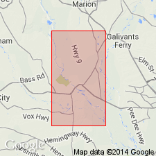
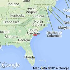
Pg. 6-7, 24-27. Peedee bed. The marls of South Carolina which are sufficiently abundant to be valuable for use are of four different formations or geological ages, and each of distinct and marked character in regard to certain minor peculiarities, though all agreeing in main chemical and agricultural characteristics, as defined above, and which only are of importance to the value of marl. That which I shall term Peedee bed is oldest marl, and is part of great secondary formation (and that division called the Cretaceous, and which is so fully developed in New Jersey), as is manifest from its characteristic fossils (principally BELEMNITES AMERICANA and EXOGYRA COSTATA). This bed, so far as I have yet ascertained, is limited to land bordering on part of great Peedee River and some its tributaries, as Black River; all the formation being connected and lying in Marion, Williamsburg, and Georgetown districts. The next oldest formation is separated from the Miocene marl (or middle Tertiary) in the geological series, or in regard to age, by the interval of two entire periods, or intervening successive formations (the new Cretaceous and the Eocene or lowest and oldest of the Tertiary, both of which are here entirely wanting), still the former two are so united in position near the Peedee that it would be difficult to describe either alone without referring continually to the other. Therefore, in the description that will be given of the secondary or Peedee bed, the overlying and connected bed of Miocene marl will be also embraced, so far as be considered separately, as part of the whole Miocene formation of the State. It is the secondary formation in that vicinity only to which I give the name of Peedee bed. This peculiar formation is known as low on Peedee River as Britton's ferry, at line dividing Georgetown and Williamsburg districts. The Peedee bed is of peculiar character and very different in appearance from all other formations in South Carolina. It occurs in alternate layers of hard marlstone and soft marl, sundry of which are to be seen in one section. Both these, wherever they underlie the Miocene, and also higher up than the latter extends, are of a dark bluish-gray color; and each is of homogeneous texture, the marl like an impure clay and the marlstone like a compact and coarse-grained hard stone. Lower down the river than any Miocene is seen, the upper marlstone of the secondary or Peedee bed is yellowish. The marl is poor compared to most of those of the great Carolinian bed and to the adjacent Miocene, usually not more than from 30 to 40 percent. The marlstone, however, is rich, varying from 66 to 68, and the little that has been tried burnt to white and excellent lime. The characteristic fossils, BELEMNITES and EXOGYRA COSTATA, are not found diffused generally, but are very abundant at particular places, of which the bluff at Birch's ferry is the best supplied.
Source: US geologic names lexicon (USGS Bull. 896, p. 1625-1626).
- Usage in publication:
-
- Peedee sand*
- Modifications:
-
- Revised
- AAPG geologic province:
-
- Atlantic Coast basin
Summary:
Sediments of the Peedee were also called the Burches Ferry marls by Sloan (1907). The exposure at Burches Ferry on Great Peedee River is mentioned by Ruffin (1843) as a typical exposure of his Peedee bed; therefore, Ruffin's name Peedee has priority over Sloan's Burches Ferry for these sediments. Throughout most of this report, the name is used as Peedee sand. [Stephenson doesn't state an intent to change the name from Peedee bed to Peedee sand. In another part of this report, Peedee formation is used, but the overall use is Peedee sand.]
Source: GNU records (USGS DDS-6; Reston GNULEX).

- Usage in publication:
-
- Peedee formation*
- Modifications:
-
- Revised
- AAPG geologic province:
-
- Atlantic Coast basin
Summary:
Name changed to Peedee formation. [No explanation given.]
Source: GNU records (USGS DDS-6; Reston GNULEX).

- Usage in publication:
-
- Peedee formation*
- Modifications:
-
- Overview
- AAPG geologic province:
-
- Atlantic Coast basin
Summary:
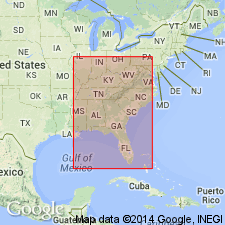
Peedee formation. The present [ca. 1938] definition of Peedee formation corresponds to Ruffin's definition in lithology and paleontology. It is uppermost of the Upper Cretaceous formations of coastal plain of eastern South Carolina (Florence and Horry Counties) and North Carolina; it unconformably overlies Black Creek formation and is everywhere unconformably overlain by Tertiary or Quaternary deposits; and it consists chiefly of dark-green or gray, finely micaceous, more or less glauconitic and argillaceous sands, many layers of which are calcareous and some sufficiently calcareous to form an impure limestone. Irregular concretionary masses of impure calcium carbonate occur in places. Dark marine clays are interstratified with the sand. Thickness o to 886 feet. In some reports it has been called Peedee sand, but that lithologic term is not strictly applicable. It is a marine formation, of Ripley age. (See L.W. Stephenson, North Carolina Geol. Survey, v. 3, 1912.)
Named from exposures on Great Peedee River, SC, the exposures at Burches Ferry, on west side of Peedee River in Florence Co., eastern SC, being a typical one. According to C.W. Cooke (USGS Bull. 867, 1936), Burches Ferry may be taken as type locality of Peedee formation, although the beds containing EXOGYRA CANCELLATA, which in North Carolina form base of Peedee formation, are absent at Burches Ferry.
Source: US geologic names lexicon (USGS Bull. 896, p. 1625-1626).
- Usage in publication:
-
- Peedee Formation*
- Modifications:
-
- Revised
- AAPG geologic province:
-
- Atlantic Coast basin
Summary:
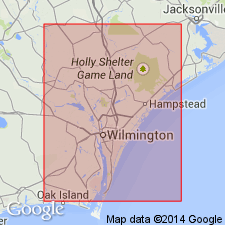
Scotts Hill Member named as part of the Peedee Formation. Named for Scotts Hill, New Hanover County, North Carolina. Formerly called Rocky Point Member of the Peedee by Wheeler and Curran (1974). Named for exposures along northeast Cape Fear River in southeast North Carolina and east-central South Carolina. Composed of sandy pelecypod biosparrudite and quartz arenite. Age is given as Cretaceous. Name changed from Rocky Point Member to Scotts Hill Member because of the existence of the Cretaceous Rocky Point Formation in Oregon and numerous other formation names using Rocky Point associated with different ages or localities.
Source: GNU records (USGS DDS-6; Reston GNULEX).
- Usage in publication:
-
- Peedee Formation
- Modifications:
-
- Biostratigraphic dating
- AAPG geologic province:
-
- Atlantic Coast basin
Summary:
Entire study area is underlain by the Peedee Formation. Throughout most of the region, the unit is gray or light-brown, silty, fine- to very fine-grained subangular quartz sand with trace quantities of glauconite, phosphorite, oyster shells, opaque mineral grains, and pyrite. Rocky Point Member is the uppermost Cretaceous unit in southeastern Brunswick Co. and north central New Hanover Co. Rocky Point is a gray, sandy, moldic limestone. Uppermost part commonly contains abundant phosphorite. Planktic foraminiferal zonation indicates a late but not latest Maastrichtian age.
Source: GNU records (USGS DDS-6; Reston GNULEX).
- Usage in publication:
-
- Peedee Formation*
- Modifications:
-
- Revised
- Age modified
- Biostratigraphic dating
- AAPG geologic province:
-
- Atlantic Coast basin
Summary:
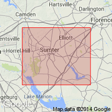
Pg. 10, 11 (fig. 8), 12, 27-28, 30, 31 (fig. 22), 36. Peedee Formation of Hazel and others (1977) and Gohn and others (1977) is restricted to upper 73 feet. Occurs in subsurface between 800 and 873 feet in Clubhouse Crossroads No. 1 drill core, near Clubhouse Crossroads, Dorchester County, southeastern South Carolina. Consists mostly of calcareous silty clay and clayey sand. Overlies Donoho Creek Formation. Age is latest Cretaceous (Maastrichtian; Navarroan Provincial Age; GLOBOTRUNCANA FALSOSTUARTI to ABATHOMPHALUS MAYAROENSIS planktic foram zone, ARKHANGELSKIELLA CYMBIFORMIS to MICULA MURUS (NC21 to NC23) calcareous nannofossil zone, "CYTHEREIS" LIXULA ostracode zone).
Source: Publication.
- Usage in publication:
-
- Peedee Formation*
- Modifications:
-
- Biostratigraphic dating
- AAPG geologic province:
-
- Atlantic Coast basin
Summary:
Peedee Formation shown as Late Cretaceous (middle and late Maastrichtian) on fig. 1. Middle and late Maastrichtian age based in part on CRASSATELLA VADOSA collected from Pender and New Hanover Cos., eastern NC, and Georgetown Co., northeastern SC.
Source: GNU records (USGS DDS-6; Reston GNULEX).
- Usage in publication:
-
- Peedee Formation*
- Modifications:
-
- Age modified
- Areal extent
- AAPG geologic province:
-
- Atlantic Coast basin
Summary:
Used as Peedee(?) Formation in central SC for allostratigraphic deposits biostratigraphically equivalent to Peedee Formation as used by Sohl and Owens (1991), although they are somewhat dissimilar in lithology due to strong deltaic influence on middle Maastrichtian deposition in central SC. Figure 4 of report shows Peedee Formation here and in eastern SC correlating with upper part of Ripley Formation and Prairie Bluff Chalk in AL; also shows assignment to Navarroan provincial stage.
Source: GNU records (USGS DDS-6; Reston GNULEX).
For more information, please contact Nancy Stamm, Geologic Names Committee Secretary.
Asterisk (*) indicates published by U.S. Geological Survey authors.
"No current usage" (†) implies that a name has been abandoned or has fallen into disuse. Former usage and, if known, replacement name given in parentheses ( ).
Slash (/) indicates name conflicts with nomenclatural guidelines (CSN, 1933; ACSN, 1961, 1970; NACSN, 1983, 2005, 2021). May be explained within brackets ([ ]).