The National Geologic Map Database is migrating to a new infrastructure. We apologize for any service disruptions during this process.
|
|---|


- Usage in publication:
-
- Pedmar Formation*
- Modifications:
-
- Named
- Biostratigraphic dating
- Dominant lithology:
-
- Sandstone
- Siltstone
- AAPG geologic province:
-
- Alaska Peninsula province
- Alaska Southwestern region
Summary:
Pedmar Formation. Consists mainly of thick-bedded, fine- to medium-grained, gray to olive-gray sandstone with siltstone and shale beds. Is 82 m thick at type section. Is 88 m thick on unnamed mountain peak above unnamed lake east of Ikagluik Creek, Katmai B-3 quadrangle (scale 1:63,360), where unit disconformably overlies Herendeen Formation. Disconformably underlies Kaguyak Formation. Is in fault contact with underlying Naknek Formation at type section. Age is Early Cretaceous (Albian) based on abundant ammonites.
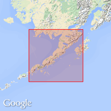
Type section: in sea-cliff, Katmai Bay, along north edge of sec. 26, T. 25 S., R. 34 W., Mount Katmai A-3 quadrangle (scale 1:63,360), Alaska Peninsula, AK. Named from Mount Pedmar, Mount Katmai A-3 quadrangle.
Source: Modified from GNU records (USGS DDS-6; Menlo GNULEX).
For more information, please contact Nancy Stamm, Geologic Names Committee Secretary.
Asterisk (*) indicates published by U.S. Geological Survey authors.
"No current usage" (†) implies that a name has been abandoned or has fallen into disuse. Former usage and, if known, replacement name given in parentheses ( ).
Slash (/) indicates name conflicts with nomenclatural guidelines (CSN, 1933; ACSN, 1961, 1970; NACSN, 1983, 2005, 2021). May be explained within brackets ([ ]).