The National Geologic Map Database is migrating to a new infrastructure. We apologize for any service disruptions during this process.
|
|---|


- Usage in publication:
-
- Peculiar shale
- Modifications:
-
- Original reference
- Dominant lithology:
-
- Shale
- AAPG geologic province:
-
- Mojave basin
Summary:
Pg. 363 (fig. 150). Peculiar shale. Shown on structure section as underlying Mahala sandstone and conglomerate (new) and overlying Hunter sandstone and conglomerate. [Age is late Miocene.]
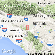
Recognized locally southwest of Chino fault in San Bernadino Co., southern CA.
Source: Publication; US geologic names lexicon (USGS Bull. 1200, p. 2963).
- Usage in publication:
-
- Peculiar shale
- Modifications:
-
- Revised
- Dominant lithology:
-
- Shale
- AAPG geologic province:
-
- Mojave basin
Summary:
Pg. 521. Peculiar shale (in Puento formation). Micaceous sandy shale with poor stratification. Thickness 657 feet. Upper part of Puente. Measured section noted. Recognized in southern California. Age is late Miocene.
Exposed in Slaughter Canyon in southeastern Puente Hills, between Chino and the Santa Ana River, San Bernardino Co., southern CA.
Source: Publication; US geologic names lexicon (USGS Bull. 1200, p. 2963).
For more information, please contact Nancy Stamm, Geologic Names Committee Secretary.
Asterisk (*) indicates published by U.S. Geological Survey authors.
"No current usage" (†) implies that a name has been abandoned or has fallen into disuse. Former usage and, if known, replacement name given in parentheses ( ).
Slash (/) indicates name conflicts with nomenclatural guidelines (CSN, 1933; ACSN, 1961, 1970; NACSN, 1983, 2005, 2021). May be explained within brackets ([ ]).