The National Geologic Map Database is migrating to a new infrastructure. We apologize for any service disruptions during this process.
|
|---|


- Usage in publication:
-
- Peay sandstone member
- Modifications:
-
- Named
- Dominant lithology:
-
- Sandstone
- AAPG geologic province:
-
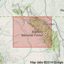
- Bighorn basin
Summary:
Name applied to a 150 to 200 ft thick gray and light-brown sandstone that lies 850 to 900 ft above base of Benton shale. Named as a member (one of four) of Benton Shale of Colorado group. Has large sandy concretions in central part. Top layer is conglomerate. Sandstone is thin bedded to massive. Some shale layers. Is the most prominent sandstone of the Colorado group. Lies on "Lower Benton shale member." Underlies the "Upper Benton shale member." Lower contact not sharply defined. Upper contact is with black shale. Sandstone layers are well indurated; the beds vary from a few inches to three ft thick. Upper part is locally massive. Large ironstone concretions found in central part of massive part. Present over most of study area, Bighorn Co., WY, Bighorn basin. Widely distributed on geologic map. Of Late Cretaceous age. Neither source of geographic name or type locality designated. Stratigraphic table.
Source: GNU records (USGS DDS-6; Denver GNULEX).
For more information, please contact Nancy Stamm, Geologic Names Committee Secretary.
Asterisk (*) indicates published by U.S. Geological Survey authors.
"No current usage" (†) implies that a name has been abandoned or has fallen into disuse. Former usage and, if known, replacement name given in parentheses ( ).
Slash (/) indicates name conflicts with nomenclatural guidelines (CSN, 1933; ACSN, 1961, 1970; NACSN, 1983, 2005, 2021). May be explained within brackets ([ ]).