

- Usage in publication:
-
- Pearce volcanics*
- Modifications:
-
- Named
- Dominant lithology:
-
- Rhyolite
- AAPG geologic province:
-
- Pedregosa basin
Summary:
Pg. 9, 116-118, pl. 5. Pearce volcanics. At west end of hill in north center sec. 1, T. 18 S., R. 25 E., hornblende andesite forms basal member and rests unconformably on Bisbee formation. Within a few hundred feet toward the east, however, andesite is overlapped by rhyolite which rests on Bisbee formation. In most other exposures of fonnation, rhyolites either overlie the andesites or are in fault contact with them. Andesitic parts of volcanics mostly normal flows, with subordinate flow breccias and a few thin water-laid andesitic tuffs. Flows are light-pinkish-gray to dark-gray and weather to rather dark-brown. Rhyolites include thick, massive flows, flow breccias, agglomerates, and tuffs, with fragmental rocks probably predominant. Flows range from light-pinkish-gray through pink to purplish and weather dark-brown commonly glassy, with spherulites and lithophysae as much as 8 cm in diameter present in some of them. A few flows are lithic, and some are porphyritic black obsidian. In Sulphur Hills, 3,000 feet is probably minimum thickness for formation. Base exposed only in hills east and northeast of Township Butte. Upper limit of formation throughout map area is simply overlap of alluvium, and because the volcanic rocks have been highly deformed, it is impossible to estimate maximum orginal thickness. Age is Miocene or Pliocene. Report includes geologic map.
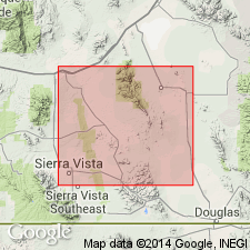
Form a group of conspicuous isolated hills rising above alluvium of Sulphur Springs Valley in neighborhood of Pearce, in T. 17 and 18 S., R. 25 and 26 E., central Cochise Co., southeastern AZ. Named from Pearce. Six Mile, Pearce, and the Sulphur Hills, Township and Three Sisters Buttes, and Turkey Creek Ridge are all composed of these rocks, central Cochise Co., southeastern AZ.
Source: US geologic names lexicon (USGS Bull. 1200, p. 2956); supplemental information from GNU records (USGS DDS-6; Denver GNULEX).
- Usage in publication:
-
- Pearce Volcanics*
- Modifications:
-
- Age modified
- AAPG geologic province:
-
- Pedregosa basin
Summary:
Shown as of Eocene to Miocene age in Dos Cabezas Mountains, Cochise Co, AZ in the Pedregosa basin. Correlation chart. Considered Miocene or Pliocene in earlier reports.
Source: GNU records (USGS DDS-6; Denver GNULEX).
For more information, please contact Nancy Stamm, Geologic Names Committee Secretary.
Asterisk (*) indicates published by U.S. Geological Survey authors.
"No current usage" (†) implies that a name has been abandoned or has fallen into disuse. Former usage and, if known, replacement name given in parentheses ( ).
Slash (/) indicates name conflicts with nomenclatural guidelines (CSN, 1933; ACSN, 1961, 1970; NACSN, 1983, 2005, 2021). May be explained within brackets ([ ]).