The National Geologic Map Database is migrating to a new infrastructure. We apologize for any service disruptions during this process.
|
|---|


- Usage in publication:
-
- Peach Springs Tuff
- Modifications:
-
- First used
- Dominant lithology:
-
- Ash
- Ignimbrite
- AAPG geologic province:
-
- Plateau sedimentary province
Summary:
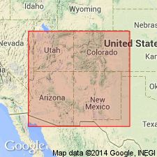
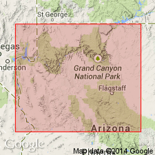
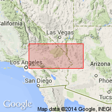
Occurs at edge of Colorado Plateau, northwest AZ. Only widespread formation that can be correlated throughout area is complex tuff herein named Peach Springs Tuff. On Hualapai Plateau composed of ash fall and ignimbrite (welded). West of Lower Grand Wash Cliffs and near Valentine, AZ, uppermost part of this acidic volcanic sequence has aspects of true volcanic flow. Total thickness of tuff decreases to north and northeast which indicates southwesterly source outside plateau. A sample of tuff dated at 18.3 +/-0.6 Ma (Damon, 1964, p.19) was collected from abandoned prevolcanic channel through Milkweed Canyon.
Source: GNU records (USGS DDS-6; Menlo GNULEX).
- Usage in publication:
-
- Peach Springs Tuff
- Modifications:
-
- Named
- Dominant lithology:
-
- Ash
- Ignimbrite
- AAPG geologic province:
-
- Plateau sedimentary province
Summary:
Named by Young (1966) in PhD thesis (Dissertation Abstracts). Composed of ash fall and welded ignimbrite; west of Grand Wash Cliffs has aspects of true volcanic flow. Milkweed Canyon diagrammatic cross section shows unit underlies lava flows and Willow Springs Formation (new) and overlies lava flows and Milkweed Member of Buck and Doe Conglomerate. Peach Springs Canyon diagrammatic cross section shows unit overlies Hualapai Volcanics. Sample from tuff collected in Milkweed Canyon was dated as 18.3 +/-0.6 Ma (Damon, 1964, p.19) [thus early Miocene].
Source: GNU records (USGS DDS-6; Menlo GNULEX).
- Usage in publication:
-
- Peach Springs Tuff
- Modifications:
-
- Areal extent
- Geochronologic dating
- Paleomagnetics
- AAPG geologic province:
-
- Plateau sedimentary province
Summary:
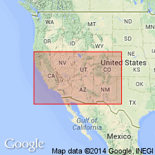
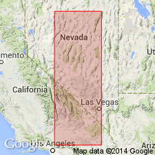
Is single cooling unit, a welded ash-flow tuff of trachytic composition and of normal polarity. Blanketed an area of 2000 sq mi on both sides of the western edge of Colorado Plateau, Mohave Co, AZ, in Plateau sedimentary province. Filled in northeast-trending pre-Colorado River canyons cut in Paleozoic rocks. Had its source west of Cerbat Mountains, in or near Black Mountains. Petrologic descriptions and areal extent map. Easternmost outcrops record deposition of basal, distinctly bedded ash 1 ft thick, locally welded, nonlaminated pinkish tuff 10 ft thick, and upper welded ash flow 30 to 60 ft thick. Western exposures have basal 30 ft ash layer, 137 ft loosely welded tuff containing volcanic pebbles of various lithologies, and upper 84 ft thick welded zone. Erupted at time when declination of geomagnetic field was east of its average value. Dated as 16.9 +/-0.4 and 18.3 +/-0.6 Ma, or middle Miocene by earlier workers.
Source: GNU records (USGS DDS-6; Menlo GNULEX).

- Usage in publication:
-
- Peach Springs Tuff*
- Modifications:
-
- Geochronologic dating
- AAPG geologic province:
-
- Mojave basin
Summary:
Pg. 10, 11, geologic time scale (inside front cover). Peach Springs Tuff. Sample from nonwelded ash-flow tuff with sanidine and minor biotite, hornblende, and sphene, in SW/4 sec. 8, T. 1 N., R. 26 E., Lat. 34 deg. 11 min. 30 sec. N., Long 114 deg. 16 min. 30 sec. W., Parker quadrangle, San Bernadino County, California, yielded K-Ar ages of 19.2 +/-0.5 Ma (biotite) and 18.6 +/-0.4 Ma (sanidine). Two samples from basalt immediately underlying Peach Springs Tuff (Young and Brennan, 1974), at Lat. 34 deg. 21 min. 00 sec. N., Long. 114 deg. 38 min. 00 sec. W., Savahia Peak SW quadrangle, San Bernadino County, California, yielded K-Ar ages of 17.4 +/-0.4 Ma and 14.9 +/-0.3 Ma (whole-rock); ages too young. Ages calculated using decay constants of Steiger and Jager, 1977 (Earth Planet. Sci. Letters, v. 36, p. 359-362). Age of Peach Springs Tuff 18.9 Ma. [Miocene, based on time scale of Berggren, 1972, Lethaia, v. 5, no. 2, p. 195-215.]
Source: Publication.
- Usage in publication:
-
- Peach Springs Tuff
- Modifications:
-
- Areal extent
- Geochronologic dating
- AAPG geologic province:
-
- Mojave basin
Summary:
Tuff resembling Peach Springs Tuff(?) (of Young, 1966) in age and lithology is present east and west of Stepladder Mountains in Sawtooth Range (Chemehuevi Mountains) and in Little Piute Mountains, CA. Consists of welded crystal-rich ash-flow tuff with blue sanidine with ages of 18.1 and 18.3 Ma.
Source: GNU records (USGS DDS-6; Menlo GNULEX).
- Usage in publication:
-
- Peach Springs Tuff
- Modifications:
-
- Areal extent
- Geochronologic dating
- AAPG geologic province:
-
- Plateau sedimentary province
- Mojave basin
Summary:
Similarities in stratigraphic position, field appearance, petrography, isotopic ages, paleomagnetic directions and phenocryst composition indicate outcrops of chatoyant sanidine ash-flow tuff in central Mojave Desert may be equivalent to Peach Springs Tuff. If confirmed then Peach Springs Tuff is scattered over area of 35,000 sq km. Mean K-Ar age from sanidine and biotite is 18.3 Ma. Sketch map shows distribution.
Source: GNU records (USGS DDS-6; Menlo GNULEX).
- Usage in publication:
-
- Peach Springs Tuff
- Modifications:
-
- Geochronologic dating
- AAPG geologic province:
-
- Mojave basin
Summary:
Pg. 4, 5, geologic time scale (inside front cover). Peach Springs Tuff.
(1) Sample from tuff, western phase of Peach Springs Tuff. K-Ar age on sanidine 20.0 +/-1.0 Ma [Miocene]; calculated age represents age of formation. The decay constants for potassium-40 that were published with this K-Ar age are in error; the age was calculated using the revised decay constants, recommended by the IUGS Subcommission on Geochronology (Steiger and Jager, 1977, Earth and Planetary Science Letters, v. 36, p. 359-362). Sample no. 11-1A (Glazner, 1986, GSA Cordilleran Sec., 82nd Ann. Mtg. Gdbk., p. 51-63). Sample locality: Sleeping Beauty area of southern Cady Mountains, Lat. 34 deg. 46 min. N., Long. 116 deg. 16 min. W., in sec. 30, T. 8 N., R. 7 E., Cady Mountains 15-min quadrangle, San Bernardino Co., CA. Collected by A.F. Glazner.
(2) Sample from a crystal-lithic rhyodacite tuff, a possible equivalent to the Peach Springs Tuff. K-Ar age on sanidine 18.6 +/-0.6 Ma [Miocene]. Sample no. USGS(D)KH78-47 (Miller and others, 1982; Glazner and others, 1986). Sample locality: central Piute Mountains, Lat. 34 deg. 46 min. 10 sec. N., Long. 115 deg. 07 min. 29 sec. W., in SW/4 NW/4 sec. 20, T. 8 N., R. 18 E., Fenner 15-min quadrangle, San Bernardino Co., CA. Collected by K.A. Howard.
Ages determined by USGS personnel in Denver, CO (R.F. Marvin, H.H. Mehnert, E.A. Brandt). Decay constants, recommended by the IUGS Subcommission on Geochronology (Steiger and Jager, 1977) are used.
Source: Publication.
For more information, please contact Nancy Stamm, Geologic Names Committee Secretary.
Asterisk (*) indicates published by U.S. Geological Survey authors.
"No current usage" (†) implies that a name has been abandoned or has fallen into disuse. Former usage and, if known, replacement name given in parentheses ( ).
Slash (/) indicates name conflicts with nomenclatural guidelines (CSN, 1933; ACSN, 1961, 1970; NACSN, 1983, 2005, 2021). May be explained within brackets ([ ]).