

- Usage in publication:
-
- Peace River Formation
- Modifications:
-
- Named
- Dominant lithology:
-
- Sand
- Clay
- Limestone
- Dolostone
- AAPG geologic province:
-
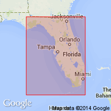
- South Florida province
Summary:
Peace River Formation is a new name for combined upper Hawthorn siliciclastic strata and Bone Valley Formation, here reduced in rank to a member of the Peace River. The upper siliciclastic strata includes beds previously placed in the Tamiami Formation of Parker (1951) and the Murdock Station and Bayshore Clay Members of the Tamiami of Hunter (1968). Type section is designated in a core in east-central DeSoto Co. where the formation is 138 ft (42 m) thick. Maximum thicknesses of more than 650 ft (198 m) have been measured in Martin and Palm Beach Cos. Unit consists of interbedded quartz sands, clays and carbonates. The siliciclastics comprise two-thirds or more of the formation. Quartz sands are clayey, calcareous to dolomitic, phosphatic, very fine to medium-grained and poorly consolidated. Clay beds are common and are quartz sandy, silty, calcareous to dolomitic, phosphatic, and poorly to moderately indurated. Carbonates may be either limestone or dolostone. Unit everywhere disconformably overlies the Arcadia Formation, which is redefined in this paper. Contact may be marked with rubble zone. Unit underlies limestone and sand of the Tamiami Formation or unnamed post-Hawthorn sediments. The Peace River occurs over most of the southern half of the Florida peninsula, but is absent from the Ocala Platform and the Sanford High. The unit is thought to range in age from latest early or early middle Miocene to early Pliocene.
Source: GNU records (USGS DDS-6; Reston GNULEX).
- Usage in publication:
-
- Peace River Formation*
- Modifications:
-
- Revised
- AAPG geologic province:
-
- Florida platform
Summary:
The Peace River Formation (as defined by Scott, 1988) of the Hawthorn Group is revised by raising the Bone Valley Member (upper member of the Peace River as defined by Scott, 1988) to formation rank and is therefore removed from the Peace River. Because the Bone Valley is of Miocene and Pliocene age and overlies the Peace River, the Peace River is accepted to be of just Miocene age. In the Land-pebble district of Florida, the Peace River consists of dolomitic clay and sand with abundant phosphate derived, in part, from the underlying carbonate rock, and ranges from 3-18 m thick. In the southern extension, the unit consists of sandy and silty clay with dolomite lenses, and ranges from 18-45 m thick.
Source: GNU records (USGS DDS-6; Reston GNULEX).
- Usage in publication:
-
- Peace River Formation
- Modifications:
-
- Biostratigraphic dating
- Overview
- AAPG geologic province:
-
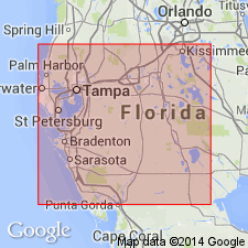
- Florida platform
Summary:
In this report there are four named formations included within Pliocene time in southern FL, including the lower parts of the Caloosahatchee and Anastasia Formations, the Tamiami Formation, and the Peace River Formation of the Hawthorn Group. All are separated from each other and from younger and older units by regional unconformities. Exact placement of the Miocene-Pliocene boundary has been controversial for years. Current data show that all or part of the Peace River is early Pliocene based on calcareous nannofossils. The reasoning used to place the entire formation in the Pliocene is that the major disconformity separating the Peace River from the underlying Arcadia Formation appears to be the discontinuity that correlates to the regression of sea level at the end of Messinian time. That hiatus is approximately 10 m.y. However, it is possible that some lower units within the Peace River may be late Miocene in age east of the platform center.
Source: GNU records (USGS DDS-6; Reston GNULEX).
- Usage in publication:
-
- Peace River Formation*
- Modifications:
-
- Age modified
- Geochronologic dating
- AAPG geologic province:
-
- Florida platform
Summary:
Peace River Formation of Hawthorn Group is used in this report following usage of Scott (1988). Includes Bone Valley Member, which is not differentiated here. Age is changed to Pliocene based on 87Sr/86Sr age estimate of 5.1 Ma on a mollusk.
Source: GNU records (USGS DDS-6; Reston GNULEX).
- Usage in publication:
-
- Peace River Formation*
- Modifications:
-
- Age modified
- AAPG geologic province:
-
- Florida platform
Summary:
Peace River Formation is middle Miocene to early Pliocene [following Scott (1988)].
Source: GNU records (USGS DDS-6; Reston GNULEX).
For more information, please contact Nancy Stamm, Geologic Names Committee Secretary.
Asterisk (*) indicates published by U.S. Geological Survey authors.
"No current usage" (†) implies that a name has been abandoned or has fallen into disuse. Former usage and, if known, replacement name given in parentheses ( ).
Slash (/) indicates name conflicts with nomenclatural guidelines (CSN, 1933; ACSN, 1961, 1970; NACSN, 1983, 2005, 2021). May be explained within brackets ([ ]).