- Usage in publication:
-
- Paxton Formation*
- Modifications:
-
- Revised
- Age modified
- AAPG geologic province:
-
- New England province
Summary:
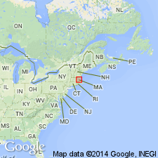
Paxton Quartz Schist or Paxton Schist revised as Paxton Formation because it contains a variety of rock types although principally a calcareous metasiltstone. Emerson (1917) considered the Paxton and Oakdale to grade into each other; others believe Paxton to be a higher metamorphic grade. In contrast, Pease (1972) and Barosh (1976) subdivided Paxton into Southbridge Formation and an unnamed unit equivalent to Hebron Formation of CT. Southbridge is here considered to be a member of Paxton Formation. As a result of mapping north of the Brimfield Schist [now Group] type locality, Peter Robinson (1978, oral commun.) believes that Bigelow Brook Formation of Brimfield Group is more appropriate as a member of Paxton Formation because it projects into Emerson's (1917) type Paxton Quartz Schist. Paxton is continuous with part of Merrimack Group of southeastern NH and probably is equivalent of Berwick Formation of Merrimack Group. Assigned a probable Silurian age based on correlation with Berwick. Intruded by granite of Silurian age (R.E. Zartman and R.S. Naylor, written commun., 1978) and therefore could be older than Silurian.
Source: GNU records (USGS DDS-6; Reston GNULEX).

- Usage in publication:
-
- Paxton Formation*
- Modifications:
-
- Overview
- AAPG geologic province:
-
- New England province
Summary:
Used as Paxton Formation of Silurian age. Includes Southbridge and Bigelow Brook Members, as well as several unnamed parts.
Source: GNU records (USGS DDS-6; Reston GNULEX).

- Usage in publication:
-
- Paxton Group*
- Modifications:
-
- Revised
- AAPG geologic province:
-
- New England province
Summary:
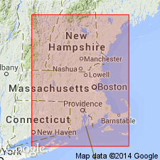
The Paxton Formation is here raised to Paxton Group and revised to exclude strata now assigned to the overlying Brimfield Group. It includes the lower Dudley Formation and the upper Southbridge Formation in central MA and northeastern CT. Outside of this area, the Paxton is undivided. It is a sequence of metagraywacke strata, which conformably overlies the Oakdale Formation and conformably underlies the Bigelow Brook Formation of the Brimfield Group in the type area. It forms a belt extending from CT to southern ME. It is correlative with the Hebron Formation in CT, the upper part of the Berwick Formation in ME, and the Rye Formation in NH. Age is Late Proterozoic. [Because of delayed publication date of Pease (1989), this report supersedes age reported in Pease (1989).]
Source: GNU records (USGS DDS-6; Reston GNULEX).

- Usage in publication:
-
- Paxton Group*
- Modifications:
-
- Age modified
- Geochronologic dating
- AAPG geologic province:
-
- New England province
Summary:
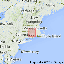
The Paxton, here of group rank, includes strata formerly mapped in CT as the Hebron Formation and in MA as the Paxton Formation. It conformably overlies the Oakdale Formation and structurally and conformably underlies the Brimfield Group. It is undivided in central MA; in northeast CT and adjacent MA it is divided into the Dudley and Southbridge Formations. Age is Late Proterozoic(?) based on the intrusion of 440 m.y. Hedgehog Hill gneiss into the overlying Brimfield Group and an age of 1188 m.y. for detrital zircons from the Paxton. [Because of delayed publication date, age given in this report is superseded by Barosh (1988).]
Source: GNU records (USGS DDS-6; Reston GNULEX).

- Usage in publication:
-
- Paxton Formation*
- Modifications:
-
- Overview
- Areal extent
- AAPG geologic province:
-
- New England province
Summary:
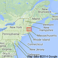
Paxton Formation occurs in Gardner, Southbridge, and Wachusett Mountain subbelts of Merrimack belt. In 1976, Robinson and Tucker (see Robinson and others, 1982, Stratigraphy and structure of the Ware-Barre area, central Massachusetts, Stop 12a, IN New England Intercollegiate Geological Conference, 74th Annual Meeting, Storrs, Conn., Oct. 2-3, 1982, Guidebook for field trips in Connecticut and south-central Massachusetts: Connecticut Geological and Natural History Survey Guidebook 5, p. 341-373.) rediscovered large cascade exposure on brook draining Eames Pond in western part of Paxton, which was probably Emerson's (1917) type locality. Paxton includes the following subdivisions: sulfidic schist and sillimanite quartzite, sulfidic quartzite and rusty schist, granofels member, amphibolite, Bigelow Brook Member, Southbridge Member, and sulfidic mica schist. Sulfidic schist and sillimanite quartzite unit was previously mapped as white schist member of Paxton by Field (1975), was lumped with upper schist member of Hamilton Reservoir Formation (now mainly included in Partridge Formation) by Seiders (1975) and Pomeroy (1977), or mapped as schist within upper gneiss member of Hamilton Reservoir Formation. Is lithic correlative of Smalls Falls Formation of northwestern ME. Schist in sulfidic schist and sillimanite quartzite unit of Paxton is very similar to subordinate rusty-weathering sillimanite-graphite-pyrrhotite-biotite schist of Fitch Formation. Since publication of MA State Geologic Map (Zen and others, 1983), this unit was traced into CT. Sulfidic quartzite and rusty schist unit may be broadly equivalent to upper part of Perry Mountain Formation and Smalls Falls Formation in ME. Granofels member in Wachusett Mountain subbelt coincides in part with original belt of Oakdale Quartzite of Emerson (1917), and corresponds to western belt of Oakdale of Grew (1970) and Oakdale Formation of G.R. Robinson (1978, 1981). These authors' designations not followed on MA State Geologic Map (Zen and others, 1983). Also very similar to Madrid and Fall Brook Formations in ME, Warner Formation of central NH, and Fitch Formation of Connecticut Valley belt. Also similar lithically to Vassalboro Formation in central ME, Eliot and Berwick Formations in southeastern NH, Oakdale Formation in Nashua subbelt in MA, and to Hebron Formation in eastern CT. Narrow belt of granofels member east of Southbridge Member corresponds to Hebron Formation as mapped by Pease (1972) in Eastford quad. Rocks mapped as Bigelow Brook Member were previously mapped as eastern part of Bigelow Brook Formation by Pomeroy (1975) and other workers. Age is Silurian. [Due to delay in publication of this report, ages are superseded by those in Barosh and Moore (1988).]
Source: GNU records (USGS DDS-6; Reston GNULEX).
For more information, please contact Nancy Stamm, Geologic Names Committee Secretary.
Asterisk (*) indicates published by U.S. Geological Survey authors.
"No current usage" (†) implies that a name has been abandoned or has fallen into disuse. Former usage and, if known, replacement name given in parentheses ( ).
Slash (/) indicates name conflicts with nomenclatural guidelines (CSN, 1933; ACSN, 1961, 1970; NACSN, 1983, 2005, 2021). May be explained within brackets ([ ]).

