The National Geologic Map Database is migrating to a new infrastructure. We apologize for any service disruptions during this process.
|
|---|


- Usage in publication:
-
- Patterson Point formation*
- Modifications:
-
- Named
- Dominant lithology:
-
- Ash
- Pumice
- Pyroclastics
- AAPG geologic province:
-
- Aleutian Islands province
- Alaska Southwestern region
Summary:
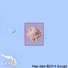
Named after Patterson Point. Type section designated as exposure in stream cut north of 1980-ft mountain, 51 deg 57'40"N, 178 deg 30'50"E, Little Sitkin Island, Rat Islands group, Aleutian Islands, AK. Extends 2 mi northwestward from Little Sitkin volcano toward Patterson Point. Consists of: (1) lower unit of salmon-pink to grayish-white, very firmly consolidated or welded dacitic glass and pumice, and (2) upper unit of light-grayish-white to bluish-gray firmly consolidated ash and pumiceous lapilli. Is several hundred ft thick. Overlies Double Point dacite (new). Geologic map of Little Sitkin Island shows age as Quaternary.
Source: GNU records (USGS DDS-6; Menlo GNULEX).
For more information, please contact Nancy Stamm, Geologic Names Committee Secretary.
Asterisk (*) indicates published by U.S. Geological Survey authors.
"No current usage" (†) implies that a name has been abandoned or has fallen into disuse. Former usage and, if known, replacement name given in parentheses ( ).
Slash (/) indicates name conflicts with nomenclatural guidelines (CSN, 1933; ACSN, 1961, 1970; NACSN, 1983, 2005, 2021). May be explained within brackets ([ ]).