

- Usage in publication:
-
- Patsy Mine volcanics*
- Modifications:
-
- Named
- Dominant lithology:
-
- Andesite
- Basalt
- Breccia
- AAPG geologic province:
-
- Great Basin province
- Plateau sedimentary province
Summary:
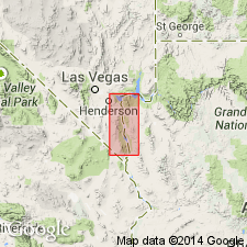
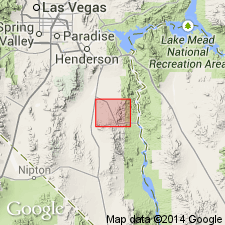
Named for exposures at the Patsy Mine about 3 mi northwest of Nelson, Clark Co, NV in the Great Basin province. The exposures constitute the type locality. Mapped (geologic map) north of type on both sides of the Colorado River in NV and adjacent AZ which is in the Plateau sedimentary province almost to the Hoover Dam area, and east of the type in the Black Mountains of Mohave Co, AZ, and in a small area in the River Mountains of Clark Co northwest of the type. Younger than the Horse Spring formation and older than the newly named Golden Door volcanics. Consists of 5,000+ ft of brown andesite and basalt lava flows and some explosion breccias. Has local tuffaceous layers. The flows vary in thickness from a few ft to more than 100 ft; they are vesicular or amygdaloidal in upper part; the flows contain some angular fragments; some of the fragments in the flows are coarse-grained quartz monzonite. Came from an eruptive center about 5 mi northeast of Nelson and another near the Hoover Dam. Was erupted through silicic plutons. Rests unconformably on Precambrian. Tertiary age; shown as Eocene? or Miocene? age on map.
Source: GNU records (USGS DDS-6; Denver GNULEX).
- Usage in publication:
-
- Patsy Mine Volcanics*
- Modifications:
-
- Geochronologic dating
- Overview
- AAPG geologic province:
-
- Great Basin province
Summary:
Has an age range of 15.2 to 22.8 m.y., a mean age of 18.3 m.y. from 5 samples on basis of K-Ar date. Thickest known section 13,200 +/-500 ft occurs at type locality. Can be divided into three parts by a middle rhyolite. Upper and lower parts are predominantly andesite. The middle part is mostly rhyolite. The lower part of the formation has (ascending): 1) dark-green to black basaltic andesite flows less than 50 ft thick; 2) gray densely welded rhyolitic ash-flow tuff; 3) monotonous successions of 40 andesite and basaltic andesite lava flows, flow breccias, and explosion breccias about 9,000 ft thick. The middle part is predominantly gray to pink rhyolite lava with local brown, gray or black vitrophyres; these lavas are interstratified with yellow zeolitized tuffaceous sedimentary rocks and red-brown andesite lava. The upper part consists of 1500 +/-300 ft of massive dark basaltic andesite lava. Geologic map of part of Boulder City and Nelson quads, NV, Great Basin province. Tertiary, Miocene age.
Source: GNU records (USGS DDS-6; Denver GNULEX).
For more information, please contact Nancy Stamm, Geologic Names Committee Secretary.
Asterisk (*) indicates published by U.S. Geological Survey authors.
"No current usage" (†) implies that a name has been abandoned or has fallen into disuse. Former usage and, if known, replacement name given in parentheses ( ).
Slash (/) indicates name conflicts with nomenclatural guidelines (CSN, 1933; ACSN, 1961, 1970; NACSN, 1983, 2005, 2021). May be explained within brackets ([ ]).