- Usage in publication:
-
- Patoka Formation
- Modifications:
-
- Overview
- AAPG geologic province:
-
- Illinois basin
Summary:
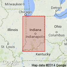
Patoka Formation of McLeansboro Group was first used in a stratigraphic column by Wier and Gray (1961). Type locality includes numerous exposures along tributaries of Patoka River near Patoka, Gibson Co., western IN. Other good exposures are along tributaries of White River near Hazelton. Rocks now recognized as Patoka were previously called Meron Group in southern IN by Logan (1922) and were included in part of Shelburn Group of Cumings (1922). Patoka is southward-thickening unit of shale, sandstone, clay, limestone, and coal. Consists of all rocks above West Franklin Member of Shelburn Formation and below Carthage Limestone Member of Bond Formation. Includes (ascending) Ditney Coal Member, Inglefield Sandstone Member, Hazelton Bridge Coal Member, Vigo Limestone Member, Dicksburg Hills Sandstone Member, Raben Branch Coal Member, and Parker Coal Member, and unnamed beds of shale, clay, and sandstone. Shale and sandstone make up more than 85 percent of formation. Thickness ranges from 100 ft in northern Sullivan Co., to 310 ft in southwestern Posey Co. Correlates with upper part of Modesto Formation of IL and middle part of Sturgis Formation in KY. Age is Late Pennsylvanian (Missourian). Report includes correlation chart.
Source: GNU records (USGS DDS-6; Reston GNULEX).

- Usage in publication:
-
- Patoka Formation*
- Modifications:
-
- Overview
- AAPG geologic province:
-
- Illinois basin
Summary:
Used as Patoka Formation of Missourian age. Includes Parker Coal Member.
Source: GNU records (USGS DDS-6; Reston GNULEX).
For more information, please contact Nancy Stamm, Geologic Names Committee Secretary.
Asterisk (*) indicates published by U.S. Geological Survey authors.
"No current usage" (†) implies that a name has been abandoned or has fallen into disuse. Former usage and, if known, replacement name given in parentheses ( ).
Slash (/) indicates name conflicts with nomenclatural guidelines (CSN, 1933; ACSN, 1961, 1970; NACSN, 1983, 2005, 2021). May be explained within brackets ([ ]).

