The National Geologic Map Database is migrating to a new infrastructure. We apologize for any service disruptions during this process.
|
|---|


- Usage in publication:
-
- Passagassawakeag Gneiss*
- Modifications:
-
- Named
- Dominant lithology:
-
- Gneiss
- AAPG geologic province:
-
- New England province
Summary:
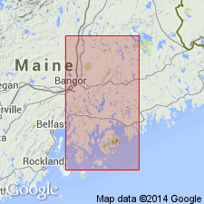
Passagassawakeag Gneiss named in Waldo Co., ME. Unit described as purplish-gray to gray granulose to weakly-to-strongly schistose layers of gneiss. Contains some garnet and trace amounts of graphite. 2,300 m thick in type area. Intruded by numerous small bodies of granitic rock. Unconformably underlies Hogback Schist or Bucksport Formation. Age given as Precambrian.
Source: GNU records (USGS DDS-6; Reston GNULEX).
- Usage in publication:
-
- Passagassawakeag Formation
- Modifications:
-
- Revised
- AAPG geologic province:
-
- New England province
Summary:
Passagassawakeag Formation is here proposed to replace term Knox Gneiss of Perkins and Smith (1925). Unit is subdivided into a basal calc-silicate member (30-150 m) and the upper Mixer Pond Member (new name) (300 m). Isotopic dating by Zartman (oral commun., 1974) and Brookins (1975, written commun.) ranges from 430+/-10 m.y. (Pb206-Pb207, zircons) to 600+/-80 m.y. (Rb-Sr).
Source: GNU records (USGS DDS-6; Reston GNULEX).

- Usage in publication:
-
- Passagassawakeag Gneiss*
- Modifications:
-
- Geochronologic dating
- AAPG geologic province:
-
- New England province
Summary:
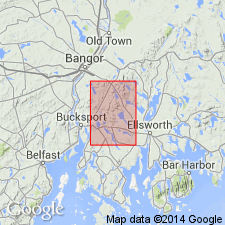
Pg. 18-19, geologic time scale (inside front cover). Passagassawakeag Gneiss. Samples from muscovite-bearing granites intruding the Passagassawakeag Gneiss, at 2 localities in Bucksport quadrangle, Hancock County, Maine, yielded U-Th-Pb ages from 433 +/-3 Ma to 215 +/-2 Ma. Concordia intercept age of 412 +/-14 Ma and 412 +/-16 Ma is approximate time of migmatization and granite intrusion in this area. Sample from migmatite zone related to Stricklen Ridge pluton and involving Passagassawakeag Gneiss and Copeland Formation of Wing (1957), in Orland quadrangle, Penobscot County, Maine, yielded same Concordia intercept age (412 +/-16 Ma). Ages calculated using decay constants of Steiger and Jager, 1977 (Earth Planet. Sci. Letters, v. 36, p. 359-362).
Source: Publication.
- Usage in publication:
-
- Passagassawakeag Gneiss*
- Modifications:
-
- Age modified
- AAPG geologic province:
-
- New England province
Summary:
Age of the Passagassawakeag Gneiss and its Mixer Pond Member of Bickel (1976) is Proterozoic(?) to Ordovician(?).
Source: GNU records (USGS DDS-6; Reston GNULEX).
For more information, please contact Nancy Stamm, Geologic Names Committee Secretary.
Asterisk (*) indicates published by U.S. Geological Survey authors.
"No current usage" (†) implies that a name has been abandoned or has fallen into disuse. Former usage and, if known, replacement name given in parentheses ( ).
Slash (/) indicates name conflicts with nomenclatural guidelines (CSN, 1933; ACSN, 1961, 1970; NACSN, 1983, 2005, 2021). May be explained within brackets ([ ]).