

- Usage in publication:
-
- Pass Peak conglomerate
- Modifications:
-
- First used
- Dominant lithology:
-
- Conglomerate
- AAPG geologic province:
-
- Yellowstone province
- Green River basin
Summary:
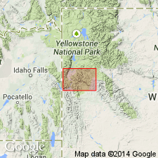
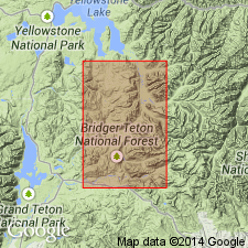
First published use of name. [Name derived from Pass Peak, a high point on the Hoback basin-Green River divide about 4 mi north of point where U.S. Hwy 287 crosses the divide, Sublette Co, WY in the Greater Green River basin.] Consists at type[?] of pebbles that average 2.5 inches in diameter in a friable sandstone matrix. More than 75 percent of the pebbles are quartzite. The rest of the pebbles are chert, vein quartz, schist, gneiss, and quartzitic sandstone. Interfingering sandstone beds present south of type. May be 5,000 ft thick. A conglomerate west of Granite Creek consists of locally derived material including fresh-water limestone may also be the Pass Peak. Age uncertain; may be Miocene. May be a marginal facies of Hoback formation (first published use). Stratigraphic chart shows unit as unconformably above the Hoback formation and unconformably below a Miocene basic breccia. [Description taken from a footnote and from a stratigraphic chart showing the section in the Teton, Snake River, and Gros Ventre ranges. The Teton Range is in Teton Co, WY in the Yellowstone province. The Snake River Range extends from Teton Co into Lincoln Co. The Gros Ventre Range extends from Teton Co into Sublette Co. Lincoln and Sublette Cos are in the Greater Green River basin. However, the areal extent of the Pass Peak may be much more limited than the title of the chart implies. Pass Peak was first shown on a map by Eardley (1944).]
Source: GNU records (USGS DDS-6; Denver GNULEX).
- Usage in publication:
-
- Pass Peak Formation
- Modifications:
-
- Overview
- AAPG geologic province:
-
- Green River basin
Summary:
Was deposited in early Eocene time in a rapidly sinking edge of an intermontane basin flanked on the north and east by the rising Gros Ventre and Wind River Ranges, and on the west by the Hoback and Wyoming Ranges. Filled from north by quartzite boulders and sand derived from Pinyon Conglomerate. Coarsest debris deposited on an alluvial fan along north edge of basin. Sand carried south into the floodplain. Arkosic rocks derived from Precambrian core of Wind River Range deposited along east edge of basin. Two current systems coalesced in central part of basin. Floodplain sequence includes tabular bar, overbank deposits. Little debris shed from west. Facies map. Facies studies. Distribution map shows formation as limited to Sublette Co, WY in the Greater Green River basin. May be as much as 3,200 ft thick. Southward may be 1,500 ft thick.
Source: GNU records (USGS DDS-6; Denver GNULEX).
- Usage in publication:
-
- Pass Peak Formation
- Modifications:
-
- Revised
- Areal extent
- AAPG geologic province:
-
- Green River basin
Summary:
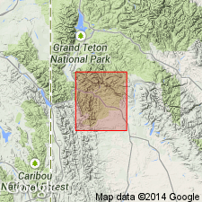
Revised in that Pass Peak Formation recognized as intertonguing with Chappo Member (same rocks assigned to Hoback Formation in earlier reports) of Wasatch, and with Lookout Mountain Conglomerate Member (new name, same rocks assigned to Pass Peak Formation in earlier reports of Wasatch). Pass Peak mapped (geologic maps, fence diagram) in eastern part of area in Sublette Co, WY in the Greater Green River basin, east of the Hoback Range. Is as thick as 975 m. Is in fault contact with deformed Paleozoic and Mesozoic rocks on east side of Hoback Range. In contact with unnamed Eocene arkose at east side of map area. Is about 460 m thick in basin center. Facies described. Fossils include: fresh-water snails, hackberry seeds, leaves of deciduous trees, mammals. Eocene age.
Source: GNU records (USGS DDS-6; Denver GNULEX).
For more information, please contact Nancy Stamm, Geologic Names Committee Secretary.
Asterisk (*) indicates published by U.S. Geological Survey authors.
"No current usage" (†) implies that a name has been abandoned or has fallen into disuse. Former usage and, if known, replacement name given in parentheses ( ).
Slash (/) indicates name conflicts with nomenclatural guidelines (CSN, 1933; ACSN, 1961, 1970; NACSN, 1983, 2005, 2021). May be explained within brackets ([ ]).