

- Usage in publication:
-
- Pascagoula formation*
- Modifications:
-
- Named
- Dominant lithology:
-
- Clay
- AAPG geologic province:
-
- Mid-Gulf Coast basin
Summary:
Name Pascagoula formation, here introduced, credited to L.C. Johnson. In southeastern MS, particularly along the Pascagoula River, Johnson has mapped a series of deposits lithologically resembling the typical Grand Gulf formation, though the bedding is more definite, and alternating layers of sand and clay partially replace the prevailing mudstones. The series appears to correspond in stratigraphic position either with upper part or with whole of the Grand Gulf, and carries a moderately abundant Neogene fauna. Eastward the deposits characteristic of the Pascagoula Basin disappear, but whether by feathering out or by gradual transition has not been ascertained.
Source: GNU records (USGS DDS-6; Reston GNULEX).
- Usage in publication:
-
- Pascagoula clay*
- Modifications:
-
- Revised
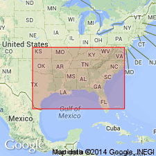
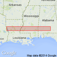
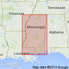
- Areal extent
- Overview
- AAPG geologic province:
-
- Mid-Gulf Coast basin
Summary:
Pascagoula clay, in part marine, unconformably underlies Citronelle formation (Pliocene) and unconformably overlies Hattiesburg clay. Consists of a series of blue, green, and gray clays, locally calcareous with interbedded sands and more rarely sandstones. Thickness is 250 ft in AL, 450 ft in western MS and eastern LA, and 250 or 300 ft in western LA and eastern TX. Pascagoula clay as used in this report differs from Johnson's Pascagoula phase or formation by including the portion of his Fort Adams or Ellisville phase extending from Tunica, LA, to Columbia, MS. Type locality is, however, the same, and the difference is largely due to a more thorough understanding of the distribution of the formation. [Name restricted from TX in 1932 by Miser, Stephenson, and Gardner, GNC. Name not used on Geologic Map of Texas, as strata included in Lagarto clay.]
Source: GNU records (USGS DDS-6; Reston GNULEX).
- Usage in publication:
-
- Pascagoula formation*
- Modifications:
-
- Revised
- AAPG geologic province:
-
- Mid-Gulf Coast basin
Summary:
In area of Camp Van Dorn, Pascagoula formation subdivided into Homochitto member below and Fort Adams member above (both new). Overlies Hattiesburg formation; underlies Citronelle formation and younger terrace deposits.
Source: GNU records (USGS DDS-6; Reston GNULEX).
- Usage in publication:
-
- Pascagoula Member
- Modifications:
-
- Revised
- AAPG geologic province:
-
- Mid-Gulf Coast basin
Summary:
Unit is assigned in this report to the Pensacola Formation (fig. 2). Underlies newly named Perdido Key Formation in southern AL and strata previously mapped as Graham Ferry Formation in MS (now Neogene undifferentiated). [See also Otvos, 1991, where unit is used at formation rank.]
Source: GNU records (USGS DDS-6; Reston GNULEX).
- Usage in publication:
-
- Pascagoula†
- Modifications:
-
- Abandoned
- AAPG geologic province:
-
- Mid-Gulf Coast basin
Summary:
"Units presently referred to as middle Miocene Hattiesburg, upper Miocene Pascagoula, and Pliocene Graham Ferry Formations do not have valid paleontological, lithologic or other stratigraphic support for their existence. They can not be satisfactorily delineated and correlated with units in other areas and it is suggested that these terms be discontinued and mapped as Neogene Undifferentiated nonmarine clastics."
Source: GNU records (USGS DDS-6; Reston GNULEX).
- Usage in publication:
-
- "Pascagoula Formation"
- Modifications:
-
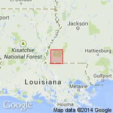
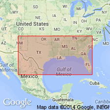
- Areal extent
- AAPG geologic province:
-
- Mid-Gulf Coast basin
Summary:
Use of the names Hattiesburg, Pascagoula, and Graham Ferry Formations are restricted to local use in subdividing the late Neogene in the MS area, as there are no consistent faunal or lithologic markers. "Pascagoula Formation" of MS correlates with the late Miocene upper clay member of the Pensacola Formation and overlying coarse clastics of AL and western FL panhandle and with the Choctawhatchee Formation of the central FL panhandle.
Source: GNU records (USGS DDS-6; Reston GNULEX).
- Usage in publication:
-
- Pascagoula Member
- Modifications:
-
- Revised
- AAPG geologic province:
-
- Mid-Gulf Coast basin
Summary:
Definition of Pensacola Formation is expanded to include strata between the early middle Miocene and the sub-Citronelle unconformities. The formation in the study area now encompasses the Amos Member, the Escambia Member, the Pascagoula Member, and the Graham Ferry Member.
Source: GNU records (USGS DDS-6; Reston GNULEX).
- Usage in publication:
-
- Pascagoula Member*
- Modifications:
-
- Revised
- AAPG geologic province:
-
- Mid-Gulf Coast basin
GNU Staff, 1995, Draft copy of Otvos, E.G., Mississippi Gulf Coast; geologic evolution, stratigraphy, coastal geomorphology, and Gulf-wide Pleistocene correlations, USGS Bull. XXXX (unpublished): U.S. Geological Survey Digital Data Series, DDS-6, 1 CD-ROM., release 3
Summary:
A maximum 4,900-ft-thick Miocene sequence underlies younger sandy-clayey alluvial-paralic deposits in MS. In absence of clearly definable and correlatable litho- or biostratigraphic horizons to bracket them, application of formation names, previously assigned to paralic-alluvial intervals (Oligocene to Miocene Catahoula Formation, Miocene Hattiesburg and Pascagoula Formations, and Pliocene Graham Ferry Formation; Brown and others, 1944) is unacceptable in MS. In intervals for which a Miocene or Pliocene age cannot be established, the term "undifferentiated Neogene clastics" is recommended. Whenever applicable, the names Pascagoula and Graham Ferry Members of Pensacola Formation are now used. Author follows usage of Otvos (1994).
Source: GNU records (USGS DDS-6; Reston GNULEX).
For more information, please contact Nancy Stamm, Geologic Names Committee Secretary.
Asterisk (*) indicates published by U.S. Geological Survey authors.
"No current usage" (†) implies that a name has been abandoned or has fallen into disuse. Former usage and, if known, replacement name given in parentheses ( ).
Slash (/) indicates name conflicts with nomenclatural guidelines (CSN, 1933; ACSN, 1961, 1970; NACSN, 1983, 2005, 2021). May be explained within brackets ([ ]).