

- Usage in publication:
-
- Parsons limestone*
- Modifications:
-
- Named
- Dominant lithology:
-
- Limestone
- Shale
- AAPG geologic province:
-
- Cherokee basin
Summary:
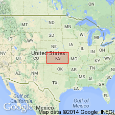
Named for town of Parsons, Labette Co, KS in the Cherokee basin. Was called Altamont limestone in earlier reports. No type locality designated. Occurs in southeastern KS along the Marmaton River where it consists of a limestone bed 8 ft thick; farther south this bed thickens somewhat, and a second one is associated with it. South of Altamont southward to the KS state line and westward to Coffeyville, the limestones are separated into two distinct members by 15 ft or more of shale. [Neither lithology described.] Overlies Bandera shales (named) and underlies Dudley shales (named). Geologic maps. Fossil lists. Of late Carboniferous age.
Source: GNU records (USGS DDS-6; Denver GNULEX).
For more information, please contact Nancy Stamm, Geologic Names Committee Secretary.
Asterisk (*) indicates published by U.S. Geological Survey authors.
"No current usage" (†) implies that a name has been abandoned or has fallen into disuse. Former usage and, if known, replacement name given in parentheses ( ).
Slash (/) indicates name conflicts with nomenclatural guidelines (CSN, 1933; ACSN, 1961, 1970; NACSN, 1983, 2005, 2021). May be explained within brackets ([ ]).