- Usage in publication:
-
- Parker Coal Member
- Modifications:
-
- Overview
- AAPG geologic province:
-
- Illinois basin
Summary:
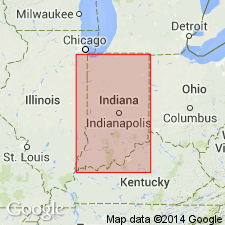
Name first used by Fuller and Clapp (1904) for coal exposed near Parkers Settlement, Posey Co., western IN. A discrepancy concerning stratigraphic position of the coal exists between Fuller and Clapp's text and columnar section, which has created some confusion in the literature. This coal is a few feet below Parker Limestone of Fuller and Clapp (Carthage Limestone Member of Bond Formation of present usage). Wier (1961, 1965, 1973) assigned Parker member rank and designated type locality in NW1/4SE1/4 sec 30, T5S, R11W, near Posey-Vanderburgh county line in Vanderburgh Co. Consists of bright-banded coal, 0.3 to 1.7 ft thick, overlain by 1 to 3 ft of black shale. Parker is thickest in Posey, Vanderburgh, and Gibson Cos., where it lies about 190 ft above West Franklin Limestone Member of Shelburn Formation. Parker is thin or absent and not generalized in western Knox Co. and western Sullivan Co. Correlates with New Haven Coal Member of Modesto Formation in IL and No. 18 coal of Sturgis Formation in northwestern KY. Age is Late Pennsylvanian (Missourian). Report includes correlation charts.
Source: GNU records (USGS DDS-6; Reston GNULEX).

- Usage in publication:
-
- Parker Coal Member*
- Modifications:
-
- Overview
- AAPG geologic province:
-
- Illinois basin
Summary:
Used as Parker Coal Member of Patoka Formation in IN. Age is Missourian.
Source: GNU records (USGS DDS-6; Reston GNULEX).
For more information, please contact Nancy Stamm, Geologic Names Committee Secretary.
Asterisk (*) indicates published by U.S. Geological Survey authors.
"No current usage" (†) implies that a name has been abandoned or has fallen into disuse. Former usage and, if known, replacement name given in parentheses ( ).
Slash (/) indicates name conflicts with nomenclatural guidelines (CSN, 1933; ACSN, 1961, 1970; NACSN, 1983, 2005, 2021). May be explained within brackets ([ ]).

