The National Geologic Map Database is migrating to a new infrastructure. We apologize for any service disruptions during this process.
|
|---|


- Usage in publication:
-
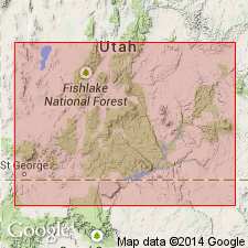
- Paria River Member
- Modifications:
-
- Named
- Dominant lithology:
-
- Sandstone
- Gypsum
- Limestone
- AAPG geologic province:
-
- Plateau sedimentary province
Summary:
Named as a member of Carmel Formation of San Rafael Group for exposures along the Paria River 5 mi below Cannonville, Kane Co, UT, Plateau sedimentary province. Type section measured along east bank of Paria River about a mi south of Cottonwood Wash road to first outcrop of Thousand Pockets Tongue. Formerly assigned to Curtis Formation; known to be older than type Curtis. Composed predominately of buff, white, or red, massive to thin-bedded, partly gypsiferous, friable sandstone. Some gypsum beds. Has lesser amounts of gray and buff limestone or calcareous shale that has flakes of lime silt or gypsum, and gray, red, massive, earthy to impure gypsum interbedded with calcareous shale or gray limestone. Is 200 ft thick at type. Ranges from 40 ft thick at Crystal Creek (T39S, R10W) to 164 ft thick in Bull Canyon (T38S, R4W). Unconformably overlies Thousand Pockets Tongue of Navajo Sandstone at type; overlies Crystal Creek Member (new) of Carmel at other localities. Underlies Winsor Member of Carmel. Measured sections. Cross section. [Age is Middle Jurassic, the age assigned to the Carmel.]
Source: GNU records (USGS DDS-6; Denver GNULEX).
- Usage in publication:
-
- Paria River Member
- Modifications:
-
- Overview
- Areal extent
- AAPG geologic province:
-
- Great Basin province
- Plateau sedimentary province
- Paradox basin
Summary:
Recognized as member of Carmel Formation from southwest UT north to San Rafael Swell and to Green and Colorado Rivers, UT. These areas are in the Great Basin and Plateau sedimentary provinces, and Paradox basin. Tongues eastward into upper member of Carmel. Stratigraphic chart. Cross sections. Facies map. Paleogeographic maps. Overlies Crystal Creek Member of Carmel and underlies Winsor member of Carmel in western sections. Overlies Thousand Pockets Tongue to Page Sandstone in eastern area of occurrence. Three facies recognized. The gypsum facies forms basal part of member west of East Kaibab monocline; it forms steep slopes and cliffs; contains other lithologies --dolomite, sandstone --locally; is regressive facies. The mudstone-gypsum facies dominates in Kaiparowits plateau, Circle Cliffs, Capitol Reef, and San Rafael Swell areas; this facies was deposited on low coastal plain and intertidal mudflat. The limestone facies forms base and top of member in north part of area; this facies accumulated in an offshore anoxic carbonate slope, on shoreward carbonate shoals at shelf margin, on restricted carbonate shelf, and in low energy carbonate shoreline. Of late Bathonian and early Callovian, Middle Jurassic age. Where upper part of Carmel cannot be divided into the Paria River and Winsor Members, the term upper member of Carmel is used.
Source: GNU records (USGS DDS-6; Denver GNULEX).
For more information, please contact Nancy Stamm, Geologic Names Committee Secretary.
Asterisk (*) indicates published by U.S. Geological Survey authors.
"No current usage" (†) implies that a name has been abandoned or has fallen into disuse. Former usage and, if known, replacement name given in parentheses ( ).
Slash (/) indicates name conflicts with nomenclatural guidelines (CSN, 1933; ACSN, 1961, 1970; NACSN, 1983, 2005, 2021). May be explained within brackets ([ ]).