

- Usage in publication:
-
- Paradox formation*
- Modifications:
-
- Named
- Dominant lithology:
-
- Salt
- Gypsum
- Anhydrite
- Shale
- Sandstone
- Limestone
- AAPG geologic province:
-
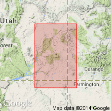
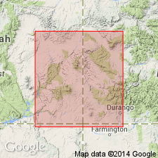
- Paradox basin
Summary:
Named for exposures in Paradox Valley, Montrose Co, CO, particularly those near town of Paradox. No type locality designated. Occurs in southeast UT, mainly in Grand and San Juan Cos, and in western CO west of Uncompahgre Plateau, mainly in Mesa, Montrose, and San Miguel Cos. Paradox is only exposed along crests of a few anticlines and at apex of a few small domes. As its beds are relatively plastic, it is often complexly folded and brecciated so that it is difficult to determine true thickness and stratigraphic relations with adjacent rocks; average thickness is probably about 2000 ft. Because of limited exposure, much of information on Paradox is from well data. Salts of Paradox were deposited in a NW-SE trending structural basin over an area of about 150 mi by 80 mi. In outcrop Paradox is mostly gypsum, and in many places also includes small broken chunks of gray limestone, sandstone, and black shale. In subsurface Paradox consists of thick salt alternating with anhydrite, shale, and limestone; also bedded potash salts are present. Underlying unit is uncertain as base of Paradox is usually not exposed, though is probably Molas formation or its equivalent. Underlies Hermosa formation, probably conformably. Section described in J. H. Shafer well no. 1, sec 16, T27S, R20E, San Juan Co, UT. Assigned Early Pennsylvanian age based on conodonts, invertebrates, and plants.
Source: GNU records (USGS DDS-6; Denver GNULEX).
- Usage in publication:
-
- Paradox formation
- Modifications:
-
- Revised
- AAPG geologic province:
-
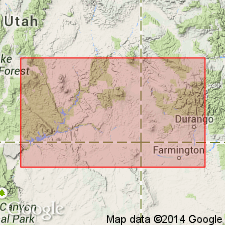
- San Juan basin
- Paradox basin
Summary:
Raised in stratigraphic rank from member of Hermosa formation to Paradox formation. Lower contact revised in that Paradox overlies the newly named Pinkerton Trail formation. Considered to be of Cherokee age. Has a present thickness that may exceed 12,000 ft perhaps due to salt flowage. Consists of cyclic deposits of salt, thin anhydrite and gypsum, thin and thick lentils of black shale, dolomite and siltstone. Divisible into lower, middle and upper members. Cross sections. Present in the San Juan basin of southwest CO, Paradox basin of southwest CO and eastern UT. Underlies Hermosa formation (restricted). Of Des Moines age. Correlation chart.
Source: GNU records (USGS DDS-6; Denver GNULEX).
- Usage in publication:
-
- Paradox member
- Modifications:
-
- Revised
- AAPG geologic province:
-
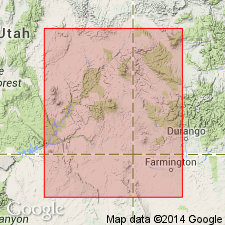
- Paradox basin
Summary:
Desert Creek zone (new), lower of two major oil zones in Paradox Salt basin, assigned to upper part of Paradox. Paradox is middle member of Hermosa formation occurring between lower and upper members of Hermosa. Desert Creek zone is productive at Aneth, Desert Creek, North Desert Creek, and Bluff fields, San Juan Co, UT and Dove Creek field, Montezuma Co, CO, Paradox basin. Desert Creek represents partial evaporite cycle; zone is bounded by black shale above and below. Stratigraphic chart. Assigned Des Moines (Pennsylvanian) age.
Source: GNU records (USGS DDS-6; Denver GNULEX).
- Usage in publication:
-
- Paradox formation
- Modifications:
-
- Revised
- AAPG geologic province:
-
- Paradox basin
- San Juan basin
- Black Mesa basin
Summary:
Used as middle formation of Hermosa group (rank raised but intent to raise not stated) in Paradox basin. Shown as extending into northwest part of San Juan basin, NM and into Black Mesa basin, AZ as a formation [not?] part of Hermosa group. Divided into three mappable members. Lower member, also called Barker Creek zone, consists of buff arkosic granulite, green-gray sandy siltstone and gypsum on edge of San Luis uplift, of interbedded black shale, gray siltstone, gypsum, and dolomite in central and southwest shelf of Paradox basin, and gray shale, gray porous dolomite, gray cherty limestone on part of southwest shelf. Middle member is a thick interbedded salt, euxinic black shale, black calcareous siltstone, gypsum, anhydrite, and dolomite that grade shelfward into penesaline gypsum, anhydrite, dolomite, and biohermal-biostromal dolomitic limestone. Upper member grades from penesaline rocks shelfward to biostromal-biohermal dolomitic limestone, gray shale, and silty dolomite. Upper member divided into Ismay and Desert Creek zones. Formation is more than 4,000 ft thick. Overlies Pinkerton Trail formation of Hermosa group. Underlies Honaker Trail formation (new) of Hermosa group. Wholly of early Desmoinesian or Middle Pennsylvanian age. Correlates with part of Oquirrh, Sandia, Madera, Naco, Supai, Belden, and Gothic formations. Many cross sections. Correlation chart.
Source: GNU records (USGS DDS-6; Denver GNULEX).
- Usage in publication:
-
- Paradox Formation
- Modifications:
-
- Areal extent
- Reference
- Revised
- AAPG geologic province:
-
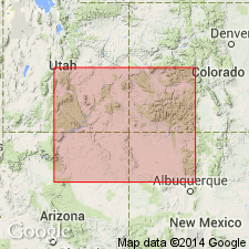
- Paradox basin
- San Juan basin
- Black Mesa basin
Summary:
In San Rafael swell area, northwest edge of Paradox basin, and in Four Corners platform area, southeast edge of basin, equivalent rocks contain no evaporites and overlying Honaker Trail and underlying Pinkerton Trail (revised) Formations of Hermosa Group become indistinguishable, thus defining limit of Paradox Formation (middle formation of Hermosa). Basin edge also defines where Hermosa Group becomes Hermosa Formation. Limits shown on diagrammatic cross section. Study area is Four Corners area of CO, UT, NM, and AZ within Paradox, San Juan, and Black Mesa basins. At type, Paradox is contorted and disturbed by salt flowage, and is incompletely exposed. Substitute subsurface type section [reference section] is proposed between depths of 5420-9600 ft in Reynolds Mining Co., No. 1 Egnar well in sec 14, T43N, R19W, San Miguel Co, CO, Paradox basin. Here evaporites are typically and fully developed and exhibit little or no salt flowage. [No description at reference provided.] Samples and mechanical logs are available. Paradox Formation in part includes rocks within Desmoinesian Four Corners Stage (new) which includes newly formalized substages which are, in ascending order, Barker Creek, Akah, Desert Creek, and Ismay Substages. Top of underlying Pinkerton Trail is revised and placed at base of lowest evaporite of Paradox. Stratigraphic chart. Age ranges from Atokan to Missourian.
Source: GNU records (USGS DDS-6; Denver GNULEX).
- Usage in publication:
-
- Paradox Formation
- Modifications:
-
- Not used
Summary:
Used by Bass and Northrop (1963) for variegated clastic rocks and evaporites between Belden and Maroon Formations in the Glenwood area, Garfield Co, CO. No evidence that Paradox of Paradox basin is continuous with the Pennsylvanian sequence in the Eagle basin. Term Paradox not used in Eagle basin.
Source: GNU records (USGS DDS-6; Denver GNULEX).
- Usage in publication:
-
- Paradox Formation*
- Modifications:
-
- Areal extent
- AAPG geologic province:
-
- San Juan basin
- Black Mesa basin
- Paradox basin
Summary:
An isopach map of the Paradox Formation (middle formation of Hermosa Group) and related rocks shows extent of unit into central McKinley Co., northwest Sandoval Co., and western Rio Arriba Co., NM, and north into CO, San Juan basin, west into Black Mesa basin, AZ, and northwest into CO and UT, Paradox basin. Limits of halite, anhydrite, and black shale facies plotted. Geographic limit of name Paradox not defined, but if name is limited to the salt and anhydrite facies, the name Paradox can only be extended into the northwesternmost part of San Juan Co. Nomenclature chart. Pennsylvanian age. Is equivalent to lower part of Madera Limestone.
Source: GNU records (USGS DDS-6; Denver GNULEX).
For more information, please contact Nancy Stamm, Geologic Names Committee Secretary.
Asterisk (*) indicates published by U.S. Geological Survey authors.
"No current usage" (†) implies that a name has been abandoned or has fallen into disuse. Former usage and, if known, replacement name given in parentheses ( ).
Slash (/) indicates name conflicts with nomenclatural guidelines (CSN, 1933; ACSN, 1961, 1970; NACSN, 1983, 2005, 2021). May be explained within brackets ([ ]).