The National Geologic Map Database is migrating to a new infrastructure. We apologize for any service disruptions during this process.
|
|---|


- Usage in publication:
-
- Parachute Creek member*
- Modifications:
-
- Named
- Dominant lithology:
-
- Shale
- AAPG geologic province:
-
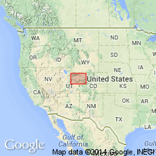
- Piceance basin
- Uinta basin
Summary:
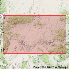
Named as 1 of 4 members of Green River formation east of Bitter Creek, Uintah Co, UT, for exposures along part of Parachute Creek, in Ts5, 6S, R96W, Garfield Co, CO, Piceance basin. No type locality designated. Distinguished from all other members of Green River by its oil shale content. Ranges in thickness from about 175 ft near Watson, UT, Uinta basin east to more than 1,000 ft near Parachute Creek. Overlies Garden Gulch member (new) of Green River. A cliff-former. Top marked by bright ocherous soft limy sandstone. Underlies Evacuation Creek member (new) of Green River. Divided into: 1) lower oil-shale group--45-200 ft thick, mostly paper shale in beds a fraction of an inch to 8 ft thick, limy and black chert inclusions with some muddy hard thin-bedded limestone; weathers cream to yellow; contains larvae, garpike, ostracod, plant fossils; forms faintly color banded cliff; 2) transitional beds--hard marlstone, locally a fine-grained sandstone, muddy limestone, and few oil-shale beds; weathers to buff or gray, broken, step-like ledges; few plant fragments, insects; 13-118 ft thick; 3) upper oil-shale group--87-730 ft thick, 29-38 percent massive oil shale; weathers papery, gray to black; has limy concretions, calcite fillings, salt crystals, contorted bedding, mud cracks, hard marlstone; abundant fly larvae. Geologic map. Cross section. Columnar section. Of middle Eocene age. Equivalent to delta-facies of Green River in UT.
Source: GNU records (USGS DDS-6; Denver GNULEX).
- Usage in publication:
-
- Parachute Creek member*
- Modifications:
-
- Areal extent
- AAPG geologic province:
-
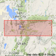
- Uinta basin
- Piceance basin
Summary:
Extends uninterruptedly as a member of the Green River formation from the summit of the Wasatch Range, Wasatch Co, UT across Duchesne and Uintah Cos, UT in the Uinta basin east into the Piceance basin of CO. Cross section. Some of the oil-shale beds within the member are very continuous. Oil shale and tuff beds described in detail. Base of tuff zone is the "mahogany marker." Top of member placed at top of the oil-shale facies. Underlies Evacuation Creek member of Green River. Overlies delta facies of Green River in western sections. Of Eocene age.
Source: GNU records (USGS DDS-6; Denver GNULEX).
- Usage in publication:
-
- Parachute Creek member*
- Modifications:
-
- Contact revised
- Overview
- AAPG geologic province:
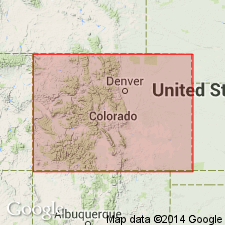
-
- Piceance basin
Summary:
Lower contact revised in that Parachute Creek member of the Green River formation underlies the newly named Anvil Points member of the Green River; contact placed at base of series of oil-shale beds (Parachute Creek) with the uppermost sandstone of a barren marlstone and sandstone (Anvil Points). Is 1,700 ft thick in subsurface of report area. Divisible into three zones: 1) lower and middle oil-shale zone; 2) barren zone; and 3) upper oil-shale zone. The Mahogany marker is about 100 ft above base of upper zone. Overlain by Evacuation Creek member of Green River; contact placed at base of first sandstone or siltstone 10+/-ft thick that occurs above uppermost marlstone of Parachute Creek. Geologic map shows member around entire basin, Rio Blanco and Garfield Cos, CO in the Piceance basin. Cross sections. Eocene age.
Source: GNU records (USGS DDS-6; Denver GNULEX).
- Usage in publication:
-
- Parachute Creek Member*
- Modifications:
-
- Areal extent
- AAPG geologic province:
-
- Piceance basin
Summary:
Is a member of the Eocene Green River formation that overlies and intertongues with Garden Gulch Member of Green River and underlies and intertongues with Evacuation Creek Member of Green River. Contains several rich oil-shale zones in the Piceance Creek basin (which is a part of the larger Piceance basin, the structural basin), Garfield and Rio Blanco Cos, CO. The Mahogany zone in the upper half of the member is 75 to 225 ft thick, is thickest in northeast part of basin, and underlies a 1,200 sq mi area (areal extent map). The Mahogany is separated from the second rich zone--the R-6 zone--by the "B" groove or black marker. The "B" groove is a lean oil-shale zone. The R-6 underlies a 700 sq mi area and has a maximum thickness of 250 ft in northeast part of basin (areal extent map). The lowest oil-shale zone--the R-4--is separated from the R-6 by the marine saline zone. The R-4 zone is in the lower one-third of the Parachute Creek Member. The R-4, as much as 150 +/-ft thick and thickest in north-central part of basin, is present over a 300 sq mi area (areal extent map). Columnar section.
Source: GNU records (USGS DDS-6; Denver GNULEX).
- Usage in publication:
-
- Parachute Creek Member*
- Modifications:
-
- Areal extent
- AAPG geologic province:
-
- Uinta basin
- Piceance basin
Summary:
Parachute Creek and Evacuation Creek Members, though separate now, were probably once one laterally continuous body of interfingering fluvial and lacustrine sediments derived from a northerly or northeasterly source. Name Parachute Creek replaces Evacuation Creek Member in Uinta basin; name Evacuation Creek abandoned, and rocks now included in upper part of Eocene Parachute Creek.
Source: GNU records (USGS DDS-6; Denver GNULEX).
- Usage in publication:
-
- Parachute Creek Member*
- Modifications:
-
- Revised
- AAPG geologic province:
-
- Piceance basin
Summary:
A newly named marker bed, Kimball Mountain Tuff Bed, forms base of Parachute Creek Member of Eocene Green River Formation in Long Point quad, Garfield Co, CO in Piceance basin.
Source: GNU records (USGS DDS-6; Denver GNULEX).
- Usage in publication:
-
- Parachute Creek Member*
- Modifications:
-
- Overview
- Dominant lithology:
-
- Marlstone
- AAPG geologic province:
-
- Piceance basin
Summary:
Is uppermost member of Green River Formation (Eocene) in central Roan Plateau area, Piceance Creek basin, northwestern CO. [Piceance Creek basin is generally defined as the smaller Tertiary oil-shale basin within Piceance basin.] Most U.S. Geological Survey reports dealing with oil-shale resources of Green River Formation in Piceance Creek basin divide the oil-shale sequence into informal named or numbered rich and lean zones, and some widely recognized key marker beds, mostly above Mahogany oil-shale zone. Numbered rich oil-shale zones are designated "R"; lean zones are designated "L". The zones are (ascending): Orange zone, R-1, L-1, R-2, L-2, R-3, L-3, R-4, L-4, R-5, L-5, R-6, B groove, Mahogany (rich zone), A groove, Four Senators, Stillwater, and Big Three. Orange zone, B groove, and A groove are usually not regarded as oil-shale zones, but as mostly barren zones. B groove and A groove mark the base and top, respectively, of Mahogany zone. The Four Senators, Stillwater, and Big Three are distinctive groups of rich oil-shale beds that are more commonly regarded as stratigraphic markers than rich oil-shale zones. The base of Parachute Creek Member in Piceance Creek basin is generally placed at or near base of R-2 oil-shale zone. Correlates informal oil-shale units. Demonstrates complex intertongued nature of Green River and Uinta Formations, particularly regarding marlstone equivalents of parts of Parachute Creek.
Source: GNU records (USGS DDS-6; Denver GNULEX).
For more information, please contact Nancy Stamm, Geologic Names Committee Secretary.
Asterisk (*) indicates published by U.S. Geological Survey authors.
"No current usage" (†) implies that a name has been abandoned or has fallen into disuse. Former usage and, if known, replacement name given in parentheses ( ).
Slash (/) indicates name conflicts with nomenclatural guidelines (CSN, 1933; ACSN, 1961, 1970; NACSN, 1983, 2005, 2021). May be explained within brackets ([ ]).