

- Usage in publication:
-
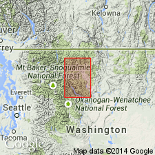
- Panther Creek Formation
- Modifications:
-
- Named
- Biostratigraphic dating
- Dominant lithology:
-
- Shale
- Conglomerate
- Arkose
- AAPG geologic province:
-
- Okanogan province
- Cascades province
Summary:
Named for Panther Creek which drains south slope of ridge where type section measured in W/2 sec.9, E/2 sec.8 T37N R20E [48 deg 43'28"N, 120 deg 21'65"W] in northern part of Mazama 15' quad, Okanogan Co, WA. Consists chiefly (90 %) of black shale containing beds of granitoid roundstone conglomerate and minor arkose. Extends from Boesel fault (southeast of type section) northwestward 18 mi where truncated by Monument Peak batholith. Weakly to nonmetamorphosed. Is 5200 ft thick at type section. Conformably overlies Goat Creek Formation (new); conformably overlain by Harts Pass Formation (new). Pelecypods from 1350 ft above base interpreted as middle Aptian [Early Cretaceous] in age.
Source: GNU records (USGS DDS-6; Menlo GNULEX).
For more information, please contact Nancy Stamm, Geologic Names Committee Secretary.
Asterisk (*) indicates published by U.S. Geological Survey authors.
"No current usage" (†) implies that a name has been abandoned or has fallen into disuse. Former usage and, if known, replacement name given in parentheses ( ).
Slash (/) indicates name conflicts with nomenclatural guidelines (CSN, 1933; ACSN, 1961, 1970; NACSN, 1983, 2005, 2021). May be explained within brackets ([ ]).