

- Usage in publication:
-
- Pantano Formation
- Modifications:
-
- Named
- Dominant lithology:
-
- Conglomerate
- Sandstone
- Mudstone
- Andesite
- Agglomerate
- AAPG geologic province:
-
- Basin-and-Range province
Summary:
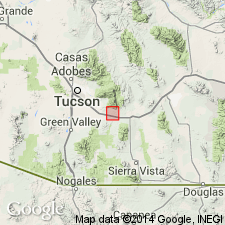
Named for a railroad station, Pantano, T16S, R17E, Pima Co, AZ, Basin-and-Range province. Name has been applied previously to some maroon-colored continental deposits. Type section measured on south side Hwy 80 between east line sec 2, T17S, R17E and center of W1/2 sec 31, T16S, R17E, Pima Co, where it is 13,762 feet thick unit. Consists at type of conglomerate (mostly), sandstone, mudstone, and 3 andesite flows; the conglomerates are maroon, brown, gray-green with subangular to rounded pebbles and cobbles (up to 36 inches in diameter) of quartzite, limestone, arkose, volcanics, granite; the sandstones are green, brown, gray, maroon; some are pebbly; the mudstones are red-brown to gray-green; base not exposed; overlain by Quaternary alluvium; cut by many faults. Beds generally become coarser and redder upwards. Type section does not include 2 units exposed in SE1/4 sec 19, T19S, R17E--1) crudely sorted, poorly stratified volcanic agglomerate, green; 2) gray mudstone of lake-bed? origin. Agglomerate is 50 to 100 feet thick, dark brown to black, with particles of tuff and lapilli. Lakebeds are 40 to 50 feet thick; deposited on the andesite and agglomerate. May be equivalent to Mineta Formation. Considered to be at least partly Miocene age. Geologic map.
Source: GNU records (USGS DDS-6; Denver GNULEX).
- Usage in publication:
-
- Pantano Formation*
- Modifications:
-
- Overview
- AAPG geologic province:
-
- Basin-and-Range province
Summary:
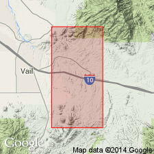
Is a name first used in an unpublished report (Tolman, 1912). First published detailed description was by Brennan (1962) who selected a type section on south side US Hwy 80 (now Interstate 10) east from sec 2, T17S, R17E to center W1/2 sec 31, T16S, R17E, Empire Mountains quad, Pima Co, AZ in the Basin-and-Range province. Detailed mapping has revealed several normal faults repeat part of Brennan's section, and that at least 3 angular unconformities exist within Pantano; certain units not at type. Is at least 6,400 ft thick and is divisible into 5 units--designated units 1 (base) to 5 (top). Consists of red-brown siltstone and mudstone, red and gray conglomeratic sandstone, conglomerate, and dark purple-gray andesite, dark purple-gray volcanic conglomerate, and tuffs. Pebbles, boulders, and cobbles in conglomerate were derived from Precambrian, Paleozoic, Upper Cretaceous, and lower Tertiary rocks. Deposited on a surface of considerable relief; lower units show depositional thinning and pinchout. Local deformation suggested by angular unconformities between some of the units. Locally overlain by Pliocene? and Pleistocene gravel. No fossils found. Tuff in unit 1 have dates of 36.7 +/-1.1 (sanidine) and 32.8 +/-2.7 (biotite) m.y. by K-Ar method. Date from an andesite flow of 24.4 +/-2.6 (plagioclase) m.y. by K-Ar method. Ranges from early Oligocene to early Miocene.
Source: GNU records (USGS DDS-6; Denver GNULEX).
- Usage in publication:
-
- Pantano Formation*
- Modifications:
-
- Overview
- AAPG geologic province:
-
- Basin-and-Range province
Summary:
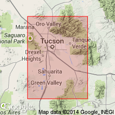
Consists of red-brown silty sandstone and gravel that are weakly to strongly cemented by calcium carbonate, and interbedded volcanic flows and tuffs dated by K-Ar as about 27 m.y. Cannot be traced with certainty from one part of Tucson basin to another. Ranges from 1,000 to 6,000+ ft thick; thickness in central part of Tucson basin unknown. Part of unit 5 of Pantano as mapped by Finnel (1970) may be part of the informally designated overlying Miocene and Pliocene Tinaja beds (first used in this report). Map unit includes Helmet Fanglomerate, San Xavier beds, and Rillito I beds of other authors. Mapped (geologic map) along east side of Tucson basin as scattered exposures from the Pantano area north to T15S, R14E, and on west side of basin near Ruby Star Ranch in T17S, R12E, Pima Co, AZ in the Basin-and-Range province. Assigned an Oligocene age [no reason for age given].
Source: GNU records (USGS DDS-6; Denver GNULEX).
- Usage in publication:
-
- Pantano Formation(?)*
- Modifications:
-
- Geochronologic dating
- AAPG geologic province:
-
- Basin-and-Range province
Summary:
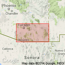
Sample collected from Pantano Formation(?) in the Empire Mountains, AZ, Lat. 31 deg. 37 min. N., Long. 110 deg. 25 min. W. Age is Oligocene to Miocene. Calculated K-Ar age on biotite 38.9 +/-1.5 Ma.
Source: Modified from GNU records (USGS DDS-6; Denver GNULEX).
For more information, please contact Nancy Stamm, Geologic Names Committee Secretary.
Asterisk (*) indicates published by U.S. Geological Survey authors.
"No current usage" (†) implies that a name has been abandoned or has fallen into disuse. Former usage and, if known, replacement name given in parentheses ( ).
Slash (/) indicates name conflicts with nomenclatural guidelines (CSN, 1933; ACSN, 1961, 1970; NACSN, 1983, 2005, 2021). May be explained within brackets ([ ]).