The National Geologic Map Database is migrating to a new infrastructure. We apologize for any service disruptions during this process.
|
|---|


- Usage in publication:
-
- Panorama Hills formation
- Modifications:
-
- Named
- Dominant lithology:
-
- Gravel
- Sand
- AAPG geologic province:
-
- California Coast Ranges province
Summary:
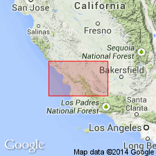
Type locality designated as Panorama Hills and vicinity, SW/4 T31S R21E and sec.1-3 T32S R21E, Kern Co, CA. Northwesterly from Elkhorn Hills, Bitterwater Creek shale (new) grades laterally through littoral sandstone with Pliocene molluscan fossils into nonmarine gravel herein named Panorama Hills formation. Is composed of some 4000 ft of crudely bedded gray pebble-cobble gravels and coarse sand of granitic and some siliceous shale detritus. Unconformably underlies Paso Robles formation. Unconformably overlies granitic breccia of Santa Margarita formation. Shown on geologic map of Caliente and Temblor Ranges. Is Pliocene age.
Source: GNU records (USGS DDS-6; Menlo GNULEX).
For more information, please contact Nancy Stamm, Geologic Names Committee Secretary.
Asterisk (*) indicates published by U.S. Geological Survey authors.
"No current usage" (†) implies that a name has been abandoned or has fallen into disuse. Former usage and, if known, replacement name given in parentheses ( ).
Slash (/) indicates name conflicts with nomenclatural guidelines (CSN, 1933; ACSN, 1961, 1970; NACSN, 1983, 2005, 2021). May be explained within brackets ([ ]).