The National Geologic Map Database is migrating to a new infrastructure. We apologize for any service disruptions during this process.
|
|---|


- Usage in publication:
-
- Pamlico formation*
- Modifications:
-
- Areal extent
- AAPG geologic province:
-
- Atlantic Coast basin
Summary:
Pg. 651. Pamlico formation. Name proposed by L.W. Stephenson in unpublished ms. In North Carolina the Talbot terrace divides into two terraces, constituting Chowan and Pamlico formations. [Age is Pleistocene.]
Source: US geologic names lexicon (USGS Bull. 896, p. 1595-1596).
- Usage in publication:
-
- Pamlico formation*
- Modifications:
-
- Principal reference
- Dominant lithology:
-
- Loam
- Sand
- Clay
- AAPG geologic province:
-
- Atlantic Coast basin
Summary:
Pg. 286-290. Pamlico formation. Fine sandy loams, sands, and clays, and to a limited extent gravels. In the swamp lands, the soils consist in large part of accumulations of peaty matter, which are of later origin than main body of deposits. Thickness 15 or 20 feet. The Pamlico terrace has been traced north through Virginia into Maryland. The upper surface of Pamlico beds forms a low, nearly level plain whose elevation above sea level nowhere exceeds 25 feet. Younger than Chowan formation, whose surface lies at elevations varying from 25 to 70 feet above sea level. Top formation of Columbia group in North Carolina. Named for Pamlico Sound in eastern North Carolina, "away from whose shores the terrace plain forming the surface extends as broad, nearly level stretches of lowland." [Age is Pleistocene.]
Source: US geologic names lexicon (USGS Bull. 896, p. 1595-1596).
- Usage in publication:
-
- Pamlico formation
- Modifications:
-
- Not used
- AAPG geologic province:
-
- Atlantic Coast basin
Summary:
Pg. 67-83. Divided Pamlico formation of Stephenson into Princess Anne formation and terrace (at 25 feet elevation), of marine origin, and Dismal Swamp formation and terrace (at 12 feet elevation), largely of marine origin, as explained under Princess Anne formation and Dismal Swamp formation.
Source: US geologic names lexicon (USGS Bull. 896, p. 1595-1596).
- Usage in publication:
-
- Pamlico formation*
- Modifications:
-
- Revised
- AAPG geologic province:
-
- Atlantic Coast basin
Summary:
Proposed following reclassification of younger Pleistocene terrace formations of Maryland, Virginia, and North Carolina:
Pamlico formation, 25-foot level.
Talbot formation restricted, 40-foot level. (Same as typical "Chowan," abandoned but not same as "Chowan" as defined.)
Penholoway terrace (deposits not yet named), 70-foot level. [These deposits have heretofore been included in Wicomico to north and in Chowan to south.]
Wicomico formation restricted, 100-foot level.
As "Dismal Swamp" terrace has identically same shore line (25 feet) as the Pamlico, the name Pamlico, which has many years priority, should be retained. The "Princess Anne" terrace was separated from the "Dismal Swamp" because of presence of a low scarp above 12 feet in neighborhood of Norfolk and elsewhere in Virginia.
Source: US geologic names lexicon (USGS Bull. 896, p. 1595-1596).

- Usage in publication:
-
- Pamlico formation*
- Modifications:
-
- Overview
- AAPG geologic province:
-
- Atlantic Coast basin
Summary:
Pamlico formation of Columbia group. See also 16th Intl. Geol. Congress Gdbk. 5, p. 34-35, 1932, and Gdbk. 12, 1932, where Cooke states †Dismal Swamp terrace is same as Pamlico terrace and recognized Princess Anne terrace (and formation) at 12-foot level. The terrace formations (including the Pamlico) shown on p. 2 and 5 of Gdbk. 12 (and herein enumerated under Columbia group) are now [ca. 1936] recognized by Cooke from Delaware to southern Georgia and probably into Florida. He includes Princess Anne in Pamlico. Age is Pleistocene.
Source: US geologic names lexicon (USGS Bull. 896, p. 1595-1596).
- Usage in publication:
-
- Pamlico sand
- Modifications:
-
- Areal extent
- AAPG geologic province:
-
- Mid-Gulf Coast basin
Summary:
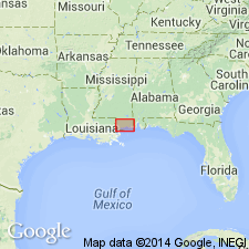
Pg. 60-61. Pamlico sand underlies Pamlico plain along north shore of Mississippi Sound. Much of outer edge of sand is capped by Recent beach and dune deposits from which it cannot readily be separated. Thickness on southeast bank of Wolf River 15 feet. [Age is Pleistocene.]
Source: US geologic names lexicon (USGS Bull. 1200, p. 2909-2910).
- Usage in publication:
-
- Pamlico sand*
- Modifications:
-
- Areal extent
- AAPG geologic province:
-
- Florida platform
Summary:
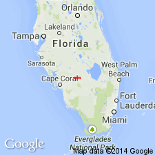
Pg. 74-75. Pamlico sand. Geographically extended into Florida where it includes all marine Pleistocene deposits younger than Anastasia formation. Consists chiefly of sand. Thickness ranges from featheredge to about 50 feet. Generally lies at altitudes of less than 25 feet above sea level on east, south, and west coasts. [Age is Pleistocene.]
Source: US geologic names lexicon (USGS Bull. 1200, p. 2909-2910).
- Usage in publication:
-
- Pamlico formation*
- Modifications:
-
- Areal extent
- AAPG geologic province:
-
- Atlantic Coast basin
Summary:
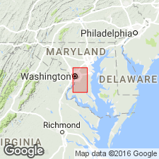
Pg. 50-51. Pamlico formation. In Prince Georges County, Maryland, and in District of Columbia, is entirely fluvial and estuarine. Thickness does not exceed 30 feet. Lies on valley floors cut in crystalline rocks and in sedimentary deposits ranging in age from Cretaceous Potomac group to Miocene Chesapeake group; may locally lie unconformably on Pleistocene Wicomico formation. Where it does not form the surface, overlain unconformably by Recent sediments. Formation accumulated during third cycle of downcutting and subsequent drowning of Potomac River; presumably this epoch is in later Pleistocene; it began during third glacial stage (Illinoian) and continued and was completed during third interglacial stage (Sangamon). [Age is Pleistocene.]
Source: US geologic names lexicon (USGS Bull. 1200, p. 2909-2910).
- Usage in publication:
-
- Pamlico sand
- Modifications:
-
- Areal extent
- AAPG geologic province:
-
- South Florida province
Summary:
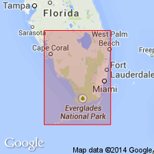
Pg. 133 (table 1), 135, 136 (fig. 4), 146, 147, 149 (fig. 13), 150, 154. Pamlico sand. In southwestern Florida, forms an almost continuous blanket of sand at elevations less than 25 feet above sea level. Generally rests with apparent unconformity on a member of the Fort Thompson, Caloosahatchee, or Tamiami formations. Between La Belle and Ortona Locks, commonly overlies Coffee Mill Hammock marl and may be overlain by Lake Flirt marl or lie exposed at surface; downstream from La Belle as far as Fort Denaud, rests, in many places, directly on Caloosahatchee formation, sometimes on upper shale bed and sometimes unconformably on Bee Branch member (new). [Age is Pleistocene.]
Source: US geologic names lexicon (USGS Bull. 1200, p. 2909-2910).
- Usage in publication:
-
- Pamlico Formation†
- Pamlico terrace
- Modifications:
-
- Abandoned
- AAPG geologic province:
-
- Atlantic Coast basin
Summary:
Author proposes that name Pamlico Formation be abandoned in GA and that the name Satilla Formation, which has priority, be reinstated. Pamlico is associated with the specific marine terrace as well as with certain Pleistocene deposits in NC. Use of name for two widely occurring, but different, geological phenomena is confusing and undesirable. Name Pamlico Formation has not been in general use in GA or SC in recent years. Name is retained for the marine terrace and abandoned for the lithostratigraphic unit. The redefined Satilla Formation of GA, SC, and FL now includes Pleistocene and Holocene coastal marine deposits formerly mapped as Pamlico (Cooke, 1943), Princess Anne and Silver Bluff Formations (Hails and Hoyt, 1969), and the Holocene shoreline complexes (Mann, 1976). Terms Princess Anne and Silver Bluff also abandoned as lithostratigraphic names, but retained for marine terraces.
Source: GNU records (USGS DDS-6; Reston GNULEX).
For more information, please contact Nancy Stamm, Geologic Names Committee Secretary.
Asterisk (*) indicates published by U.S. Geological Survey authors.
"No current usage" (†) implies that a name has been abandoned or has fallen into disuse. Former usage and, if known, replacement name given in parentheses ( ).
Slash (/) indicates name conflicts with nomenclatural guidelines (CSN, 1933; ACSN, 1961, 1970; NACSN, 1983, 2005, 2021). May be explained within brackets ([ ]).