

- Usage in publication:
-
- Palmer gneiss*
- Modifications:
-
- Named
- Dominant lithology:
-
- Gneiss
- Schist
- AAPG geologic province:
-
- Lake Superior region
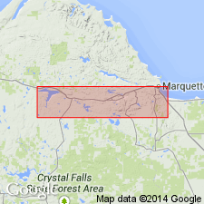
Summary:
Is Archean formation mapped (pl XIII) in narrow east-west belt in vicinity of Palmer, Marquette Co., MI (Lake Superior region) in northern border of Southern Complex of the Marquette series. Is named Palmer gneiss because of typical exposures west of Lake Palmer, shown on map in sec 25, T47N, R27W. "The schists are light-gray, or dark-gray, or pinkish in color. They are fine grained, sometimes apparently homogeneous like a chert, and at other times showing little eyes of quartz in a hydromicaceous matrix, like a devitrified and schistose quartz-porphyry. All varieties are highly foliated. * * * the gray varieties of the schists present a uniform structure, with very little mineralogical variation. They show undulatory extinguishing quartz grains, with irregular contours and granulated borders, lying in a matrix composed of sericite, muscovite, occasional particles of calcite, and sometimes small flakes and plates of biotite, besides remnants of feldspar. * * * minerals of the matrix are in very tiny grains, and together they form a felted mass of nearly uniform composition. This felt of secondary minerals obscures completely, in most instances, all traces of the materials from which it was derived, except for the remains of feldspars that may be detected here and there between the fibers. *** The white and pink schists differ very slightly from the gray schists described above."
Source: GNU records (USGS DDS-6; Reston GNULEX).
For more information, please contact Nancy Stamm, Geologic Names Committee Secretary.
Asterisk (*) indicates published by U.S. Geological Survey authors.
"No current usage" (†) implies that a name has been abandoned or has fallen into disuse. Former usage and, if known, replacement name given in parentheses ( ).
Slash (/) indicates name conflicts with nomenclatural guidelines (CSN, 1933; ACSN, 1961, 1970; NACSN, 1983, 2005, 2021). May be explained within brackets ([ ]).