

- Usage in publication:
-
- Palm Canyon complex
- Modifications:
-
- Named
- Dominant lithology:
-
- Limestone
- Schist
- Diorite
- AAPG geologic province:
-
- Peninsular Ranges province
Summary:
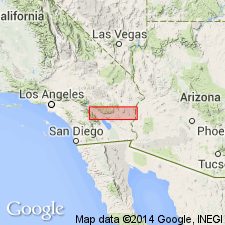
Named for exposures on E side of lower Palm Canyon about 12 mi S of Palm Springs, [Idyllwild and Palm Desert 15' quads], Riverside Co., CA. Rocks formerly Fraser's "metamorphic series" (1931). Consists of metasediments (limestones, quartzites, schists), igneous rocks (diorite, pegmatite, silexite), and mixtures of above. Is many 100's, possibly 1000's of feet thick. Intruded by San Jacinto granodiorite and Bradley Granodiorite (new). Considered Paleozoic(?) age or older based on Crinoidal fragments.
Source: GNU records (USGS DDS-6; Menlo GNULEX).
- Usage in publication:
-
- Palm Canyon complex
- Modifications:
-
- Age modified
- AAPG geologic province:
-
- Peninsular Ranges province
Summary:
Assigned Paleozoic and (or) Mesozoic age based on belief to be partly or wholly correlative with Diamond Valley complex.
Source: GNU records (USGS DDS-6; Menlo GNULEX).
- Usage in publication:
-
- Palm Canyon Group
- Modifications:
-
- Redescribed
- AAPG geologic province:
-
- Peninsular Ranges province
Summary:
[Rocks of Palm Canyon Complex of Miller (1944) shown on sketch map and cross section of Santa Rosa mylonite zone in northern Peninsula Ranges batholith; referred to as Palm Canyon Group]. Group is described as an upper metasedimentary sequence in fault contact with lower group of strongly deformed plutonic rocks. Carbonate rocks are widespread in Palm Canyon Group and possess microstructures that reflect deformation conditions. Current available geochronologic data suggest that deformation within Santa Rosa mylonite zone occurred in Late Cretaceous between 97 Ma (Hill, 1981) and 75 to 70 Ma (Krummenacher and others, 1975).
Source: GNU records (USGS DDS-6; Menlo GNULEX).
For more information, please contact Nancy Stamm, Geologic Names Committee Secretary.
Asterisk (*) indicates published by U.S. Geological Survey authors.
"No current usage" (†) implies that a name has been abandoned or has fallen into disuse. Former usage and, if known, replacement name given in parentheses ( ).
Slash (/) indicates name conflicts with nomenclatural guidelines (CSN, 1933; ACSN, 1961, 1970; NACSN, 1983, 2005, 2021). May be explained within brackets ([ ]).