

- Usage in publication:
-
- Pakoon limestone
- Modifications:
-
- Named
- Dominant lithology:
-
- Limestone
- AAPG geologic province:
-
- Great Basin province
- Plateau sedimentary province
Summary:
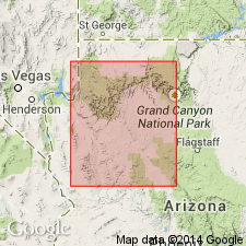
Named for exposures measured on west face and crest of Pakoon Ridge, northwest of Pakoon Spring, T35N, R16W, Mohave Co, AZ in the Plateau sedimentary province. These exposures are the type section. Overlies Callville limestone (restricted). Underlies Queantoweap sandstone (named). Contact with Queantoweap is sharp. Is 688 ft thick at its type and 305+ ft thick in the North Grand Wash measured section. Extends west to the Virgin Mountains of AZ-NV, thereby extending into the Great Basin province. Cross section. Composed of tan-red and gray, dolomitic, medium- to thick-bedded to thinly laminated, tan-weathering, usually fine-grained limestone. Some chert bands. Contains the Lower Permian Wolfcampian fusulinids--TRITICITES, SCHWAGERINA, PSEUDOSCHWAGERINA, etc. The fusulinids occur in a 23 ft interval about 42 ft above the top of the Callville. These dolomitic beds were included in the Callville by Longwell. These dolomitic beds are removed from the Callville because of their Permian age.
Source: GNU records (USGS DDS-6; Denver GNULEX).
- Usage in publication:
-
- Pakoon Dolomite*
- Modifications:
-
- Redescribed
- Dominant lithology:
-
- Dolomite
- AAPG geologic province:
-
- Great Basin province
Summary:
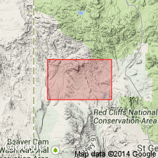
Mapped in southwest UT, Great Basin province. Redescribed as light-gray fine-grained dolomite weathering to light-brownish-gray ledges and low cliffs. Often cherty; rarely fossiliferous, most fossils occurring in thin limestone beds in upper third of unit. Exposed only on Square Top Mountain allochthon. Thickness is 260 m. Overlies Callville Limestone; underlies Queantoweap Sandstone. Early Permian age.
Source: GNU records (USGS DDS-6; Denver GNULEX).
For more information, please contact Nancy Stamm, Geologic Names Committee Secretary.
Asterisk (*) indicates published by U.S. Geological Survey authors.
"No current usage" (†) implies that a name has been abandoned or has fallen into disuse. Former usage and, if known, replacement name given in parentheses ( ).
Slash (/) indicates name conflicts with nomenclatural guidelines (CSN, 1933; ACSN, 1961, 1970; NACSN, 1983, 2005, 2021). May be explained within brackets ([ ]).