- Usage in publication:
-
- Pahranagat Formation*
- Modifications:
-
- Named
- Geochronologic dating
- Reference
- Dominant lithology:
-
- Ash-flow tuff
- AAPG geologic province:
-
- Great Basin province
Summary:
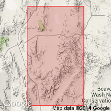
Pg. 8 (fig. 1), 26-27. Pahranagat Formation. Consists of pumice-rich, generally pale purple to pinkish-gray rhyolite ash-flow tuff (single cooling unit). Divided into two facies: (1) an intracaldera tuff facies restricted to within Kawich caldera; includes rocks previously assigned to the tuff of Kawich Range (Rogers and others, 1967), the tuff of Kawich caldera and the tuffs of Kawich Peak (Gardner and others, 1980), and part of the tuff of White Blotch Spring (Ekren and others, 1971); and (2) a widespread outflow tuff facies (also called outflow sheet); includes rocks previously assigned to [†]Pahranagat Lakes Tuff (Williams, 1967), the upper cooling unit of the tuff of White Blotch Spring at White Blotch Spring, the granite-weathering tuff (Quinlivan and Rodgers, 1974; Ekren and others, 1972; Ekren and others, 1973; Snyder and others, 1972), and the tuff of Saulsbury Wash (Kleinhampl and Ziony, 1985). Thickness about 45 m at type section, 12 m at southern end of White River Narrows, 110 m in southern Pancake Range, and 144 m in southern Monitor Range. At type section, underlies Harmony Hills Formation and overlies Bauers Tuff Member of Condor Canyon Formation. Age is early Miocene, based on radiometric ages (average about 22.6 Ma) from its sampled rocks.
Type section (outflow tuff facies): in East Pahranagat Range just north of Medsger Pass, Lat. 37 deg. 15 min. 18 sec. N., Long. 115 deg. 13 min. 22 sec. W., Alamo 7.5-min quadrangle, Lincoln Co., NV. Named from Pahranagat Lakes and the East Pahranagat and Pahranagat Ranges south and west of Alamo, NV, where good exposures of outflow tuff facies (or outflow sheet) are abundant.
Reference sections (outflow tuff facies): (1) at southern end of White River Narrows (see Williams, 1967, p. 81) on west side of NV Highway 318, Lat. 37 deg. 50 min. 17 sec. N., Long. 115 deg. 02 min. 20 sec. W., White River Narrows 7.5-min quadrangle; (2) in southern Pancake Range on western side of Black Beauty Mesa, Lat. 38 deg. 16 min. 40 sec. N., Long 116 deg. 06 min. 25 sec. W., Lunar Crater 15-min quadrangle (rocks previously called granite-weathering tuff); and (3) in southern Monitor Range at southeast end of Woodchopper Canyon, Lat. 38 deg. 09 min. 53 sec. N., Long. 116 deg. 50 min. 52 sec. W., Mud Spring 7.5-min quadrangle (rocks previously called tuff of Saulsbury Wash).
References cited:
Ekren, E.B., and others, 1971, USGS Prof. Paper 651, 91 p. (northern Nellis Air Force Base Bombing and Gunnery Range, Nye Co., NV)
Ekren, E.B., and others, 1972, USGS Misc. Inv. Ser. Map I-719, scale 1:48,000. (The Wall quadrangle, Nye Co., NV)
Ekren, E.B., and others, 1973, USGS Misc. Inv. Ser. Map I-806, scale 1:48,000. (Reveille quadrangle, Nye Co., NV)
Gardner, J.N., and others, 1980, Los Alamos Sci. Lab. LA-8390-MAP, UC-51. (northern Kawich and southern Reveille Ranges, Nye Co., NV)
Kleinhampl, F.J., and Ziony, J.I., 1985, Nevada Bur. Mines and Geol. Bull., no. 99A, 172 p. (northern Nye Co., NV)
Quinlivan, W.D., and Rodgers, C.L., 1974, USGS Misc. Inv. Ser. Map I-821, scale 1:48,000. (Tybo quadranlge, Nye Co., NV)
Rogers, C.L., and others, 1967, USGS Geol. Quad. Map GQ-672, scale 1:62,500. (Quartzite Mountain quadrangle, Nye Co., NV)
Snyder, R.P., and others, 1972, USGS Misc. Inv. Ser. Map I-700, scale 1:48,000. (Lunar Crater quadranlge, Nye Co., NV)
Williams, P.L., 1967, Univ. Washington PhD dissert., 139 p.
Source: Publication; supplemental information from GNU records (USGS DDS-6; Menlo GNULEX).
For more information, please contact Nancy Stamm, Geologic Names Committee Secretary.
Asterisk (*) indicates published by U.S. Geological Survey authors.
"No current usage" (†) implies that a name has been abandoned or has fallen into disuse. Former usage and, if known, replacement name given in parentheses ( ).
Slash (/) indicates name conflicts with nomenclatural guidelines (CSN, 1933; ACSN, 1961, 1970; NACSN, 1983, 2005, 2021). May be explained within brackets ([ ]).

