

- Usage in publication:
-
- Pahasapa limestone*
- Modifications:
-
- Named
- Dominant lithology:
-
- Limestone
- AAPG geologic province:
-
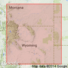
- Williston basin
- Chadron arch
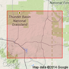
Summary:
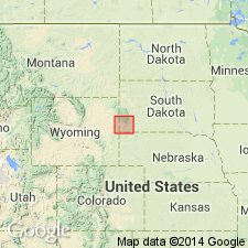
Named as a formation in the Black Hills, SD in the Williston basin and on the Chadron arch. Neither type section nor locality designated. Name is the Dakota Indian name for the Black Hills. Formerly known as Gray limestone. Is massive gray limestone, 225-500 ft thick in the central and southern Black Hills. Constitutes much of the high, wide plateau west of the central region of crystalline rocks of the Black Hills, and is most characteristically exhibited in the great line of cliffs in the in-facing escarpment surrounding that region. It does not exhibit any noteworthy lithologic subdivisions, but its upper part is often siliceous and flinty, and stained red from the overlying red beds of Minnelusa formation. Overlies Englewood limestone (new) with which it merges rapidly; overlain by Minnelusa formation. Fossils occur sparingly and indicate a Lower (Early) Carboniferous age. Lists the fauna, and shows distribution of the formation in the southern part of the Black Hills, SD.
Source: GNU records (USGS DDS-6; Denver GNULEX).
- Usage in publication:
-
- Pahasapa limestone*
- Modifications:
-
- Overview
- AAPG geologic province:
-
- Williston basin
Summary:
A limestone of Mississippian age on east side of Bighorn Range, Bighorn and Powder River basins, given a local name --Littlehorn limestone. Thought to be equivalent with the Pahasapa limestone of the Black Hills and possibly with Madison limestone of MT. Fossils (brachiopods, corals) identified. Correlation diagram.
Source: GNU records (USGS DDS-6; Denver GNULEX).
- Usage in publication:
-
- Pahasapa limestone*
- Modifications:
-
- Overview
- Age modified
- Areal extent
- AAPG geologic province:
-
- Williston basin
- Powder River basin
Summary:
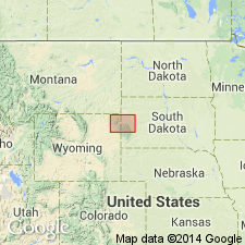
Shows distribution in northern Black Hills and vicinity, SD and WY, including the Bear Lodge uplift, WY in the Williston and Powder River basins. Thickness ranges from 100 ft on the flanks of Polo Mountain, Lawrence Co, SD to about 700 ft in Spearfish Canyon, Lawrence Co, SD. Gives section measured on north side of Elk Creek, southeast of Runkel, T5 and 6E, R4N, Meade Co, SD. Gives expanded list of fossils. Fauna is that of Madison limestone of the Rocky Mountain region which is of Mississippian age, and is equivalent, in general, to the Chouteau, Burlington, and Keokuk of the Mississippi Valley.
Source: GNU records (USGS DDS-6; Denver GNULEX).
- Usage in publication:
-
- Pahasapa limestone*
- Modifications:
-
- Overview
- AAPG geologic province:
-
- Williston basin
- Chadron arch
Summary:
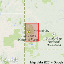
Shows distribution and summarizes information for the central Black Hills, SD in the Williston basin and on the Chadron arch. Gives thickness as ranging from 300 ft on Whitewood Creek, Lawrence Co, SD to 630 ft in Spearfish Canyon and Robinson [Robison] Gulch, Lawrence Co, SD. Early Mississippian in age, equivalent to the Burlington and Keokuk limestones of the Mississippi Valley.
Source: GNU records (USGS DDS-6; Denver GNULEX).
- Usage in publication:
-
- Pahasapa limestone
- Modifications:
-
- Areal extent
- AAPG geologic province:
-
- Chadron arch
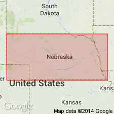
Summary:
Name extended southward in the subsurface into northwestern Nebraska. Used in the Duthie well, sec 33, T35N, R47W, Dawes Co, NE for limestone and minor gray shale at depths of 2,194-2,595 ft. Underlies Minnelusa group; overlies Englewood formation?. Mississippian in age.
Source: GNU records (USGS DDS-6; Denver GNULEX).
- Usage in publication:
-
- Pahasapa limestone
- Modifications:
-
- Areal extent
- AAPG geologic province:
-
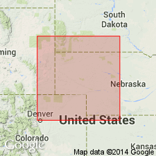
- Denver basin
Summary:
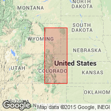
The Guernsey formation of Smith, 1903 (USGS Hartville folio, no. 91) not used in the Hartville uplift, Wyoming, Denver basin. The main body of massive limestone in upper part of the Guernsey formation of Smith (1903) in the Hartville uplift, Wyoming, is correlated with and assigned to the Pahasapa limestone of the Black Hills area. Overlies Englewood limestone; underlies Fairbank formation (new). Report includes measured sections.
Source: Modified from GNU records (USGS DDS-6; Denver GNULEX).
- Usage in publication:
-
- Pahasapa limestone
- Modifications:
-
- Age modified
- Areal extent
- AAPG geologic province:
-
- Chadron arch
- Powder River basin
- Williston basin
Summary:
Name used in Black Hills, SD in the Williston basin, Powder River basin, and on the Chadron arch. Probably includes Kinderhookian beds in basal part. Appears to continue [upward] to uppermost Osagean or Meramecian. upper part probably varies in age as a result of pre-Pennsylvanian erosion. Unconformably underlies Minnelusa formation; conformably overlies Englewood limestone.
Source: GNU records (USGS DDS-6; Denver GNULEX).
- Usage in publication:
-
- Pahasapa limestone
- Modifications:
-
- Overview
- AAPG geologic province:
-
- Williston basin
- Powder River basin
- Chadron arch
Summary:
A formation in Madison group together with underlying Englewood formation, in the Black Hills area, SD and WY in Williston and Powder River basins and on Chadron arch. Divides Madison group in WY, MT, and parts of adjacent States into three conformable depositional sequences, or units, rather than strict formational units. Lower unit includes the Lodgepole interval in MT, and the half of Pahasapa formation and underlying Englewood formation in Black Hills area, SD and WY [as depicted in a section in Spearfish Canyon, T6N, R2E, Lawrence Co, SD in Williston basin]. Middle unit includes Mission Canyon formation and overlying evaporite section of basal Charles formation, and is correlated with middle part of Pahasapa formation in Black Hills area in the section at Spearfish Canyon. It consists of two evaporite cycles consisting of cyclic, marine, crystalline dolomites overlain by primary dense dolomites. The upper unit includes upper part of Charles strata overlying basal evaporite zone, and where preserved at top of Pahasapa formation in Black Hills area [as at Spearfish Canyon] consists of [about 75 ft] of oolitic and dense limestones, with thin, interbedded, primary dense dolomites (brecciated in the outcrops) in upper part. In southern Black Hills, only lower unit is present. Shows isopach and lithofacies maps of the three units and discusses their environments of deposition. Mississippian in age.
Source: GNU records (USGS DDS-6; Denver GNULEX).
- Usage in publication:
-
- Pahasapa limestone
- Modifications:
-
- Revised
- AAPG geologic province:
-
- Powder River basin
- Williston basin
- Chadron arch
Summary:
Overlain unconformably by Fairbank formation rather than Hartville formation in the Black Hills and nearby areas, SD and WY, in Williston and Powder River basins and on Chadron arch.
Source: GNU records (USGS DDS-6; Denver GNULEX).
- Usage in publication:
-
- Pahasapa formation
- Modifications:
-
- Overview
- AAPG geologic province:
-
- Williston basin
Summary:
Averages 550 ft thick and lies disconformably between the underlying Englewood and overlying Minnelusa formations in sections measured in Little Elk (sec 7, T3N, R6E), Spearfish (northwest part T5N, R2E), and Whitewood (secs 13 and 14, T5N, R3E) Canyons, Lawrence Co, SD in the Williston basin. Comprises six members of alternating limestone and dolomite designated (ascending) a to f. Generalized description given of the six members. The disconformity at base of Pahasapa represents, in the subsurface of Williston basin, the depositional period of the lower Lodgepole shaly limestone. The three lower Pahasapa members (a, b, and c) become the middle and upper [parts of] Lodgepole formation in the Williston basin. The three upper members of Pahasapa (d, e, and f) grade laterally into the lower (second oolitic), middle (anhydritic), and upper (first oolitic) zones of Mission Canyon formation in Williston basin. Early Mississippian in age.
Source: GNU records (USGS DDS-6; Denver GNULEX).
- Usage in publication:
-
- Pahasapa limestone
- Modifications:
-
- Revised
- AAPG geologic province:
-
- Williston basin
- Chadron arch
Summary:
Assigned to the Madison group, together with the underlying Englewood limestone, in outcrops in the eastern part of the Black Hills, SD in Williston basin and on the Chadron arch.
Source: GNU records (USGS DDS-6; Denver GNULEX).
- Usage in publication:
-
- Pahasapa Formation
- Modifications:
-
- Overview
- AAPG geologic province:
-
- Williston basin
Summary:
At Boxelder Canyon, Meade Co, and at Whitewood Canyon, Lawrence Co, in the Black Hills of SD, Williston basin, Early Mississippian conodonts have been found in the basal part of the Pahasapa Formation. Conodonts were found in the basal 3 ft of the Pahasapa in Boxelder Canyon (measured section 5 ft thick described) and in the basal 6 ft of the Pahasapa in Whitewood Canyon (measured section 6 ft thick described). Upper part of Pahasapa not described. Pahasapa overlies Englewood Formation which has late Late Devonian fossils in its upper part.
Source: GNU records (USGS DDS-6; Denver GNULEX).
- Usage in publication:
-
- Pahasapa Limestone
- Modifications:
-
- Revised
- AAPG geologic province:
-
- Williston basin
- Powder River basin
- Chadron arch
Summary:
Overlain unconformably by Sacajawea Formation of Minnelusa Group in the Black Hills, SD and WY, in Williston and Powder River basins, and on Chadron arch. Mississippian in age.
Source: GNU records (USGS DDS-6; Denver GNULEX).
- Usage in publication:
-
- Pahasapa Limestone
- Modifications:
-
- Overview
- AAPG geologic province:
-
- Williston basin
- Chadron arch
Summary:
Name used in eastern part of Black Hills, in SD, Williston basin and on Chadron arch. Shows correlation with other formations in the Rocky Mountain region. Discusses thickness and lithofacies of Pahasapa and equivalent rocks, subdivided by age. Mississippian (Kinderhook and Osage) in age.
Source: GNU records (USGS DDS-6; Denver GNULEX).
For more information, please contact Nancy Stamm, Geologic Names Committee Secretary.
Asterisk (*) indicates published by U.S. Geological Survey authors.
"No current usage" (†) implies that a name has been abandoned or has fallen into disuse. Former usage and, if known, replacement name given in parentheses ( ).
Slash (/) indicates name conflicts with nomenclatural guidelines (CSN, 1933; ACSN, 1961, 1970; NACSN, 1983, 2005, 2021). May be explained within brackets ([ ]).