- Usage in publication:
-
- Pagoda oolite
- Modifications:
-
- Original reference
- Dominant lithology:
-
- Limestone
- Oolite
- Shale
- AAPG geologic province:
-
- Montana folded belt
Summary:
Pg. 37 and passim. Pagoda oolite. Most striking character is oolitic texture. Consists of (descending): (1) cream-colored to chocolate-gray thick-bedded, massive oolitic limestone, entirely free from clay, 56 feet; (2) thin- to medium-bedded fine-grained chocolate-colored limestone in beds 1 to 8 inches thick, all carrying small amounts of buff-colored clay disseminated in flakes, 30 feet; (3) thin-bedded cream-gray platy oolitic limestone that weathers white gray, 75 feet. Thickest (400 feet) in Deaborn section; thinnest (87 feet) in Wall Creek section; at type locality 168 feet. Underlies Pentagon shale and overlies Steamboat limestone. Age is Middle or Late Cambrian.
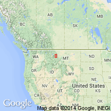
Type locality: on east side of peak lying N. 20 deg. E. of top of Pagoda Mountain, in SW/4 sec. 3, T. 22 N., R. 13 W., [unsurveyed, Pagoda Mountain 7.5-min quadrangle, Flathead Co., northwestern MT]. Named from Pagoda Mountain, but is not present on the peak that forms very top of that mountain.
Source: US geologic names lexicon (USGS Bull. 896, p. 1586).

- Usage in publication:
-
- Pagoda limestone
- Modifications:
-
- Revised
- Dominant lithology:
-
- Limestone
- Oolite
- Shale
- AAPG geologic province:
-
- Montana folded belt
Summary:
Pg. 1075, 1085, 1090 (fig. 2). Termed Pagoda limestone. Underlies Pentagon shale; overlies Dearborn limestone. Thickness type section 364 feet; [detailed measured section p. 1077-1083; see also Deiss, 1939]. [Age is Middle Cambrian (Albertan).]
[Type locality: Prairie Reef area, in NE/4 sec. 9, T. 21 N., R. 11 W., Prairie Reef 7.5-min quadrangle, Lewis and Clark Co., northwestern MT.]
Source: US geologic names lexicon (USGS Bull. 1200, p. 2893); GNU records (USGS DDS-6; Denver GNULEX).

- Usage in publication:
-
- Pagoda limestone
- Modifications:
-
- Areal extent
- AAPG geologic province:
-
- Montana folded belt
Summary:
Pg. 40-41, measured sections. Pagoda limestone. Chiefly pale cream- and chocolate-gray, generally fine-grained limestone; lower fifth+/- consists of dull-green fissile shales interbedded with gray, tan, and green-gray, thin-bedded limestones, and basal few feet include 2- to 4-inch beds of conglomerate. Several intervals of pale red or maroon chaclareous mudstones are interbedded with the shales and limestones. Thickness 364 feet. Underlies Steamboat limestone in central and southern sections. Detailed measured sections [type summarized on p. 28; see Deiss, 1938, p. 1077-1083 for detailed measured section]. [Age is Middle Cambrian.]
Type locality stated to be on upper part of southeast face, from 44 to 400 ft below the top of Prairie Reef, [Prairie Reef 7.5-min quadrangle, Lewis and Clark Co., northwestern MT]. Named from Pagoda Mountain which lies approx. 13 mi N. 63 deg. W. of Prairie Reef, in southern part of Flathead Range.
Source: Publication; US geologic names lexicon (USGS Bull. 1200, p. 2893).
For more information, please contact Nancy Stamm, Geologic Names Committee Secretary.
Asterisk (*) indicates published by U.S. Geological Survey authors.
"No current usage" (†) implies that a name has been abandoned or has fallen into disuse. Former usage and, if known, replacement name given in parentheses ( ).
Slash (/) indicates name conflicts with nomenclatural guidelines (CSN, 1933; ACSN, 1961, 1970; NACSN, 1983, 2005, 2021). May be explained within brackets ([ ]).

