

- Usage in publication:
-
- Paducah Group
- Modifications:
-
- Named
- Dominant lithology:
-
- Sand
- Silt
- Clay
- Gravel
- AAPG geologic province:
-
- Permian basin
- Palo Duro basin
Summary:
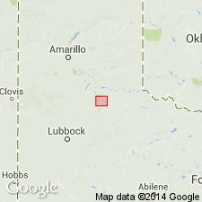
Name applied to a group of genetically similar and geographically close formations in the vicinity of Paducah, Cottle Co, TX. Includes the (ascending) Seymour, Good Creek, and Groesbeck Formations, and some unnamed lacustrine and palustrine deposits on the southern and eastern Rolling Plains. Includes the newly named Lingos Formation on the western and northern Rolling Plains of TX. These formations occur in the Palo Duro and Permian basins. Geologic maps. Stratigraphic chart and sections. No type locality designated. Only the Lingos Formation which consists of sand, gravel, clay, silt 48-82 m thick described in this report. Lingos deposited in alluvial-fan systems (lower part), lacustrine environment (middle part), eolian and fluvial origin (upper part). Of Pleistocene (Irvingtonian and Rancholabrean) and Holocene age.
Source: GNU records (USGS DDS-6; Denver GNULEX).
For more information, please contact Nancy Stamm, Geologic Names Committee Secretary.
Asterisk (*) indicates published by U.S. Geological Survey authors.
"No current usage" (†) implies that a name has been abandoned or has fallen into disuse. Former usage and, if known, replacement name given in parentheses ( ).
Slash (/) indicates name conflicts with nomenclatural guidelines (CSN, 1933; ACSN, 1961, 1970; NACSN, 1983, 2005, 2021). May be explained within brackets ([ ]).