The National Geologic Map Database is migrating to a new infrastructure. We apologize for any service disruptions during this process.
|
|---|


- Usage in publication:
-
- Packsaddle series
- Modifications:
-
- Original reference
- Dominant lithology:
-
- Metamorphics
- AAPG geologic province:
-
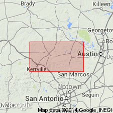
- Llano uplift
Summary:
Pl. 3, p. lvii, lviii, 276-281 (Comstock and Dumble). Packsaddle series. Metamorphosed shaly beds and marble forming top division of Texan system. Unconformably underlies Cambrian Hickory series and overlies Llano series [restricted sense]. Age is Precambrian (Llano series).
[Named from Packsaddle Mountain, Llano Co., central TX.]
Source: US geologic names lexicon (USGS Bull. 896, p. 1585).
- Usage in publication:
-
- Packsaddle schist*
- Modifications:
-
- Revised
- Adopted
- AAPG geologic province:
-
- Llano uplift
Summary:
Pg. 14-23. Packsaddle schist. Dominantly basic rocks, generally of dark color, including biotite, amphibolite, and graphitic schists and crystalline limestone, also lighter-colored, more feldspathic bands resembling quartzite. Intruded by granite, which is not easily separated [but which is not a part of formation]. Upper formation of Llano series in Llano and Burnet Counties [central Texas]. Grades into underlying acidic Valley Spring gneiss by a transition zone. Unconformably overlain by Hickory sandstone. Age is Precambrian (Llano series). [Adopted deflnitlon.]
Source: US geologic names lexicon (USGS Bull. 896, p. 1586).
- Usage in publication:
-
- Packsaddle schist*
- Modifications:
-
- Mapped
- Areal extent
- Dominant lithology:
-
- Schist
- Limestone
- AAPG geologic province:
-
- Llano uplift
Summary:
Packsaddle schist, upper formation of Llano series. Mapped in two major areas in Burnet quadrangle, and in several large outcrop areas in Llano quadrangle, Texas. Consists of mica, amphibolite, and graphitic schists, and crystalline limestone. Locally includes some feldspathic rocks with much quartz. Amphibolite schists are abundant and are characterized by having very little quartz. Section 2,539 feet thick measured on Oatman Creek east-southeast of Bachelor Peak in Llano quadrangle. Overlies Valley Spring gneiss, lower formation of Llano series. Unconformably underlies Hickory sandstone. Presence of banding infers metamorphism of a sedimentary sequence originally Algonkian age. Report includes geologic map, columnar section.
Source: GNU records (USGS DDS-6; Denver GNULEX).
- Usage in publication:
-
- Packsaddle schist*
- Modifications:
-
- Overview
- AAPG geologic province:
-
- Llano uplift
Summary:
Intruded by Big Branch gneiss.
Source: US geologic names lexicon (USGS Bull. 1200, p. 2890).
- Usage in publication:
-
- Packsaddle schist*
- Modifications:
-
- Overview
- AAPG geologic province:
-
- Llano uplift
Summary:
Pg. 152-153. Packsaddle schist. Oldest Precambrian rocks in Llano uplift are mostly light colored, highly feldspathic metasediments, named Valley Spring gneiss, followed by dark-colored metasediments; including amphibolite, mica schist, graphite schist, and some marble, all of which are included in Packsaddle schist. These rocks are highly folded, and during folding it is believed the igneous rocks were intruded which were metamorphosed into Red Mountain gneiss and dioritic Big Branch gneiss. Date of intrusion of perioditic rocks, now serpentized into Coal Creek serpentine, in relation to Big Branch gneiss not satisfactorily determined. Town Mountain granite invaded the already deformed metasediments and was followed by Oatman Creek granite, Sixmile granite, and Llanite, the latter being the youngest. Age is Precambrian (Llano Series).
Source: US geologic names lexicon (USGS Bull. 1200, p. 2890).

- Usage in publication:
-
- Packsaddle Group
- /Packsaddle Schist
- Modifications:
-
- Principal reference
- Revised
- Dominant lithology:
-
- Schist
- Marble
- Leptite
- AAPG geologic province:
-
- Llano uplift
Summary:
Packsaddle Group of Llano Supergroup. Rank raised to group. Divided into (descending) Click, Rough Ridge, Sandy, and Honey Formations. Consists of mostly marble, graphite schist, amphibole schist, mica schist, and leptite. Thickness about 20,000 feet (6,000 m). Overlies Valley Spring Gneiss of Llano Supergroup. Intruded by Coal Creek Serpentine. Age is Precambrian.
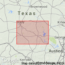
Type section (composite): along Honey, Cottonwood, and Sandy Creeks, and on a portion of the J.L. Pearson Ranch, southwest of Click, Llano region, Llano Co., central TX.
[Often referred to as Packsaddle Schist in text. Term should be ignored; invalid hierarchy, formations cannot include other formations (CSN, 1933; ACSN, 1961, 1970; NACSN, 1983, 2005, 2021).]
Source: Publication.
- Usage in publication:
-
- Packsaddle Schist*
- Modifications:
-
- Revised
- AAPG geologic province:
-
- Llano uplift
Summary:
Packsaddle Schist. Consists of hornblende, graphite, biotite, muscovite, actinolite, and calcareous schists, quartzites and quartzofeldspathic rocks, amphibolites, and marbles. Interpreted to represent a continental-shelf-and-slope setting along the flank of an arc; relationship with other units is not stratigraphic as previously thought, but tectonic. Occupies structural position below the older Big Branch Gneiss (1,326 to 1,301 Ma) and above Valley Spring Gneiss (1,272 to 1,366 Ma). Intruded by Red Mountain and Comanche Creek Gneisses. Age is Mesoproterozoic (protolith age of ca. 1,257 to 1,247 Ma, based on U-Pb isotopic analyses).
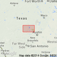
Study area in southeastern part of Llano uplift, Llano Co., central TX.
Source: Publication.
For more information, please contact Nancy Stamm, Geologic Names Committee Secretary.
Asterisk (*) indicates published by U.S. Geological Survey authors.
"No current usage" (†) implies that a name has been abandoned or has fallen into disuse. Former usage and, if known, replacement name given in parentheses ( ).
Slash (/) indicates name conflicts with nomenclatural guidelines (CSN, 1933; ACSN, 1961, 1970; NACSN, 1983, 2005, 2021). May be explained within brackets ([ ]).