The National Geologic Map Database is migrating to a new infrastructure. We apologize for any service disruptions during this process.
|
|---|


- Usage in publication:
-
- Pacific sandstone
- Modifications:
-
- First used
- Dominant lithology:
-
- Sandstone
- AAPG geologic province:
-
- Ozark uplift
Summary:
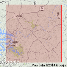
First used in Miller Co, MO, Ozark uplift. Intent to name not stated. Resembles "in position and manner of occurrence" First Saccharoidal sandstone of Swallow or Pacific sandstone as typically exposed at Pacific [Franklin Co, MO], for which unit probably named. Occurs as very small isolated remnants in sec 30, T40N, R13W, secs 26, 33, T39N, R14W, and secs 12, 13, T38N, R14W. Consists of thin heterogeneous beds of chert, sandstone and cherty sandstone; conglomeratic at base. Sandstone in sec 30, T40N, R13W is white to reddish brown, friable with medium to well-rounded grains; chert is white, compact, and probably of fragmental origin. Thickness is 30 ft at measured section. Unconformably overlies Jefferson City formation; underlies First Magnesian limestone of Swallow or Chouteau limestone. Geologic map. Assigned undifferentiated Cambrian and Ordovician age.
Source: GNU records (USGS DDS-6; Denver GNULEX).
For more information, please contact Nancy Stamm, Geologic Names Committee Secretary.
Asterisk (*) indicates published by U.S. Geological Survey authors.
"No current usage" (†) implies that a name has been abandoned or has fallen into disuse. Former usage and, if known, replacement name given in parentheses ( ).
Slash (/) indicates name conflicts with nomenclatural guidelines (CSN, 1933; ACSN, 1961, 1970; NACSN, 1983, 2005, 2021). May be explained within brackets ([ ]).