

- Usage in publication:
-
- Pachuta member
- Modifications:
-
- Original reference
- Dominant lithology:
-
- Marl
- Limestone
- AAPG geologic province:
-
- Mid-Gulf Coast basin
Summary:
Pg. 1838 (fig. 6), 1839 (footnote). Pachuta (marl) member of Yazoo clay (or formation) proposed for 6 to 25 feet of buff, gray, or white, partly indurated generally glauconitic fossiliferous marl, overlain by Shubuta (clay) member (new) and underlain by Cocoa sand member or North Creek clay member (new). Recognized in eastern Mississippi and western Alabama. Age is late Eocene.
Type locality: exposures on south side of Pachuta Creek, 1.25 mi south and southeast of Pachuta, in SW/4 sec. 8, T. 2 N., R. 14 E., Clarke Co., eastern MS.
Source: US geologic names lexicon (USGS Bull. 1200, p. 2888-2889).
- Usage in publication:
-
- Pachuta marl member*
- Modifications:
-
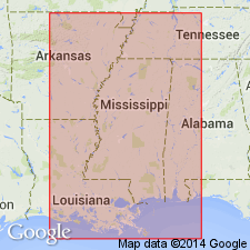
- Areal extent
- AAPG geologic province:
-
- Mid-Gulf Coast basin
Summary:
Pg. 122, 126, pl. 3. Pachuta marl member of Yazoo clay. In Choctaw County, Alabama, consists of yellow sandy hard limestone with prints of fossils and light-gray almost white chalky marlstone irregularly indurated and containing white lime nodules; thins gradually from about 10 feet at Mississippi-Alabama line to about 5 feet in south-central part of county. [Age is late Eocene.]
Source: US geologic names lexicon (USGS Bull. 1200, p. 2888-2889).

- Usage in publication:
-
- Pachuta Marl Member
- Modifications:
-
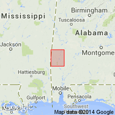
- Overview
- AAPG geologic province:
-
- Mid-Gulf Coast basin
Summary:
Pg. 67. Pachuta Marl Member of Yazoo Clay of Jackson Group. Light-greenish-gray clayey, glauconitic, fossiliferous, calcareous sand or sandy marl to limestone that weathers to pale-yellowish-orange. Present in southwest Alabama. Thickness ranges from 6 to 15 feet. Age is late Eocene (Priabonian).
See also L.D. Toulmin, 1977, Alabama Geol. Survey Mon., no. 13, p. 126-129.
Source: Publication.
For more information, please contact Nancy Stamm, Geologic Names Committee Secretary.
Asterisk (*) indicates published by U.S. Geological Survey authors.
"No current usage" (†) implies that a name has been abandoned or has fallen into disuse. Former usage and, if known, replacement name given in parentheses ( ).
Slash (/) indicates name conflicts with nomenclatural guidelines (CSN, 1933; ACSN, 1961, 1970; NACSN, 1983, 2005, 2021). May be explained within brackets ([ ]).