- Usage in publication:
-
- Ox Frame Volcanics*
- Modifications:
-
- Redescribed
- Reference
- Age modified
- Dominant lithology:
-
- Rhyolite
- Rhyodacite
- Andesite
- AAPG geologic province:
-
- Basin-and-Range province
Summary:
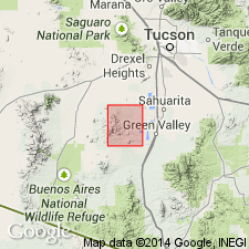
Adopted [with change from Oxframe to Ox Frame] and redescribed from Formation to Volcanics. Ox Frame Canyon from NE1/4 sec 22 to N1/2 sec 3, T18S, R11E, Pima Co, AZ is designated the type locality. Reference section designated in western foothills of Sierrita Mountains along Tascuela Canyon in sec 18, T18S, R11E where base is an intrusive monzonite (Jurassic) and top is Tascuela Redbeds. Reference section is 4,000 ft thick. Consists of light-colored silicic rocks of rhyolite to rhyodacite, andesite and dacite composition. Occur as flows, flow breccias, welded and nonwelded tuffs and tuff breccias with interbeds of sandstone and conglomerate. Locally lies with angular unconformity on Paleozoic sedimentary rocks. Disconformably overlain by Tascuela Redbeds (new). Is intruded by quartz monzonite that has an apparent age of 190 +/-20 Ma based on Pb-alpha dating of zircon. Also intruded by rocks dated by Rb-Sr method as 140 +/-14 Ma and 130 +/-6 Ma. Correlated with Mount Wrightson Formation. Age changed from Cretaceous? to Triassic. Measured section. Geologic map.
Source: GNU records (USGS DDS-6; Denver GNULEX).

- Usage in publication:
-
- Ox Frame Volcanics*
- Modifications:
-
- Age modified
Summary:
Included with rocks of late Early to early Middle Jurassic age. Thought to be younger than Chinle Formation and equivalent to Navajo Sandstone. Middle Jurassic age assignment based on placement of Aalenian as the basal stage of the Middle Jurassic between the Lower Jurassic Toarcian Stage and the Middle Jurassic Bajocian Stage. [Some authors follow Imlay (1980) in that they do not recognize the Aalenian Stage, and they place the Lower-Middle Jurassic boundary between the Toarcian and the Bajocian.]
Source: GNU records (USGS DDS-6; Denver GNULEX).
For more information, please contact Nancy Stamm, Geologic Names Committee Secretary.
Asterisk (*) indicates published by U.S. Geological Survey authors.
"No current usage" (†) implies that a name has been abandoned or has fallen into disuse. Former usage and, if known, replacement name given in parentheses ( ).
Slash (/) indicates name conflicts with nomenclatural guidelines (CSN, 1933; ACSN, 1961, 1970; NACSN, 1983, 2005, 2021). May be explained within brackets ([ ]).

