

- Usage in publication:
-
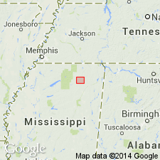
- Owl Creek marl
- Modifications:
-
- Named
- Dominant lithology:
-
- Marl
- AAPG geologic province:
-
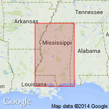
- Upper Mississippi embayment
Summary:
Owl Creek marl of Ripley group described as dark-bluish micaceous fossiliferous marl, more or less clayey in different portions. Thickness at Owl Creek Bluff 20 ft. Overlain by Eocene concretionary limestone.
Source: GNU records (USGS DDS-6; Reston GNULEX).
- Usage in publication:
-
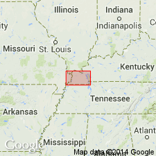
- Owl Creek horizon
- Modifications:
-
- Areal extent
- Overview
- AAPG geologic province:
-
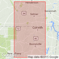
- Upper Mississippi embayment
Summary:
Owl Creek is a fossiliferous horizon that can be traced from southern TN southward into MS to Owl Creek, Tippah Co. Overlain by Eocene and underlain by McNairy sand member [restricted].
Source: GNU records (USGS DDS-6; Reston GNULEX).

- Usage in publication:
-
- Owl Creek formation
- Modifications:
-
- Overview
- AAPG geologic province:
-
- Upper Mississippi embayment
Summary:
In 1926 and subsequent years the marine beds designated Owl Creek marl by Hilgard were treated by the USGS as a tongue of typical Ripley deposits, overlying the near-shore deposit called McNairy sand member of Ripley formation. (See B. Wade, 1926, USGS Prof. Paper 137.) In 1937 the name was changed to Owl Creek formation, and Ripley formation was restricted to underlying deposits, the overlying chalk (heretofore designated "Oktibbeha tongue of Selma chalk") to hereafter be treated as a part of the Prairie Bluff chalk (expanded), and Oktibbeha to be discarded. (See L.W. Stephenson and W.H. Monroe, AAPG Bull., 1937.)
Source: US geologic names lexicon (USGS Bull. 896, p. 1580).
- Usage in publication:
-
- Owl Creek sandy clay member, tongue
- Modifications:
-
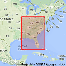
- Areal extent
- Revised
- AAPG geologic province:
-
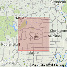
- Upper Mississippi embayment
Summary:
The Owl Creek is geographically extended into Stoddard Co., southeastern MO, where it is referred to as Owl Creek sandy clay member or tongue of Ripley formation.
Source: GNU records (USGS DDS-6; Reston GNULEX).
- Usage in publication:
-
- Owl Creek formation*
- Modifications:
-
- Overview
- Dominant lithology:
-
- Clay
- Sand
- AAPG geologic province:
-
- Upper Mississippi embayment
Summary:
Owl Creek formation, in Crowleys Ridge area, MO, consists of 11 ft of clay and sand. Unconformably overlies McNairy sand; unconformably underlies Clayton formation. Fossils described
Source: GNU records (USGS DDS-6; Reston GNULEX).
- Usage in publication:
-
- Owl Creek formation*
- Modifications:
-
- Overview
- AAPG geologic province:
-
- Upper Mississippi embayment
Summary:
Owl Creek formation described in TN and MS where it consists characteristically of dark silty sand and subordinate amounts of clay that are glauconitic, micaceous, and highly fossiliferous. Thickness commonly 30 to 40 ft. Thickest in southern area of outcrop where it merges into Prairie Bluff chalk. In Hardeman Co., TN, formation is overlapped by Midway group. Southward along outcrop belt, it can be traced until it interfingers with Prairie Bluff chalk in Pontotoc Co. MS. Owl Creek lies within bounds of EXOGYRA COSTATA zone. It is unconformably overlain by Clayton formation and lies with unconformity on Ripley formation. In some areas, overlies McNairy sand member of Ripley, and in other areas Keownville limestone member (new) of Ripley. [Keownville was later abandoned by author as it proved equivalent to Cusseta, named by Mellen (1958).]
Source: GNU records (USGS DDS-6; Reston GNULEX).
- Usage in publication:
-
- Owl Creek Formation*
- Modifications:
-
- Areal extent
- AAPG geologic province:
-
- Upper Mississippi embayment
Summary:
Owl Creek Formation geographically extended from MS, TN, and MO into the subsurface of western KY. Not assigned to Selma Group in this area.
Source: GNU records (USGS DDS-6; Reston GNULEX).
- Usage in publication:
-
- Owl Creek Formation*
- Modifications:
-
- Biostratigraphic dating
- AAPG geologic province:
-
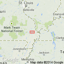
- Black Warrior basin
- Upper Mississippi embayment
Summary:
Owl Creek Formation shown as Late Cretaceous (middle and late Maastrichtian) on fig. 1. Middle and late Maastrichtian age based in part on late Maastrichtian CRASSATELLA VADOSA collected in Tippah and Union Cos., northern MS; and SCAMBULA PERPLANA collected in Union Co.
Source: GNU records (USGS DDS-6; Reston GNULEX).

- Usage in publication:
-
- Owl Creek Formation*
- Modifications:
-
- Overview
- AAPG geologic province:
-
- Upper Mississippi embayment
- Illinois basin
Summary:
Owl Creek Formation mapped undivided in IL and MO with McNairy Sand, Coffee Formation, and Little Bear Formation. Consists of glauconitic, silty to sandy clay and silt. Age is Maastrichtian.
Source: GNU records (USGS DDS-6; Reston GNULEX).
For more information, please contact Nancy Stamm, Geologic Names Committee Secretary.
Asterisk (*) indicates published by U.S. Geological Survey authors.
"No current usage" (†) implies that a name has been abandoned or has fallen into disuse. Former usage and, if known, replacement name given in parentheses ( ).
Slash (/) indicates name conflicts with nomenclatural guidelines (CSN, 1933; ACSN, 1961, 1970; NACSN, 1983, 2005, 2021). May be explained within brackets ([ ]).