

- Usage in publication:
-
- Overton fanglomerate*
- Modifications:
-
- Named
- Dominant lithology:
-
- Conglomerate
- AAPG geologic province:
-
- Great Basin province
Summary:
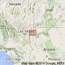
Consists of coarse, angular fragments mostly of limestone with sand-filled matrices and calcium carbonate cement. Thin beds of volcanic ash found in upper part. Varies from 20 to 3,000+ feet thick. Considered to be an alluvial fan deposit. No fossils found. Mapped east of Valley of Fire and west of Muddy Creek. Separated from the older unnamed cross-bedded sandstone by a "great unconformity." Is older than Horse Spring formation (new). Age is late Miocene. Report includes geologic map, nomenclature table.
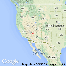
Named from typical exposures near settlement of Overton, in Muddy Valley, Clark Co., NV, in the Great Basin province.
Source: Modified from GNU records (USGS DDS-6; Denver GNULEX).
- Usage in publication:
-
- Overton fanglomerate*
- Modifications:
-
- Overview
- Dominant lithology:
-
- Conglomerate
- Sandstone
- AAPG geologic province:
-
- Great Basin province
Summary:
Mapped only on Overton Ridge east of the Muddy Mountains in Clark County, Nevada, in the Great Basin province, where it occurs above an unnamed Jurassic cross-bedded sandstone and beneath the Horse Spring formation. Ranges from 475 feet thick at Wieber Wash, to 3,165 feet thick at Kaolin Wash. Consists of very coarse (mostly boulders and pebbles), poorly sorted limestone, with a few lenses of sandstone and irregular cross-bedded white and red sandstone that interfingers with the conglomerate. Intervening space in conglomerate filled with sand and calcium carbonate cement. Some scattered pebbles of quartz and silicified wood. Considered to have been deposited on a steep grade adjacent to a high scarp by swift intermittent desert streams during Miocene time. Report includes geologic map, 6 measured sections.
Source: Modified from GNU records (USGS DDS-6; Denver GNULEX).
For more information, please contact Nancy Stamm, Geologic Names Committee Secretary.
Asterisk (*) indicates published by U.S. Geological Survey authors.
"No current usage" (†) implies that a name has been abandoned or has fallen into disuse. Former usage and, if known, replacement name given in parentheses ( ).
Slash (/) indicates name conflicts with nomenclatural guidelines (CSN, 1933; ACSN, 1961, 1970; NACSN, 1983, 2005, 2021). May be explained within brackets ([ ]).