

- Usage in publication:
-
- Ouachita shale
- Modifications:
-
- Original reference
- Dominant lithology:
-
- Shale
- Limestone
- AAPG geologic province:
-
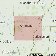
- Ouachita folded belt
Summary:
Pg. 30, 33. Ouachita shale. Chiefly dark-colored clay shale, but not uncommonly the dark layers alternate with green ones. In many places slaty cleavage is developed, when the alternating dark and green layers produce ribboned slate. Thin layers of limestone are interbedded in lower part. Quartz veins and thin layers of hard flinty material are common. Thickness probably not less than 900 feet. Grades into underlying Crystal Mountain sandstone [which at this time included Blakely sandstone, according to H.D. Miser, 1917]. Unconformably overlain by 75 to 150 feet of shale called Stringtown shale [only a part of typical Stringtown shale], which separates it from overlying Bigfork chert. [Age is Early and Middle Ordovician.]
[Named from Ouachita Mountains, southwestern AR, the pronunciation of which is Washita.]
Source: US geologic names lexicon (USGS Bull. 896, p. 1577).
- Usage in publication:
-
- Ouachita shale†
- Modifications:
-
- Abandoned
- AAPG geologic province:
-
- Ouachita folded belt
Summary:
Interpreted †Ouachita shale as = Mazarn shale, Blakely sandstone, and lower part of Womble shale of present terminology. (See 1917 entry under Blakely sandstone.)
Source: US geologic names lexicon (USGS Bull. 896, p. 1577).
For more information, please contact Nancy Stamm, Geologic Names Committee Secretary.
Asterisk (*) indicates published by U.S. Geological Survey authors.
"No current usage" (†) implies that a name has been abandoned or has fallen into disuse. Former usage and, if known, replacement name given in parentheses ( ).
Slash (/) indicates name conflicts with nomenclatural guidelines (CSN, 1933; ACSN, 1961, 1970; NACSN, 1983, 2005, 2021). May be explained within brackets ([ ]).