

- Usage in publication:
-
- Otterville limestone member
- Modifications:
-
- Original reference
- Dominant lithology:
-
- Limestone
- Shale
- AAPG geologic province:
-
- South Oklahoma folded belt
Summary:
Pg. 8. Otterville limestone member of Glenn formation. Solid brown limestone, of oolitic texture, which grades locally into several beds of brown limestone separated by blue shales. Thickness 70 feet. Forms low ridge running southeast from Otterville, 1 mile east of Armore Country Club. Exposed northward to as far west as Henry House Creek; parallels mountains east of Springer; surrounds town of Glenn. Underlies Cup Coral member and overlies Springer member (both of Glenn). Correlates with part of Millsap formation of north-central Texas and McAlester shale north of Arbuckle Mountains, Oklahoma (corr. chart). Fossils listed (brachiopods, bryozoans, gastropods, pelecypods, cephalopods). Age is Pennsylvanian. Report includes geologic map, structural map, cross sections, correlation chart.
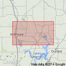
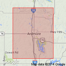
Type locality: in sec. 3, T. 3 S., R. 1 W., near site of abandoned hamlet of Otterville, Carter Co., south-central OK. [See also Tomlinson (1929).]
Source: US geologic names lexicon (USGS Bull. 896, p. 1576); supplemental information from GNU records (USGS DDS-6; Denver GNULEX).
- Usage in publication:
-
- Otterville member
- Modifications:
-
- Revised
- Biostratigraphic dating
- AAPG geologic province:
-
- South Oklahoma folded belt
Summary:
Pg. 331-347. Otterville limestone of Goldston [1922] does not belong to Glenn formation. It is older than Glenn. The Otterville correlates with beds which in some places have been included in Wapanucka and in other places in upper part of Caney shale, but would probably better be excluded from both of those formations. It was not included in typical Wapanucka limestone as delimited in Atoka folio [J.A. Taff, 1902, USGS Geol. Atlas of the US, Atoka folio, no. 79, 8 p.].
Source: US geologic names lexicon (USGS Bull. 896, p. 1576).
- Usage in publication:
-
- Otterville member
- Modifications:
-
- Revised
- AAPG geologic province:
-
- South Oklahoma folded belt
Summary:
Pg. 29-30. Revised the Otterville to member of Dornick Hills formation. Goldston [1922] applied Otterville limestone to different limestone ledges as much as 2,400 feet apart stratigraphically, though he described it as a single limestone only 70 feet thick. It is desirable to confine term to the limestone which Girty and Roundy [1923, AAPG Bull., v. 7, no. 4, p. 331-347] made their "Otterville" collections. This is probably, though not quite certainly, identical with the Otterville of Goldston's type locality, in sec. 3, T. 3 S., R. 1 W., near site of abandoned hamlet of Otterville. It attains an observed thickness of 25 feet, and may locally, including shaly layers, reach Goldston's figure of 70 feet. Most characteristic facies is a slightly ferruginous, platy granular limestone composed chiefly of tiny shell fragments; but oolite is common, and in Love County it locally carries limestone conglomerate. Lies 750 feet below Bostwick member (new) and 300 to 1,000 feet above Jolliff member [as here defined], both of Dornick Hills formation. Is separated from the other members by unnamed shales. Correlates faunally with lower part of Wapanucka limestone, with part of Morrow group, and with part of Marble Falls limestone of Texas. Age is Pennsylvanian. Report includes geologic map, columnar section.
Source: US geologic names lexicon (USGS Bull. 896, p. 1576-1577); supplemental information from GNU records (USGS DDS-6; Denver GNULEX).
- Usage in publication:
-
- Otterville member
- Modifications:
-
- Revised
- AAPG geologic province:
-
- South Oklahoma folded belt
Summary:
Pg. 137 (fig. 2), 138, 139. Reallocated to member status in Golf Course formation (new). Best developed at West Velma, in Harrisburg trough, where it is about 870 feet thick and consists of dark-gray generally calcareous and carbonaceous shale, or silty very fine sandy carbonaceous marly shale to marl, and argillaceous fine-grained calcareous sandstone to fine sandy fossiliferous limestone. Member may contain oolitic limestone with typical Morrow ostracods, brachiopods, and bryozoans. Overlies Limestone Gap shale member; underlies Bostwick member of Lake Murray formation (new).
Source: US geologic names lexicon (USGS Bull. 1200, p. 2872).
- Usage in publication:
-
- Otterville member
- Modifications:
-
- Principal reference
- Redefined
- Dominant lithology:
-
- Limestone
- AAPG geologic province:
-
- South Oklahoma folded belt
Summary:
Pg. 6 (fig. 2), 20-21. Member of Golf Course formation. Includes 25 feet or more of limestone. Along southwest limb of Caddo anticline, northwest of Lake Ardmore, it is single resistant unit. Elsewhere it comprises 2 to 4 separate ledges with intervening tan shales occupying 100 to 400 feet of stratigraphic section. South of Ardmore, about 800 feet of black shale with sideritic layers intervene between underlying Jolliff conglomerates and Otterville limestone. Above Otterville are 100 to 500 feet of light-colored shale with a few ledges of thin calcareous sandstone and sandy limestone, which become conglomeratic southward. Otterville member was named by Goldston (1922) from village of that name not now in existence but shown on early maps in NW/4 SW/4 sec. 3, T. 3 S., R. 1 W. Roth (1937, personal commun.) discovered fusulinids in limestone which Goldston had mapped as Otterville at that locality. These fusulinids proved limestone to be younger (possibly as young as Lester) than those mapped as Otterville elsewhere through Ardmore basin, including both localities from which Girty and Roundy (1923, AAPG Bull., v. 7, no. 4) made their collections of prolific Otterville fauna. Name Otterville is here retained for those limestones from which these collections came from and not for one vanished village of Otterville. New type locality suggested for redefined Otterville.
Type locality: Girty and Roundy's (1923, p. 343) Station 4062, 250 feet southwest of northeast corner sec. 6, T. 6 S., R. 2 E., Love Co., OK, together with adjacent exposure 650 feet south of that corner in draw at east side of road in sec. 5.
Source: US geologic names lexicon (USGS Bull. 1200, p. 2872-2873).
For more information, please contact Nancy Stamm, Geologic Names Committee Secretary.
Asterisk (*) indicates published by U.S. Geological Survey authors.
"No current usage" (†) implies that a name has been abandoned or has fallen into disuse. Former usage and, if known, replacement name given in parentheses ( ).
Slash (/) indicates name conflicts with nomenclatural guidelines (CSN, 1933; ACSN, 1961, 1970; NACSN, 1983, 2005, 2021). May be explained within brackets ([ ]).