The National Geologic Map Database is migrating to a new infrastructure. We apologize for any service disruptions during this process.
|
|---|


- Usage in publication:
-
- Otterdale sandstone*
- Modifications:
-
- Named
- Dominant lithology:
-
- Sandstone
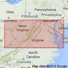
- AAPG geologic province:
-
- Piedmont-Blue Ridge province
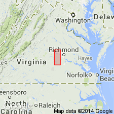
- Richmond basin
Summary:
Thick coarse sandstone in the vicinity of Otterdale, Chesterfield Co., VA, is named Otterdale Sandstone of the Chesterfield Group. It contains tree trunks and fragments and traces of lignite or jet. Overlies the Vinita Beds. Thickness is 500 ft (150 m). Age is Late Triassic.
Source: GNU records (USGS DDS-6; Reston GNULEX).
- Usage in publication:
-
- Otterdale Formation
- Modifications:
-
- Revised
- AAPG geologic province:
-
- Richmond basin
- Piedmont-Blue Ridge province
Summary:
Nomenclature in this report follows Ediger and others (in prep). Richmond basin sequence is divided into three formations (ascending): Tuckahoe, Turkey Branch, and Otterdale Formations of Newark Supergroup. Chesterfield Group not used. The Otterdale is restricted to southern 2/3 of the Richmond basin. It may be present in exposed part of the Taylorsville basin. Age is late Carnian based on palynoflora.
Source: GNU records (USGS DDS-6; Reston GNULEX).
For more information, please contact Nancy Stamm, Geologic Names Committee Secretary.
Asterisk (*) indicates published by U.S. Geological Survey authors.
"No current usage" (†) implies that a name has been abandoned or has fallen into disuse. Former usage and, if known, replacement name given in parentheses ( ).
Slash (/) indicates name conflicts with nomenclatural guidelines (CSN, 1933; ACSN, 1961, 1970; NACSN, 1983, 2005, 2021). May be explained within brackets ([ ]).