

- Usage in publication:
-
- Otter Point formation
- Modifications:
-
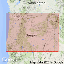
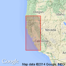
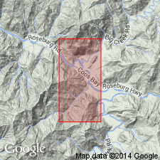
- Areal extent
- AAPG geologic province:
-
- Oregon-Washington Coast Ranges province
Summary:
Applied name to sequence of uppermost Jurassic rocks in southwestern Oregon Coast. Contains volcanic rocks and bedded cherts; fossiliferous.
Source: US geologic names lexicon (USGS Bull. 1350, p. 547); GNU records (USGS DDS-6; Menlo GNULEX).
- Usage in publication:
-
- Otter Point formation
- Modifications:
-
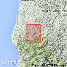
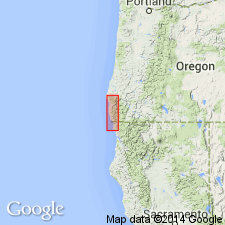
- Areal extent
- AAPG geologic province:
-
- Oregon-Washington Coast Ranges province
Summary:
Extended into Sixes River area, Powers 15' quad, and is continuous into Langlois 15' quad, to west, Curry and Coos Cos, OR. Two general divisions recognized: lower part a melange of sheared siltstone and sandstone with lenses of chert, extrusive basalt, and detached blocks of blueschist; upper part, massive light-gray buff-weathered poorly bedded sandstone with small angular mudstone clasts. Conglomerate, though not common, apparently occurs in both lower and upper parts; bedded radiolarian (up to 70 percent of rock) chert in scattered outcrops in lower part. Unconformably overlies Galice Fm and Jurassic ultramafic rocks and in fault contact with Colebrooke Schist: unconformably underlies Humbug Mountain Conglomerate. Unconformity may separate lower and upper parts. No fossils found in Powers quad; assigned to Late Jurassic based on age of formation to west.
Source: GNU records (USGS DDS-6; Menlo GNULEX).
- Usage in publication:
-
- Otter Point Formation
- Modifications:
-
- Principal reference
- Reference
- Biostratigraphic dating
- Dominant lithology:
-
- Mudstone
- Sandstone
- AAPG geologic province:
-
- Oregon-Washington Coast Ranges province
Summary:
Pg. 30 (fig. 2), 31 (fig. 3), 33 (fig. 4), 36-45. Otter Point Formation. Formal proposal of name. Myrtle Group of Imlay, 1959 (AAPG Bull., v. 43, no. 12), whose type locality is along South Umpqua River near Days Creek, consists of Upper Jurassic Riddle Formation and Lower Cretaceous Days Creek Formation. Rocks of like age in Port Orford-Gold Beach area were designated by these names. Koch (1963) renamed the coastal rocks (ascending) Otter Point, Humbug Mountain Conglomerate, and Rocky Point Formation. The Otter Point includes bedded chert, numerous graded beds, and several zones of pillowed flows and pyroclastic rocks. These previously undescribed lithologic types are not present in the inland Oregon, temporally equivalent Riddle Formation. At type section the formation consists of repetitiously interstratified dark-gray to black thin mudstone, and several thin beds of andesitic keratophyric volcanic breccia. Thickness about 260 feet. Widmier (1962, unpub. thesis [1963, Dissert. Abs., v. 23, no. 11]) used name Whalehead Formation for belemnoid- and chert-bearing sedimentary section faulted against the Dothan, a few miles south of Crook Point. This name is considered less desirable than that of the correlative Otter Point Formation. Concordant with Vondergreen Hill Peridotite. Fossiliferous [fossils listed]. Age is latest Jurassic (Tithonian; Portlandian and Purbeckian) based on pelecypod BUCHIA PIOCHII.
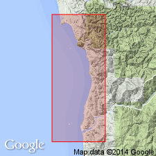
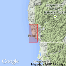
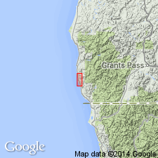
Type section: measured at Otter Point, in NE/4 sec. 13, T. 36 S., R. 15 W., Gold Beach 15-min quadrangle, Curry Co., southwestern OR. Otter Point is a promontory about 3 mi north of Gold Beach, Curry Co., southwestern OR Coast.
Reference sections: measured at Nesika Beach, in SE/4 sec. 36, T. 35 S., R. 15 W., and near Miller Creek, in southeast corner sec. 28, T. 35 S., R. 14 W., [Port Orford 15-min quadrangle, Curry Co., southwestern OR].
Source: Publication; US geologic names lexicon (USGS Bull. 1350, p. 547-548); GNU records (USGS DDS-6; Menlo GNULEX).
- Usage in publication:
-
- Otter Point Formation*
- Modifications:
-
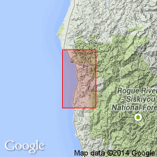
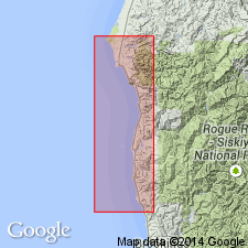
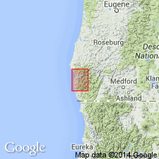
- Areal extent
- AAPG geologic province:
-
- Oregon-Washington Coast Ranges province
Summary:
Geographically extended to offshore stacks and reefs (Mack Reef, Island Rock, Redfish Rocks, Orford Reef, and parts of Rogue River and Blanco Reefs) from Crook Pt. (south of Cape Sebastian) to near Blacklock Pt. (north of Cape Blanco). Most of offshore volcanic and sedimentary rocks have undergone low-grade metamorphism (occurrence of pumpellyite and laumontite). Shown on map in fault contact with Dothan Formation near Whalehead Island area.
Source: GNU records (USGS DDS-6; Menlo GNULEX).
- Usage in publication:
-
- Otter Point Formation*
- Modifications:
-
- Geochronologic dating
- Redescribed
- AAPG geologic province:
-
- Oregon-Washington Coast Ranges province
Summary:
Includes high-grade blueschist blocks with K-Ar ages in Langlois quad of about 142 and 149 Ma (phengite mica), 132 Ma (glaucophane), and 141 Ma (actinolite); in Bandon quad of about 147 Ma (phengite mica) and 145 Ma (glaucophane). High-grade blueschist blocks occur extensively only in Otter Point Formation in Oregon and Franciscan Formation in California.
Source: GNU records (USGS DDS-6; Menlo GNULEX).
- Usage in publication:
-
- Otter Point Formation*
- Modifications:
-
- Overview
- AAPG geologic province:
-
- Oregon-Washington Coast Ranges province
Summary:
Is a complex flysch-like assemblage of steeply dipping and sheared sedimentary and volcanic rocks. Considered as a whole to be a tectonostratigraphic complex of melange (Otter Point complex) rather than a true rock-stratigraphic unit because of pervasive shearing, lack of preserved stratigraphic order, and the presence of exotic rock masses; individual outcrops qualify as broken formation (as associated serpentinite not everywhere present). Occurs in coastal area from Whaleback Is. area to Sisters Rock area and as fault slivers near Black Point and at Cape Blanco. In Sixes River area shown on map as part of undifferentiated uppermost Jurassic and lower Cretaceous. In fault contact with Dothan Formation (Macklyn Member) in Whalehead Is. to Carpenterville areas. Correlates with Riddle Formation near Roseburg. Is Portlandian or Tithonian (latest Jurassic) [Does not cite Baldwin and Hess (1966) map, but credits Lent (1969) PhD thesis for area north of Sixes River for "Otter Point complex" occurrence].
Source: GNU records (USGS DDS-6; Menlo GNULEX).
- Usage in publication:
-
- Otter Point Formation*
- Modifications:
-
- Overview
- AAPG geologic province:
-
- Oregon-Washington Coast Ranges province
Summary:
Contains (by petrologic analyses) more volcanic debris and lesser amounts of interbedded shale than Dothan Formation; submarine volcanic rocks of basalts and andesitic compositions are more abundant than in Dothan. No major unconformity or structural break between Otter Point and Dothan recognized in Port Orford or Gold Beach quads, but to south there is evidence of structural break. Grades imperceptibly eastward from coastal Oregon inland (near Gardner Ranch area) into Dothan Formation. May represent eastern flank of a Late Jurassic island arc. Correlates in part with Dothan Formation based on Late Jurassic fossils found recently in Dothan along Chetco River.
Source: GNU records (USGS DDS-6; Menlo GNULEX).
- Usage in publication:
-
- Otter Point Formation*
- Modifications:
-
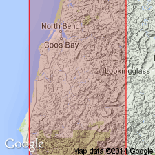
- Areal extent
- AAPG geologic province:
-
- Oregon-Washington Coast Ranges province
Summary:
Pg. 11+, geol. maps. Otter Point Formation. Geographically extended into Coquille River drainage area, Coos County, Oregon. Rocks previously assigned to Myrtle Formation (Diller, 1903, USGS Geol. Atlas, Folio 89). Crops out primarily along South Fork between Broadbent and Salmon Creek southwest of Powers. Subdivided into: lower member of sheared virtually structureless and incompetent siltstone and thin bedded sandstone with rootless masses of sandstone, greenstone, chert, and blueschist; and upper member of massive feldspathic sandstone with characteristic speckled appearance and local thin beds of conglomerate and pebbly sandstone which include blueschist pebbles. [General thickness not stated.] In fault contact or unconformable with older and younger rocks. Age of lower member is Late Jurassic (Tithonian) based on pelecypod BUCHIA PIOCHII and ammonoids; no fossils recovered from upper member but is probably older than Early Cretaceous Humbug Mountain Conglomerate.
Source: Publication; GNU records (USGS DDS-6; Menlo GNULEX).
- Usage in publication:
-
- Otter Point Formation*
- Modifications:
-
- Revised
- AAPG geologic province:
-
- Oregon-Washington Coast Ranges province
Summary:
Otter Point Formation. Considered to be oldest formation (of three) of Myrtle Group in Oregon coastal area of Klamath Mountains province. Units within Myrtle Group in this coastal area (ascending, Otter Point Formation, Humbug Mountain Conglomerate, and Rocky Point Formation) are similar lithologically, and are differentiated largely on basis of evolution of clam BUCHIA [assignment of Otter Point Formation, Humbug Mountain Conglomerate, and Rocky Point Formation to the Myrtle Group is on a biostratigraphic rather than lithostratigraphic basis and should not be considered a valid lithostratigraphic group].
Source: Modified from GNU records (USGS DDS-6; Menlo GNULEX).
- Usage in publication:
-
- Otter Point Formation
- Modifications:
-
- Overview
- AAPG geologic province:
-
- Oregon-Washington Coast Ranges province
Summary:
Referred to as melange because of pervasive shearing and apparent lack of structural continuity and as an ophiolite because of deep-sea floor composition. Is banded by faults of regional significance. Includes isolated exposures of hard, massive quartz rich sandstone in Langlois quad. [Includes detailed geologic maps of Port Orford, Gold Beach, Langlois, Cape Ferrelo 15' quads.] These exposures regarded as younger in age, probably Cretaceous, because of extremely different depositional environment of rocks of this type; however no fossils of Cretaceous age are known from unit according to D.L. Jones.
Source: GNU records (USGS DDS-6; Menlo GNULEX).
- Usage in publication:
-
- Otter Point Formation*
- Modifications:
-
- Redescribed
- AAPG geologic province:
-
- Oregon-Washington Coast Ranges province
Summary:
Referred to as Otter Point Formation (in text) and Otter Point complex (on figure 1). At localities slightly inland from Cape Sebastian area, Cape Sebastion Sandstone overlies the (?) Upper Jurassic Otter Point Formation. [Does query refer to age or occurrence?]
Source: GNU records (USGS DDS-6; Menlo GNULEX).

- Usage in publication:
-
- Otter Point Formation*
- Modifications:
-
- Age modified
- Biostratigraphic dating
- AAPG geologic province:
-
- Oregon-Washington Coast Ranges province
Summary:
Age changed from latest Jurassic (late Tithonian) to latest Jurassic (late Tithonian) and Early Cretaceous (Berriasian) based on late Tithonian BUCHIA PIOCHII and Berriasian B. UNCITOIDES in association with ammonite NEOCOSMOCERAS which is more common in Berriasian than in Tithonian. Shown as 11,000 ft thick on correlation chart (figure 22).
Source: GNU records (USGS DDS-6; Menlo GNULEX).
- Usage in publication:
-
- Otter Point Formation*
- Modifications:
-
- Age modified
- AAPG geologic province:
-
- Oregon-Washington Coast Ranges province
Summary:
Is northernmost occurrence of arc-related volcanic rocks (postulated island arc between Franciscan assemblage (trench) and Great Valley Sequence (arc-trench gap)). Appears to record period of Late Jurassic arc volcanism that originally lay well to west of continental margin. Rocks similar to Upper Jurassic Otter Point Formation of southwestern Oregon occur at Trinidad Head in northern California where keratophyre is abundant, and well-bedded sandstone and siltstone are intercalated with thin volcanic flows. Appears to structurally underlie adjacent coeval Dothan (Franciscan) rocks.
Source: GNU records (USGS DDS-6; Menlo GNULEX).
- Usage in publication:
-
- Otter Point Formation*
- AAPG geologic province:
-
- Oregon-Washington Coast Ranges province
Summary:
Is largely a melange (tectonically mixed) of Late Jurassic and Early Cretaceous sedimentary rocks, submarine flows, and less abundant pods of chert and blueschist. Exotic blocks of Otter Point terrane slid into Eocene Roseburg Formation in Power 15' quad as early Eocene seas lapped against Otter Point highlands.
Source: GNU records (USGS DDS-6; Menlo GNULEX).
- Usage in publication:
-
- Otter Point Formation*
- Modifications:
-
- Paleomagnetics
- AAPG geologic province:
-
- Oregon-Washington Coast Ranges province
Summary:
Mudstone, fine sandstone, and limy concretions sampled from 23 sites at 4 localities in Otter Point Formation within Gold Beach terrane were observed to have both normal and reverse polarities. "Data suggest that the rocks of this terrane have been displaced northward about 1,200 km..." "and may have accreted in post-mid-Eocene time." "Fossils of Aptian to Albian age (Evitt, personal commun.) were collected by Roure, from a tectonic zone between the Otter Point Formation and Hunters Cove Formation. Probably, these fossils are from the Houstenaden Creek unit and, if so, narrow age of unconformity to Lower Cretaceous."
Source: GNU records (USGS DDS-6; Menlo GNULEX).
- Usage in publication:
-
- Otter Point Complex
- Modifications:
-
- Redescribed
- AAPG geologic province:
-
- Oregon-Washington Coast Ranges province
Summary:
Redefined as Otter Point complex (named Otter Point Formation by Koch, 1966), a structurally complicated assemblage of turbidites, mudstone, volcanic rock, and lenses of bedded chert in southwestern OR. Occurs only west of north-northwestern trending high angle faults (marking boundary of American and Humboldt plates), and with Upper Cretaceous rocks forms distinct terrane (Gold Beach terrane) unlike anything east of faults. Is in fault contact with Houstenaden Creek Formation (new), Cape Sebastian Sandstone, and Hunters Cove Formation, and also Dothan complex. Is island-arc derived assemblage of principally submarine slope, fan and fan-channel deposits derived from present-offshore direction. Age is Tithonian.
Source: GNU records (USGS DDS-6; Menlo GNULEX).
For more information, please contact Nancy Stamm, Geologic Names Committee Secretary.
Asterisk (*) indicates published by U.S. Geological Survey authors.
"No current usage" (†) implies that a name has been abandoned or has fallen into disuse. Former usage and, if known, replacement name given in parentheses ( ).
Slash (/) indicates name conflicts with nomenclatural guidelines (CSN, 1933; ACSN, 1961, 1970; NACSN, 1983, 2005, 2021). May be explained within brackets ([ ]).