The National Geologic Map Database is migrating to a new infrastructure. We apologize for any service disruptions during this process.
|
|---|


- Usage in publication:
-
- Otay Formation
- Modifications:
-
- Named
- Dominant lithology:
-
- Sandstone
- Conglomerate
- AAPG geologic province:
-
- Peninsular Ranges province
Summary:
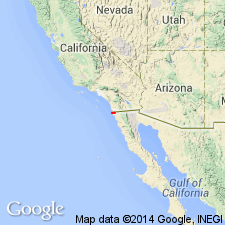
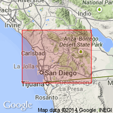
Occurs east of San Diego Bay along east side of La Nacion fault, San Diego Co, southwestern CA. Distribution shown on geologic sketch map of San Diego area. Consists predominantly of 35 to 50 m of white, volcanically derived tuffaceous fine sandstone, with thin bentonitic interbeds marked by basal breccia conglomerate. Overlies Sweetwater Formation (new); underlies San Diego Formation. Is equivalent to Miocene-Pliocene Rosarito Beach Formation just south of U.S.-Mexico border. Age is Miocene.
Source: GNU records (USGS DDS-6; Menlo GNULEX).
- Usage in publication:
-
- Otay Member
- Modifications:
-
- Revised
- AAPG geologic province:
-
- Peninsular Ranges province
Summary:
Otay Formation of Artim and Pinckney (1973) is reduced in rank to member and assigned to Rosarito Beach Formation. Type section designated in natural amphitheater on northeast side of Chester Canyon opposite bentonite clay mine where unit is exposed in single natural cliff with both lower and upper contacts exposed. Overlies Sweetwater Member of Rosarito Beach Formation; underlies San Diego Formation. Age given as Miocene.
Source: GNU records (USGS DDS-6; Menlo GNULEX).

- Usage in publication:
-
- "Otay" Formation, Member†
- Modifications:
-
- Abandoned
- AAPG geologic province:
-
- Peninsular Ranges province
Summary:
"Otay" Formation of Artim and Pinckney (1973) is abandoned in favor of Rosarito Beach Formation. "It [the abandonment] is favored by Artim and Pinckney (1979, pers. commun.)." p.115
Source: GNU records (USGS DDS-6; Menlo GNULEX).
For more information, please contact Nancy Stamm, Geologic Names Committee Secretary.
Asterisk (*) indicates published by U.S. Geological Survey authors.
"No current usage" (†) implies that a name has been abandoned or has fallen into disuse. Former usage and, if known, replacement name given in parentheses ( ).
Slash (/) indicates name conflicts with nomenclatural guidelines (CSN, 1933; ACSN, 1961, 1970; NACSN, 1983, 2005, 2021). May be explained within brackets ([ ]).