

- Usage in publication:
-
- Ost limestone bed
- Modifications:
-
- Original reference
- Dominant lithology:
-
- Limestone
- AAPG geologic province:
-
- Nemaha anticline
Summary:
Pg. 47, 52. Ost limestone bed of Tecumseh shale member of Shawnee group. Ost limestone is proposed for the limestone next above Kenosha shale and below Rakes Creek shale. Thickness 1.5 feet. Age is Pennsylvanian.
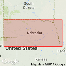
Type locality: being on Ost farm, on South Fork [Weeping Water] Creek about 3.5 mi east of Avoca, Cass Co., southeastern NE.
Source: US geologic names lexicon (USGS Bull. 896, p. 1568); GNC KS-NE Pennsylvanian Corr. Chart, sheet 1, Oct. 1936; supplemental information from GNU records (USGS DDS-6; Denver GNULEX).
For more information, please contact Nancy Stamm, Geologic Names Committee Secretary.
Asterisk (*) indicates published by U.S. Geological Survey authors.
"No current usage" (†) implies that a name has been abandoned or has fallen into disuse. Former usage and, if known, replacement name given in parentheses ( ).
Slash (/) indicates name conflicts with nomenclatural guidelines (CSN, 1933; ACSN, 1961, 1970; NACSN, 1983, 2005, 2021). May be explained within brackets ([ ]).